|
- Through mutual friends we met each other for the first time about a year before the trip.
The four of us couldn't be more different in skills, talents, and dispositions except age; we
were all over 60 years old. We committed to sail the Dalmatian Islands for two weeks.
These are the stories, photos and movies of the voyage. Our differences made the experience more
interesting in that we saw most things in four different ways. As you will see in the photos and videos,
the trip was an incredible success and will bring life long memories of sailing the Dalmatian
Islands to each of us.
|
|
- Two of us came from Lafayette, one from New Orleans and one from the Czech Republic. One brought
a motorcycle to tour Europe after the voyage, one brought a drone and two big cameras to capture our destinations.
One cooked, two washed dishes. One did the accounting. One person's bag was a day late arriving.
One did most of the planning. We all ate and drank like royalty.
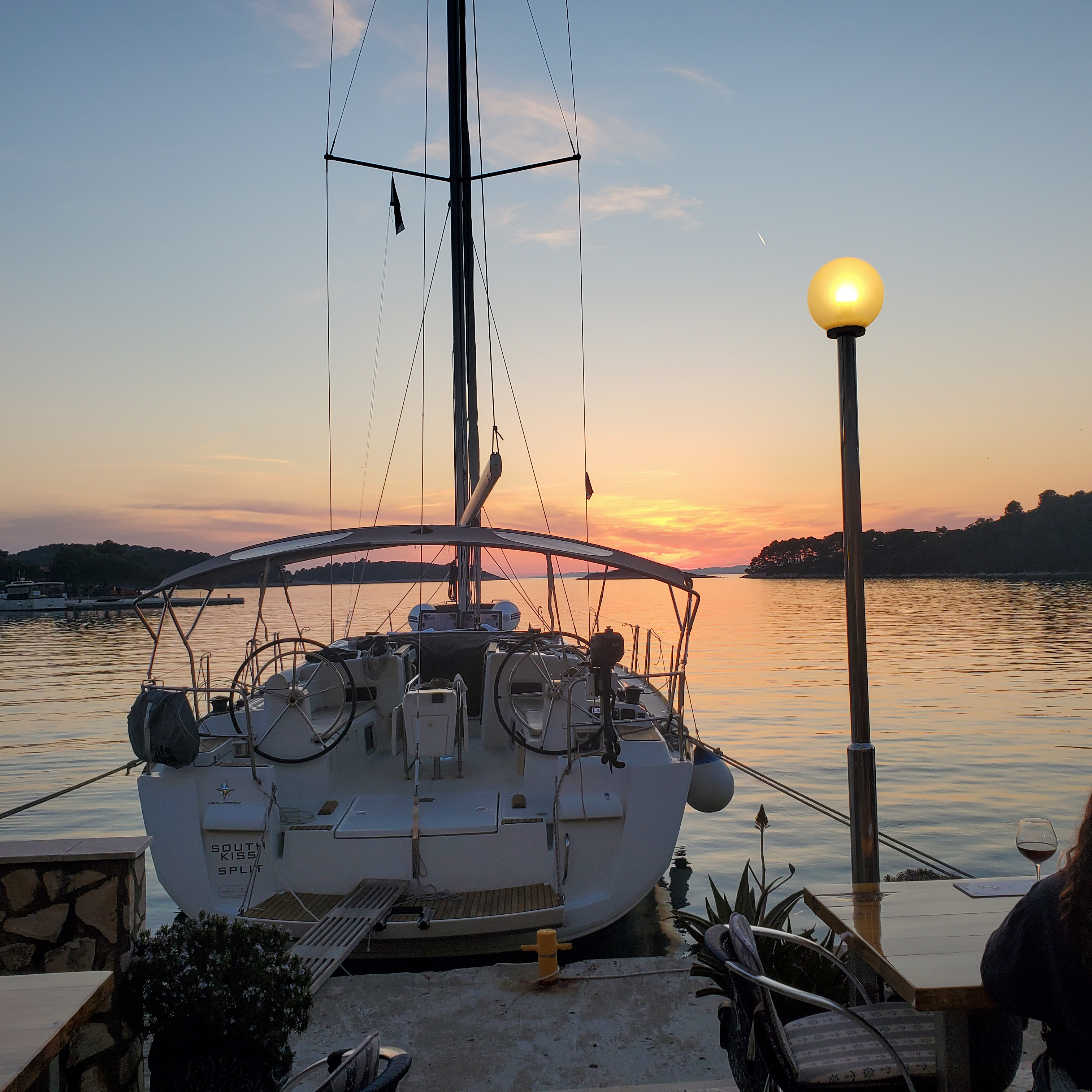
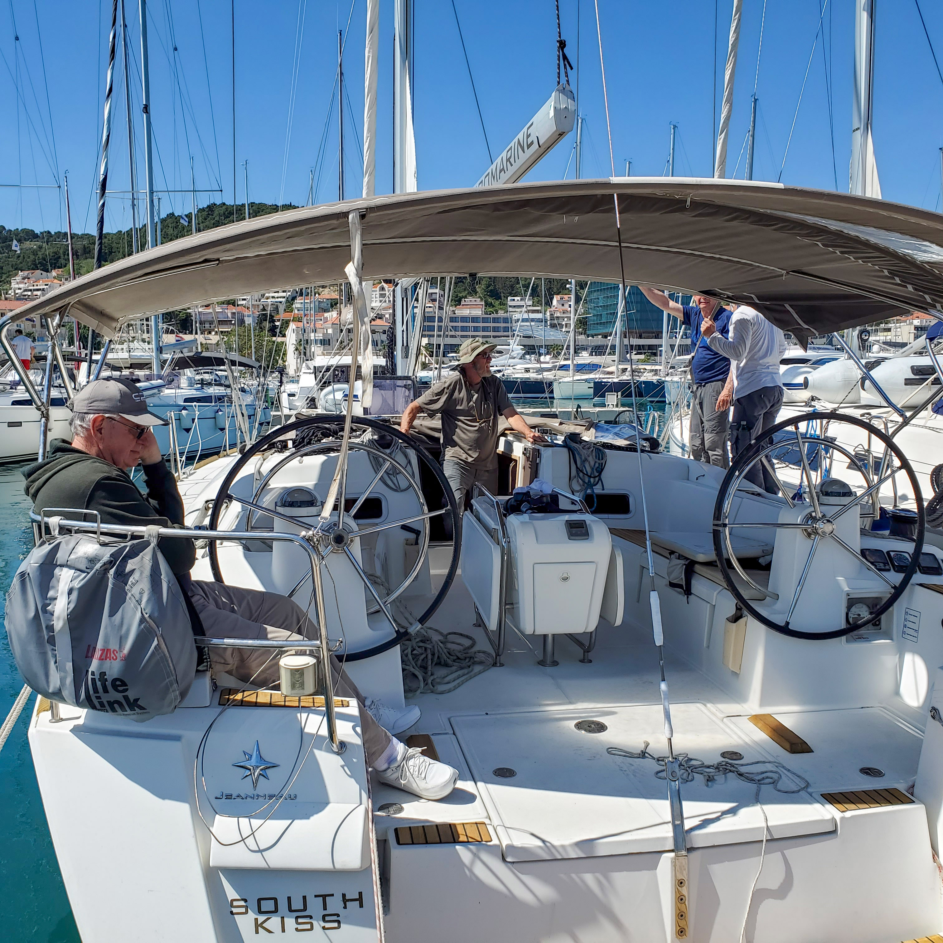
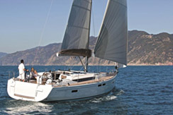
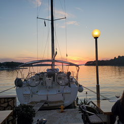
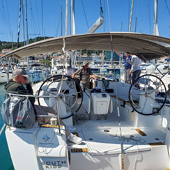
- We all arrived Split on different days at different times but early enough to capture a glimmer of Split
before boarding our vessel. We boarded the "SV South Kiss" on a Saturday evening and departed
ACI Marina Split on Sunday morning, May 1, 2022.
- Photos
|

|
- We departed the harbor and headed south for the island of Vis. We saw the Svjetionik Rt. Ražanj
light house as we passed between the islands of Brač and Solta. South of the light house we encountered
good winds and were able to do some sailing for the rest of the passage into Vis. We did our first Med
mooring at the city dock in front of the town. In town we encountered the oddest rounded stones used in
the main street.
- Until 1797, Vis was under the rule of the Republic of Venice. During this time large settlements developed along
the coastline (Comisa (now Komiža) and Lissa (now Vis)). After the Second World War, the Yugoslav People's Army
used the island as one of its main naval bases until abandoning the base in 1989. After Croatia became independent
in 1991, its navy did not reclaim most of the facilities, and the many abandoned buildings are being used for civilian
purposes and tourism, including tunnels, bunkers and a secret submarine base. In 2008, 34 mines left over from World
War II were cleared from the island.
- In 2017 the movie "Mamma Mia! Here We Go Again" was filmed on location on Vis.
- Photos
|
|
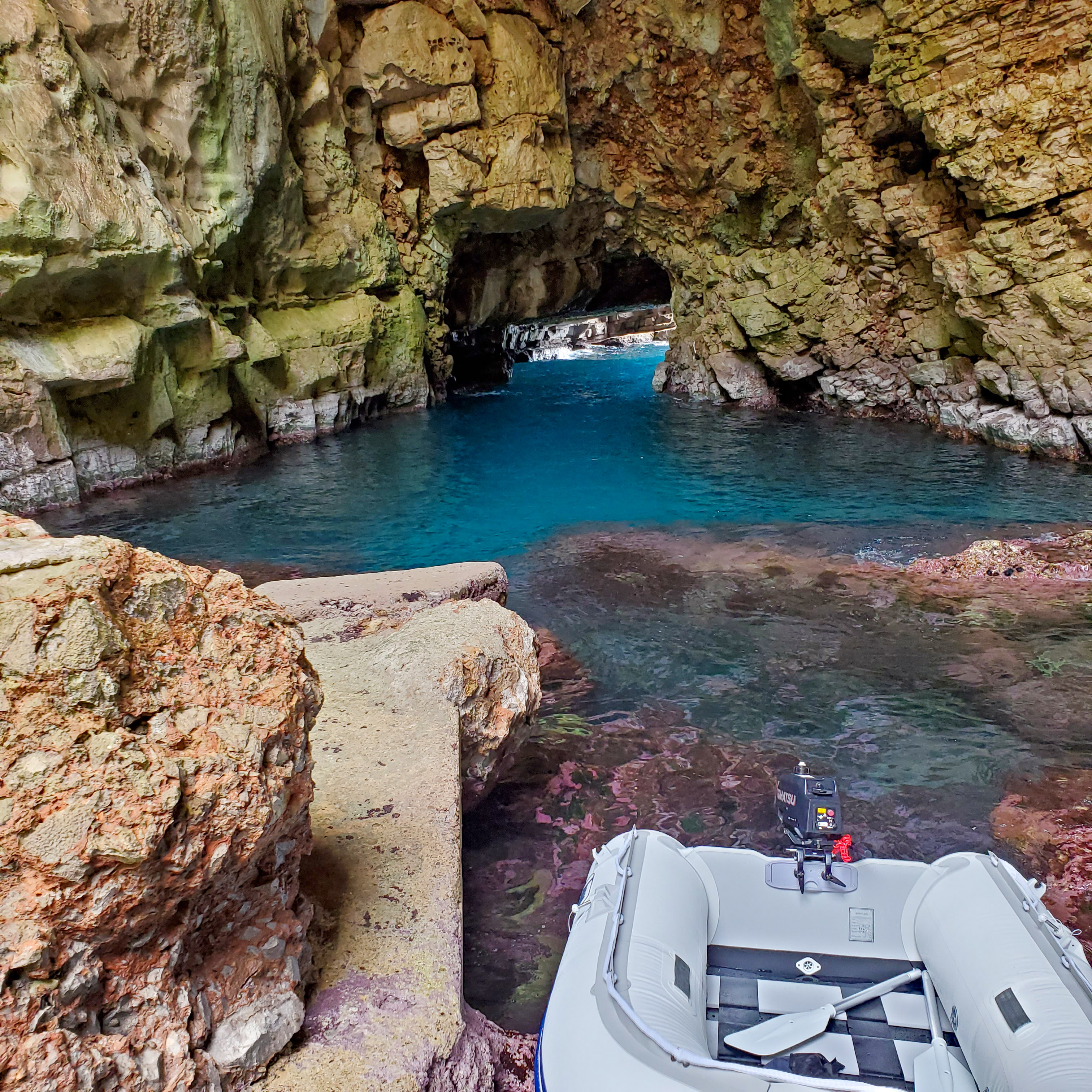
- We departed Vis harbor for the secret submarine base on the north side of the island which we found very interesting.
Then we proceeded south west to the island of Biševo, Komiža to view the Blue Grotto. Our final destination this day
was on the south side of Vis, a beautiful beach behind cliffs called Stiniva. Three fascinating stops in
one day.
- Stiniva bay and beach on Vis Island is undoubtedly one of the most picturesque beaches in Croatia.
This tiny shingle beach, situated at the southern shores of the island is framed by the iconic tall
cliffs cut deep into the narrow bay. This unspoiled south coast of the island is opened to high seas
where erosion formed this beautiful landscape. Since the 1960s the whole of Stiniva bay is a protected
significant landscape with the intention to preserve its original look and feel.
- Drone video of Stiniva, Vis
- Photos
|
|
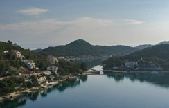
- Pasadur is a small bay and village located on the western side of the island of Lastovo. It is about 3 kilometers
north of the ferry port Ubli, which is also the nearest point one can get to Pasadur and Lastovo Island by public
transport from the Croatian Mainland. It is located at the connection point between Prezba Island and Lastovo
mainland.
The island is also connected with a bridge with the smaller island Prezba in village Pasadur (meaning passage in local
dialect). In the very near vicinity is Velo Lago and Malo Lago, the well-known Lastovo bays (that remind of lakes –
hence the name: lago=lake). These two salted lakes/bays are split by Pasadur teraferma, which are very popular among
visitors and locals for peaceful swimming and sunbaths. Pasadur is also popular with sailors, as it is a very safe
bay to overnight, as the bay itself is sheltered from almost all winds.
- Drone video of Passadur, Lastovo
- Drone video of Cape Struga Lighthouse, Lastovo
- Drone video of Glavat Lighthouse, Lastovo
- Photos
|
|
-
Pomena is a small village as well as a harbor located at the west end of the Island of Mljet, about 2 km away from the
village of Govedari. The village has just over 50 permanent inhabitants.
They live in farming, fishing, and tourist trade. Initially, it was founded by the Govedjari people, as that was their
nearest sheltered bay and access to the sea. They used to come to the bay mainly to fish. However, since the growth
of tourist trade in the area, and the construction of Hotel Odisej (see it in the above photo) Pomena became more
of a tourist place.
Being located just over 15 minutes walk to Malo Jezero (Small Lake) of Mljet National Park, the village is the main entry
point to the Park. Nowadays has its hotel, a couple of restaurants and coffee bars, grocery and souvenir shops,
agencies, etc… As a bay, is a very safe place for anchorage, being sheltered by a tiny island of Pomestak, which
acts as a local naturist beach too.
- Drone video of Pomena, Mljet
- Photos
|

|
- Saplunara on Mljet is a lovely large bay located at the Eastern tip of the Island along the island’s main road. It is
established not so long ago by people from Korita village (located further up the hills) who built their summer holiday
homes in the bay so nowadays Saplunara has about 20 houses and 30 permanent residents.
The place is well known for its sandy beaches Velika and Mala Saplunara and Blaca, surrounded by dense pine woods. Due to
its sandy beaches, its name has roots in Latin word for sand – ‘sabulum‘. The bay is opened to the south-west, so it
has a lot of natural sunshine and is sheltered from Bura and Maestral winds. The bay itself is about one kilometre
long and due to its secluded position, the waters here are very warm all year around. The bay has its restaurant,
café and a small shop. Some people that own houses in the bay rent rooms and apartment to tourists so it is fairly
easy to find a place to stay here.
- Drone video of Suplanara, Mljet
- Photos
|
|
|
|
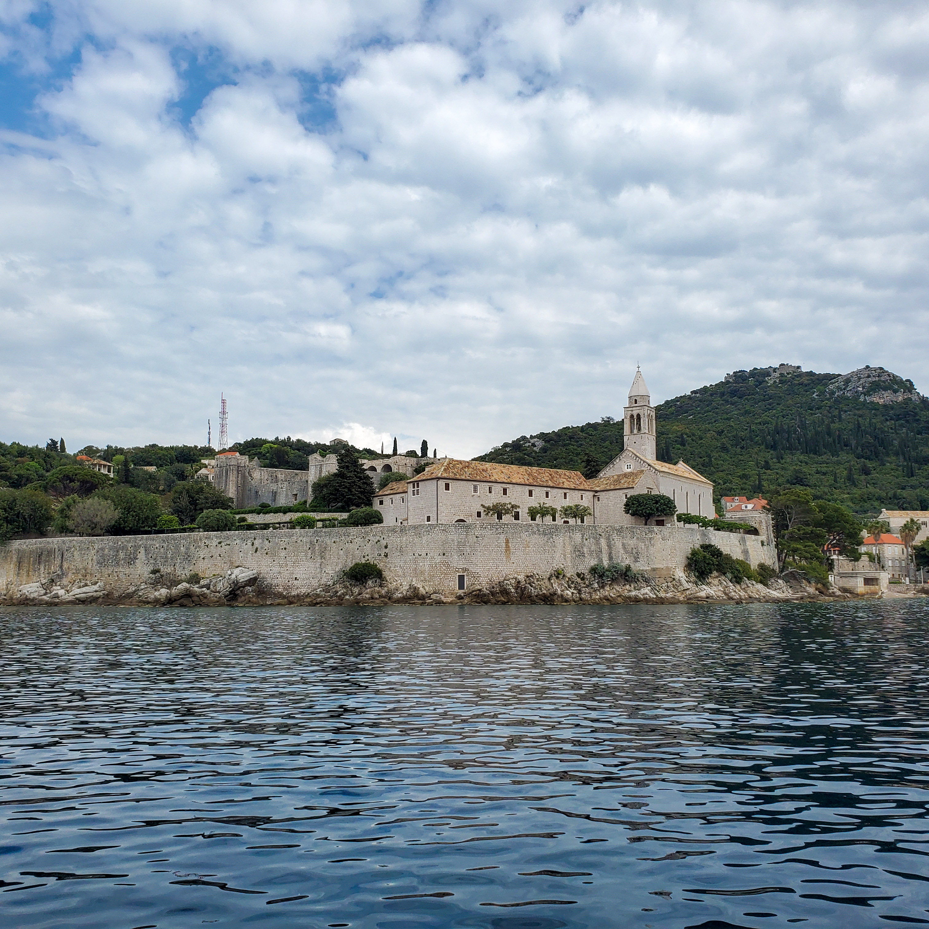
- The “middle” island of the Elafiti trio (geographically and size-wise, at least), Lopud is home to just over 200 people although
is considered the most developed of the three islands.
Its name stems from the Greek name for the island, Delaphodia, although it was also named Lafota by the Romans who once had
a settlement there. The island became part of the Republic of Ragusa in the 11th century. The island really only has one village,
which is also called Lopud and is located in Lopud bay. Sunj Bay – which is sandy – is located on the other side of the island.
- Dronie of David and Ray in the harbor of Lopud
- Drone video of Lopud
- Photos
|
|
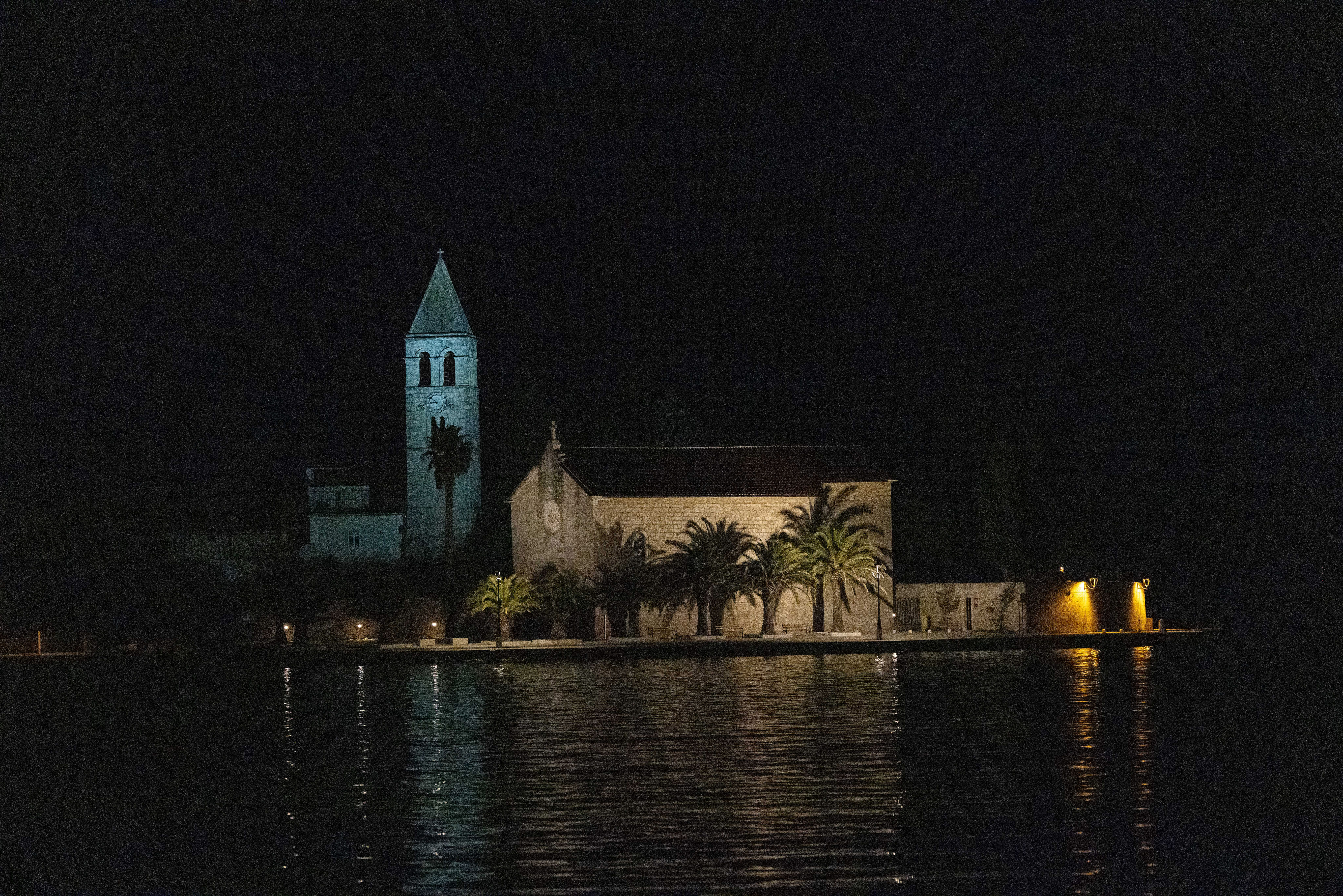
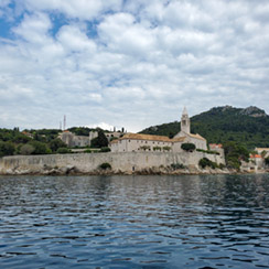
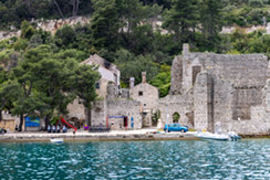
- Polace, a village in the western part of the northern coast of the island of Mljet. It is the largest and the safest bay on the whole
Island, as it is secluded and sheltered by 4 small islands Tajnik, Moračnik, Ovrata and Kobrava. Due to its sheltered position, the bay
is very popular among sailors and yachtsmen to do their anchorage there. The bay itself is 5.6 km long and about 4 km wide. Polace is
lso one of the ferry ports on Mljet where passenger catamaran ferry arrives from Dubrovnik.
The village has just over one hundred permanent inhabitants. It has a couple of restaurants and cafes, as well as a shop for basic provisions.
Polace is pronounced Pola-che.
The village has a number of ancient ruins dating from the 1st to the 6th centuries. However, of greatest significance is the Roman palace
hence the name “Polace” from the 5th century whose walls dominate the village. This is one of the largest buildings
in Dalmatia from the Roman period.
- Drone video of Polace, Mljet
- Dronie of David and Ray in Polace, Mljet
- Asteroid of David and Ray in Polace, Mljet
- Drone video of Polace, Mljet
- Dronie of crew in Polace, Mljet
- Asteroid of crew in Polace, Mljet
- Photos
|
|
|

|
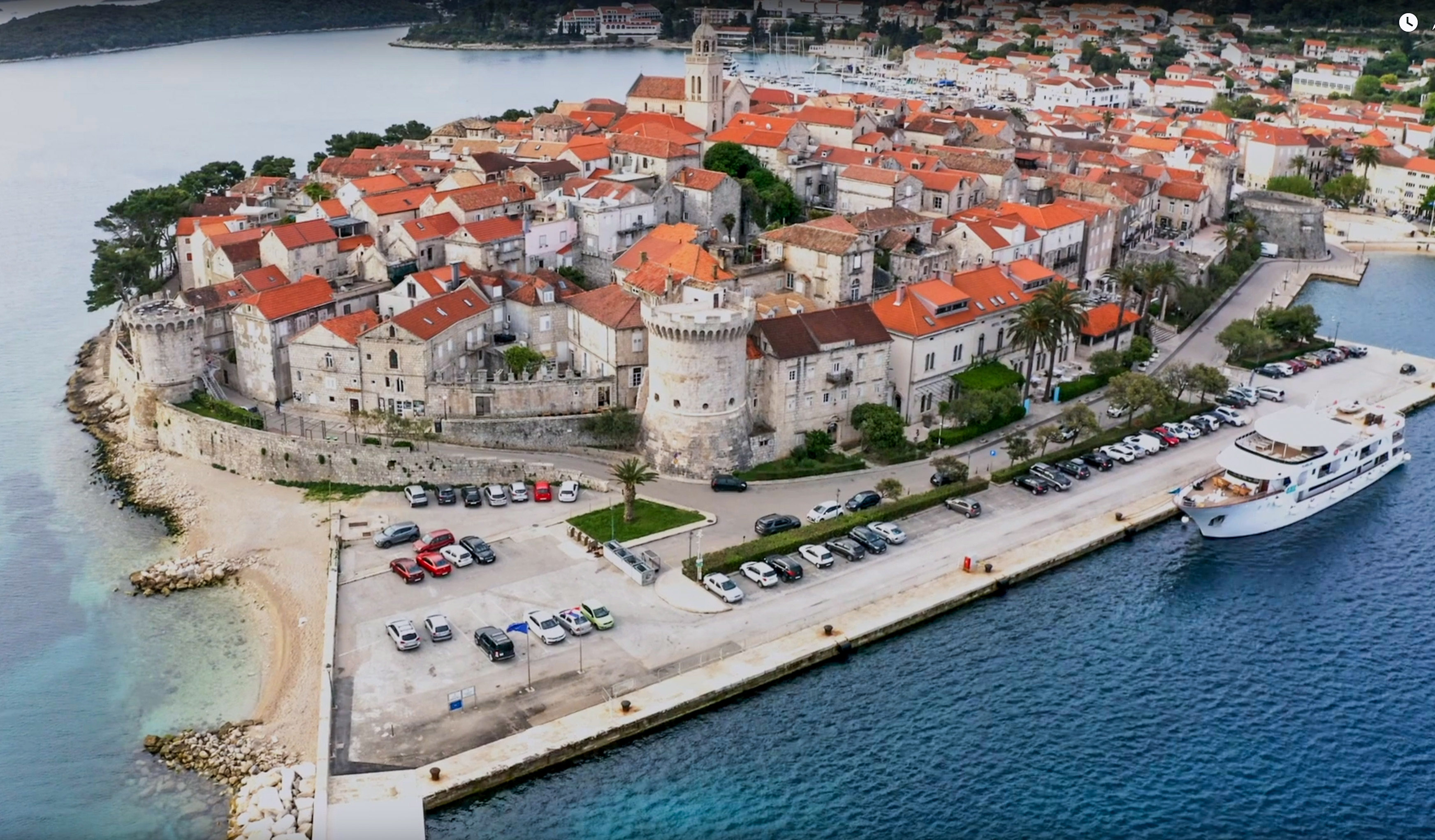
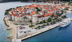
- When the ferry chugs out, Vela Luka returns to its main businesses which include fishing and marketing Korcula's
famous olive oil. In addition to the health and rehabilitation centre, Kalos, there are a few modest hotels, some local
cafes and restaurants and a couple of things to see and do.
Vela Luka's most interesting sight is Vela Spila or Great Cave. This vast rocky hideout was clearly inhabited in the Neolithic
Period. Despite its antiquity, Vela Luka remained lightly inhabited until the 18th century when its position as a gateway
port to Korcula Island brought some prosperity.
In the 1960s, the Kalos health centre opened on the Kale cove which had long been known for its medicinal mud deposits and a
spring of radon mineral water, supposed to bring health benefits. The fact that Vela Luka is one of Croatia's sunniest
spots (2671 sunshine hours per year) has also attracted health-seeking visitors.
- Drone video of Vela Luka, Korčula
- Photos
|
|
- “Bohemian retreat nestled in lush botanical gardens on a tiny island in the Adriatic Sea
(approximately 10 minutes by boat from Hvar)”
This is art and nature in perfect harmony, an Arcadian idyll on a Dalmatian island. Professor Eugenio Meneghello
bought a 300-hectare wilderness in 1906, complete with 2 pebble beaches, and planted it with pines, palms, exotic
shrubs and aromatic herbs like rosemary and lavender. One century and 3 generations later, his family are the pioneers
of eco-tourism in Croatia. His granddaughter-in-law Dagmar and her 3 children still tend their forefather’s ‘Garden of
Eden’, but have turned it into an exclusive hideaway with a cluster of villas and bungalows and 2 restaurants, all
built of local stone.
Interiors have been painted deep, vibrant colours and are decorated with unusual driftwood sculptures and contemporary
artwork. The result is a discreet yet spiritual escape from the modern world. Popular with flora loving families and hippies
at heart, it’s a great place to while away the days eating fresh seafood, swimming in the bay, exploring by kayak and diving
nearby shipwrecks.
- Drone video of Palmižana, St. Klement, Paklinski Islands
- Photos
|
|
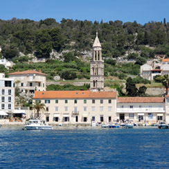
- We departed St. Klement Island and visited Hvar. Hvar's location at the center of the
Adriatic sailing routes has long made this island an important base for commanding trade up and down the
Adriatic, across to Italy and throughout the wider Mediterranean. It has been inhabited since pre-historic
times, originally by a Neolithic people whose distinctive pottery gave rise to the term Hvar culture, and
later by the Illyrians. The ancient Greeks founded the colony of Pharos in 384 BC on the site of today's
Stari Grad, making it one of the oldest towns in Europe. They were also responsible for setting out the
agricultural field divisions of the Stari Grad Plain, now a UNESCO World Heritage Site. In medieval times,
the town of Hvar rose to importance within the Venetian Empire as a major naval base. Prosperity brought
culture and the arts, with one of the first public theatres in Europe, nobles' palaces and many fine communal buildings.
- Drone video of Hvar and the Castle
- Drone video of Fish Farm and Sub Den in Milna
- Drone video of Lučica
- Photos
|
|
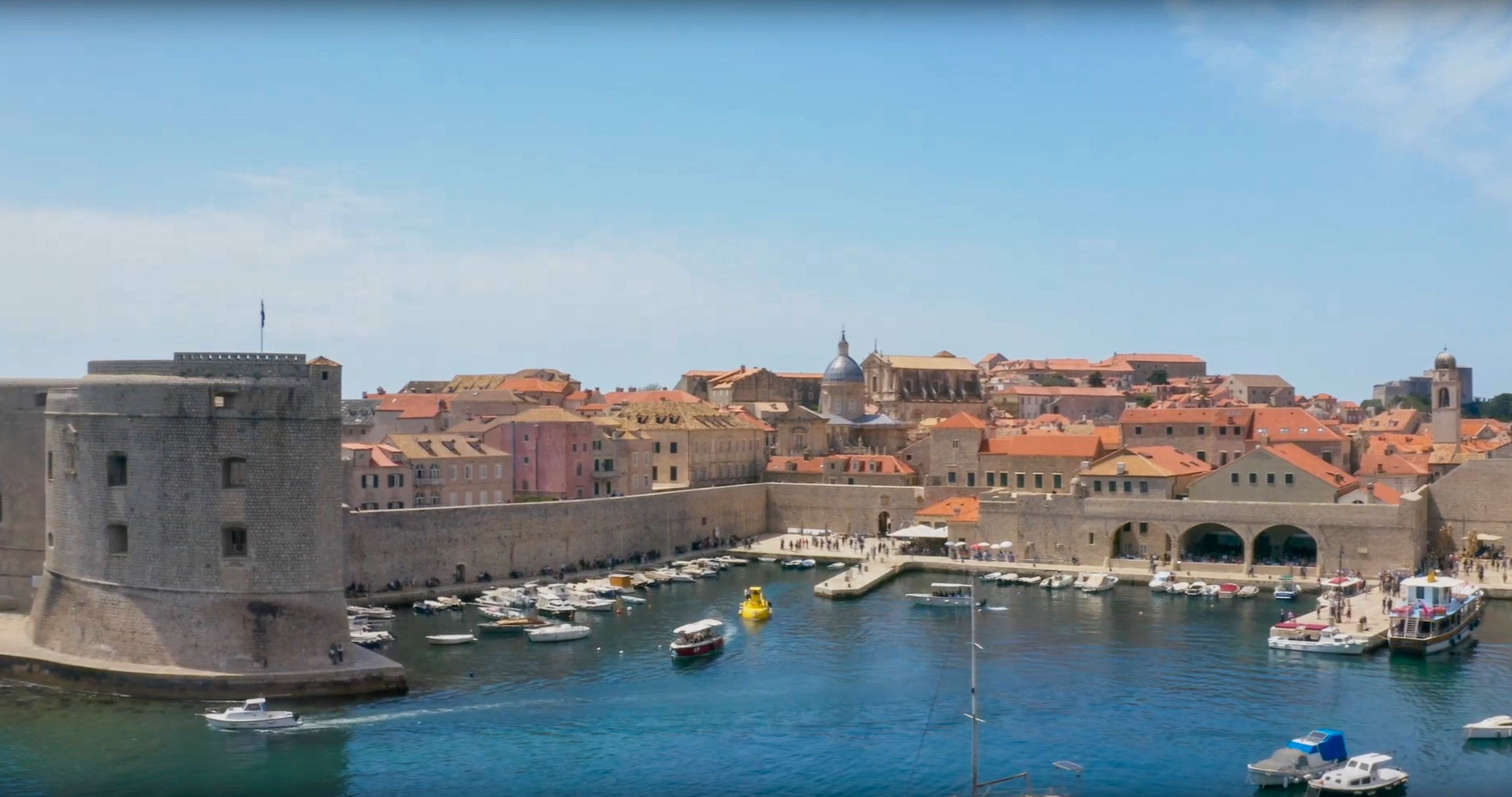
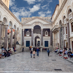
- ACI marina Split, with the harbors of two sailing clubs, protected by solid rock breakwater from southerly winds
and rough seas, offers a glorious view of Split and its center – Diocletian’s Palace. It is at ACI Marina Split
that the Split Lungomare begins; the longest and most certainly one of the most beautiful promenades in the Adriatic.
ACI marina Split was awarded the prize “Tourist Flower – Quality for Croatia” for the third place in 2017 in the
category of the best medium marina on the Adriatic, while in 2017 received the award for the second place. ACI
marina split is also the winner of the prestigious Blue Flag Award.
- Drone video of Milna, Brač
- Photos
|

|
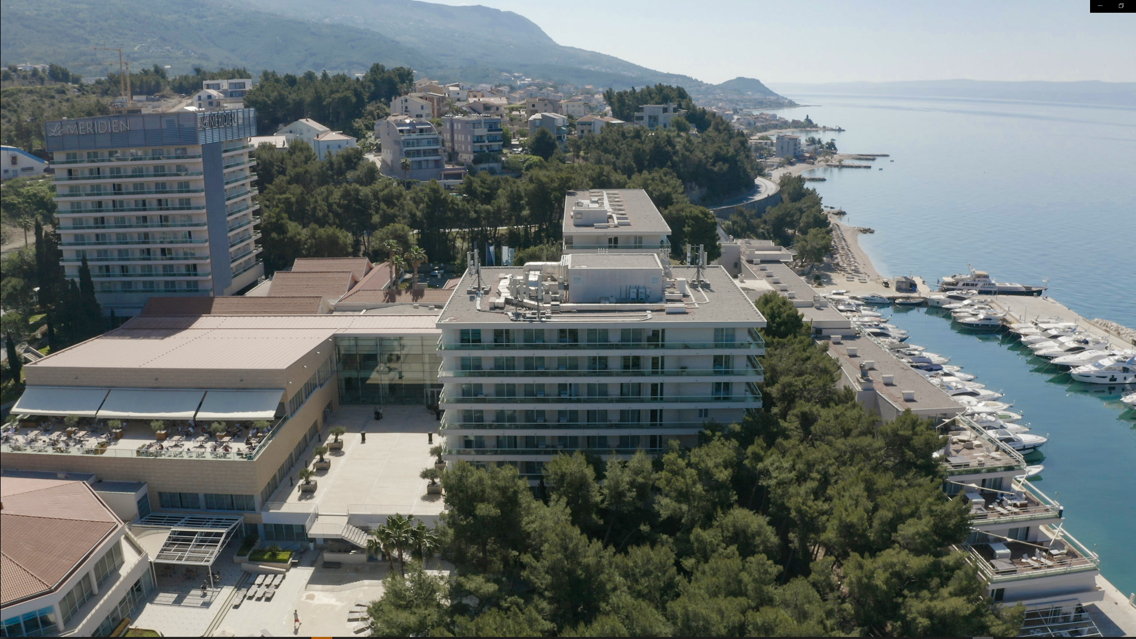
- Le Méridien Lav is the only five-star resort in Split. Located in Podstrana, 5 mi south of Split, it has a 2,400
feet long beach line, landscaped gardens and it overlooks the city and the surrounding islands. A combination of
6 restaurants and bars in the resort and along the Marina Promenade allows guests to experience a variety of cuisines.
The RE:CUPERA Wellness and Spa includes saunas, steam baths, whirlpools, nail and pedicure studios, a deep relaxation
room and much more. A large selection of treatments is offered. Relaxing ambiance, large panoramic windows, balconies,
high quality furniture and comfortable beds are only some of the outstanding features of each guest room.
You can enjoy the several state-of-the-art tennis courts, as well as various water sport activities, such as jet ski,
stand up paddle, towing and more. The Marina Promenade of the resort features shops, restaurants, bars, and cafés, and
the Yacht Marina is home to 60 yachts.
- Drone video of the Hotel Le Meridian Split
- Video of mice in Schiphol Airport, Amsterdam
- Photos
|