|
My Adventures on the
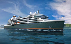
MV Seabourn Pursuit Expedition
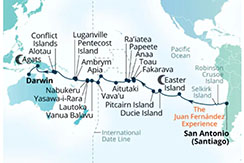
Argentina, Polynesia, Melanesia, New Guinea & Australia
March, April, & May of 2026
-
Below is a Table of Contents which links to each day's activity for easy access or, if you prefer, you can simply scroll down and read the adventures day by day.
The left hand column contains links to my images stored in my Adobe Portfolio and links to my hand-held camera videos stored in my YouTube channel.
- March 29, 30 - Lafayette, LA to Santiago, Chile
- March 31 - Santiago, Chile
- April 1 - Valparaiso, Chile
- April 2 - Embark Seaborn Pursuit
- April 3 - First Day at Sea
- April 4 - Alejandro Selkirk Island, Cile
- April 5 - Santa Clara Island, Chile
- April 6 - Second Day at Sea
- April 7 - Third Day at Sea
- April 8 - Fourth Day at Sea
- April 9 - Fifth Day at Sea
- April 10 - Easter Island, Chile
- April 11 - Easter Island, Chile
- April 12 - Sixth Day at Sea
- April 13 - Seventh Day at Sea
- April 14 - Dulce Island, Pitcairn
- April 15 - Pitcairn Island, Pitcairn
- April 16 - Eighth Day at Sea
- April 17 - Ninth Day at Sea
- April 18 - Fakarava, Tuamotu, French Polynesia
- April 19 - Tahanea, French Polynesia
- April 20 - Anaa, French Polynesia
- April 21 - Papeete, Tahiti, French Polynesia
- April 22 - Raiatea, French Polynesiaa
- April 23 - Tenth Day at Sea
- April 24 - Aitutaki, Cook Islands
- April 25 - Eleventh Day at Sea
- April 26 - Twelfth Day at Sea
- April 27 - Cross International Date Line
- April 28 - Apia, Upolu, Samoa
- April 29 - Thirteenth Day at Sea
- April 30 - Neiafu & Nuku Island, Vava'u Tonga
- May 1 - Vanua, Balavu, Fiji
- May 2 - Yasawa-i-Rara, Fiji
- May 3 - Lautoka, Fiji
- May 4 - Nabukeru, Fiji
- May 5 - Fourteenth Day at Sea
- May 6 - Ambrym, Vanuatu
- May 7 - Luganville, Espiritu Santo, Vanuatu
- May 8 - Fifteenth Day at Sea
- May 9 - Sixteenth Day at Sea
- May 10 - Seventeenth Day at Sea
- May 11 - Alotau, Papua New Guinea
- May 12 - Eighteenth Day at Sea
- May 13 - Nineteenth Day at Sea
- May 14 - Twentieth Day at Sea
- May 15 - Agats, Per, Indonesia
- May 16 - Twenty Fourth Day at Sea
- May 17 - Twentyfifth Day at Sea
- May 18 - Darwin, Australia
- May 19,20 - Australia to Lafayette, LA
|

My Images of Lafayette to Chile
|
-
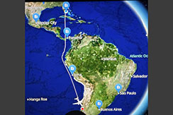
Sunday, 3/29/26, my sister, Janet, drove me to New Orleans for my flights to Chile. I was glasd there was only one change in planes in Miami. American Airlines managed to screw that up by arbitrarily shortening my layover from two hours to one hour and then delaying takeoff from New Orleans for 40 minutes giving me a 20 minute connecting time in Miami for an international flight. The pilot put the pedal to the metal (inched the throttles forward a bit) and made up twenty minutes. I was the last on the plane to Chile with the doors slamming shut behind me. How my bags made it, I'll never know, but they did.
-
Kali stayed at my home. My second cousin's daughter, Maria, cared for her and slept in the house with her. Kali and Maria were both happy.
-
TSA was unfunded during this time and I was told to be at the airport 4 hours early. I flew through TSA, but due to the increased wait times, the Firs Class lounges were packed. I had a wait time of 6 hours for a flight that left in 4 hours. Never mind, I hung around and was admitted in 20 minutes. Patiencee, kindness and persistence pays off again.
-
On Moday 3/30/26, I landed at the Santiago, Chile airport. I was able to zip through the airport security, immigration and customs only to find that I had two drivers waiting for me, one from the the Seabourn Cruise Line van and the driver that David Locke (my travel agent and dear friend) had arranged for me. I decided to use The one David had arranged, Franck Torrealba, owner of Turbo Transfer (+56 9 8659 3036). He is on WhatsApp. He was an attorney in Venezuela and is now attending night school in Santiago to become a lawyer in Chile. I hired him for the next two days; a day tour of Santiago and a day tour of Valparaiso. I highly recommend Franck, a great tour guide and a great conversationalist.
-
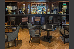
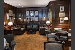
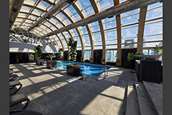
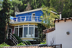
Checking into the hotel designated by Seabourn Cruise Line, the Ritz Carlton of Santiago was like a good old world experience, plenty of helpful staff. After a short wait, I was shown to a wonderful room with a great view. Everything about the hotel was elegant and first class, including the bar, rooftop pool and spa. I enjoyed my stay immensely.
-
Return to Table of Contents
|
My Images of Santiago
|
- - - - MY JAUNTS - - - -
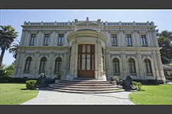
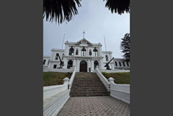
- On Tuesday, 3/31/26 Franck picked me up from the hotel in his BMW. It was a full day. First stop was Palacio Cousiño which is a 19th‑century mansion in central Santiago built as the private residence of the mining magnate Cousiño‑Goyenechea family and later converted into a public museum and national monument. The property on Calle Dieciocho was purchased by businessman Luis Cousiño in the mid‑1800s, in an elite residential district just south of downtown Santiago. Construction of the palace was commissioned around 1870–1875 for Luis and his wife, Isidora Goyenechea, and carried out by French architect Paul Lathoud, with gardens designed by Spanish landscaper Manuel Arana. The Cousiño‑Goyenechea family lived in the mansion until around 1928, using it as their urban home and as a setting for high‑society receptions.
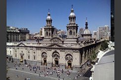
- The next stop was Santiago Metropolitan Cathedral which is the principal temple of the Catholic Church in Chile and the seat of the Archdiocese of Santiago, dedicated to the Assumption of the Virgin Mary. The cathedral complex includes the Archbishop’s Palace and the El Sagrario Parish, all recognized as national monuments. A church has existed on this site since the 16th century; the current cathedral is the fifth temple built there, with major construction of the present structure starting around 1745–1748. It was made a Metropolitan Cathedral (raising Santiago to an archdiocese) by Pope Gregory XVI in 1840, with architectural work over about 150 years by figures such as Joaquín Toesca and Ignacio Cremonesi.
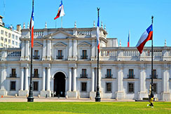
- The next stop was the presidential palace in Santiago, Chile which is called Palacio de La Moneda, It serves as the seat of the President of the Republic of Chile. Palacio de La Moneda has its origins as Santiago’s colonial mint and later became Chile’s presidential seat, with a history marked by architectural evolution and the 1973 coup. Construction began in 1784, designed by Italian architect Joaquín Toesca in a neoclassical style. It was inaugurated in 1805 as the “Real Casa de Moneda de Santiago,” housing Chile’s coin production. Coins were minted here roughly from 1814 until 1929, giving the building its name “La Moneda” (“The Coin”). In the 1840s, President Manuel Bulnes converted part of the building into the government palace and presidential residence; it became the official seat of government around 1845–1846.
- The next stop was at Pablo Neruda’s Santiago house, La Chascona, which was begun in 1953 as a secret love nest for his companion (later wife) Matilde Urrutia, and later became a museum and headquarters of the Pablo Neruda Foundation. The house is multi‑level, irregular, and filled with nautical motifs, reflecting Neruda’s fascination with the sea. He brought selected woods (such as cypress from southern Chile) and eclectic objects, turning rooms into bar‑like salons, lookout spaces, and cozy corners for writing and entertaining.Neruda bought a steep, overgrown plot at the foot of Cerro San Cristóbal in the Bellavista neighborhood in 1953. He commissioned Spanish architect Germán Rodríguez Arias, but personally altered the plans so much that the house is often seen as largely his own creation. The name “La Chascona” comes from Matilde’s wild, curly red hair; chascona in Chilean Spanish refers to unkempt or tousled hair.
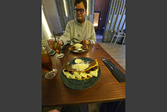
- We had a wonderful traditional Venezuelan meal of Cachapas: Sweet corn pancakes served with cheese and sausage with a little cream over it. Franck insisted I try some of his country's food. I've never had anything like it. The Cachapas were really good. They were accompanied by a glass of sugar cane juice and lime, which was incredibly refreshing. Rincón Venezolano en Chile literally means “Venezuelan Corner in Chile”. This Venezuelan restaurant served traditional dishes like arepas, pabellón criollo, tequeños, hallacas, and cachapas.
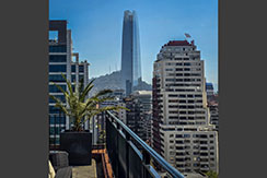
- The last stop of the day was the Sky Costanera which is the observation deck and 360° viewpoint on the 61st–62nd floors of Santiago's Gran Torre Costanera, the tallest skyscraper in South America. It sits about 300 meters above the city and is marketed as the highest viewing platform in Latin America, offering panoramic views of Santiago and the Andes, with elevators from the Costanera Center mall below. Warning you depart the elevator from a different floor you board. It took a while to find Franck again.
- - - - INTERESTING BACKGROUND ON SANTIAGO, CHILE - - - -
- Santiago is the capital and largest city of Chile and one of the largest cities in the Americas. Located in the Chilean Central Valley within the Santiago Basin, between the Andes to the east and the Chilean Coastal Range to the west, it anchors the Santiago Metropolitan Region and its conurbation of Greater Santiago, which comprises more than forty communes and concentrates over a third of the national population and around 45% of Chile's GDP.[citation needed] Most of the city lies between 500 and 650 meters (1,640 and 2,130 ft) above sea level, with recent urban growth extending into the Andean foothills.
- Return to Table of Contents
|
My Videos of Valparaiso
My Images of Valparaiso
|
- - - - MY JAUNTS - - - -
-
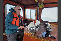
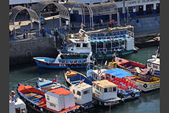
On Wednesday the first of April Franck drove me to Valparaiso. The ship was scheduled to be boarded in San Antonio, Chile. But, I wanted to see Valparaiso due to its impact on the whaling industry in the 1700's. Although there was no history about the whales, I did have a great time there. In the port, I chartered a 13-meter launch without passengers, the MV Luchita, to see the port and the city from the water. The sea fog was lifting, but still restricted visibility somewhat. Never mind, I had fun piloting the launch around the harbor.
-
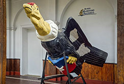
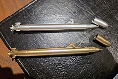
The Maritime Museum was awesome, very large and full of the history of the Chilean Navy. What it lacked in whaling history, it more than made in Chilean Navy artifacts of all ages. I bought souvenir submarine pens. They were too cool to pass up. They had some of the largest scale model sailing ships, I've seen yet. There were several Navy personnel stationed in the museum. It was quite a fortress full of exhibits and memorials to Chilean Navy accomplishments. See below for the significance of the Navy to Valparaiso.
-
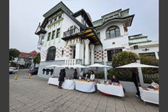
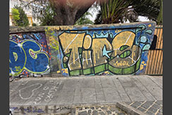
Valparaiso is a dirty city which looks dirtier since they legalized graffiti as "art". Graffiti of every shape and color is everywhere. Immigrants built the city and the sign shows the Avenue of America renamed to the Avenue of Yugoslavia. The architecture of this architect office is quite unique and very impressive!
-
The Restaurant "Donde Willy" is hidden awa down an alley and offers an incredible and memorable meal. Chilean Sea Bass covered with King Crab on a Carrott Souffle. The Waiter / silent partner introduced me to the finest Chilean wines. He worked in NYC and owned a restaurant on restaurant row and one in queens. He really knew his wines. Tasted two fabulous whites and chose a light Chassagne Montrachet flavored Chilean wine with a hint of citrus. Paired perfect with the sea bass. What a meal for only $40. I loved this place. The hardest part is choosing from the menu, octopus, sea urchin, abalone, and the list went on.
-
From Rocaoceanica in Vina del Mar, you can see both coastlines, Valparaiso and Vina del Mar. It is quite a sight to take in. The rich folks, working in the capital (Santiago), buy condos on the shore here for their weekends. Its their Louisiana Grand Isle in Chile, only grander.
- - - - INTERESTING BACKGROUND ON VALPARAISO - - - -
-
Valparaíso is a major city, commune, seaport, and naval base in the Valparaíso Region of Chile. Valparaíso was originally named after Valparaíso de Arriba, in Castile-La Mancha, Spain. With a population of 284,938, it is the 10th-largest commune in Chile.
-
Greater Valparaíso is the second-most populous metro area in the country. Valparaiso is the second-largest city in the metro area (behind Viña del Mar). It is located about 120 km (75 mi) northwest of Santiago, by road, and is one of the Pacific Ocean's most important seaports. Valparaíso is the capital of Chile's second most-populated administrative region and has been the Chilean Navy headquarters since 1817, as well as being the seat of the National Congress of Chile since 1990.
-
Valparaíso played an important geopolitical role in the second half of the 19th century when it served as a major stopover for ships traveling between the Atlantic and Pacific oceans via the Straits of Magellan. The area experienced rapid growth during its golden age as a magnet for European immigrants, when the city was known by international sailors as "Little San Francisco" and "jewel of the Pacific". Notable developments during this bustling period include Latin America's oldest stock exchange, the continent's first volunteer fire department, Chile's first public library, and the oldest Spanish language newspaper in continuous publication in the world, El Mercurio de Valparaíso. In 2003, the historic quarter of Valparaíso was declared a UNESCO World Heritage Site.
-
The twentieth century was unfavorable to Valparaíso, as many wealthy families abandoned the city. The opening of the Panama Canal in 1914, and the associated reduction in ship traffic, dealt a serious blow to the region's shipping- and port-based economy. By the 21st century, the port of San Antonio had surpassed Valparaíso in trade volume (TEU) handled, leading to the questioning of its traditional moniker of Puerto Principal ("principal port") of Chile.
-
Between 2000 and 2015, the city experienced a recovery, attracting artists, tourists, and cultural entrepreneurs, who settled after they were attracted by the city's hillside historic districts. Today, many thousands of people visit Valparaíso each month, from Chile and abroad, to enjoy the city's labyrinth of cobbled alleys and colorful buildings. The Port of Valparaíso still continues to be a major distribution center for container traffic, copper, and fruit exports. It also receives growing attention from cruise ships that visit during the South American summer. Most significantly, Valparaíso has transformed itself into a major educational and entertainment hub, with four large traditional universities and several large vocational colleges. While the city is well-known for its artisans and bohemian culture,[ it is also famous for the annual Viña Del Mar International Song Festival (often simply called "Viña" or "Viña Del Mar"), usually held in March, in a recently refurbished, 40,000-capacity amphitheater.
- Return to Table of Contents
|
Videos of Embarkation Day
My Images of Embarkation Day
|
- - - - MY JAUNTS - - - -
-
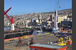
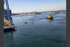
The weather rolled in sea fog and shut down the port of San Antonio. So the boarding had to be changed to Valparaiso.
-
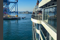
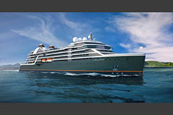
On Thursday, 4/2/26, we boarded Seabourn Pursuit. It was a great experience to be on board a Seabourn Expedition ship. I cruised Iceland and Greenland on the Seabourn Venture in 2023.
-
I'm looking forward to a memorable 48 day expedition of the South pacific islands. Although my abin seems small, it is so much bigger than anything I had with Tidewater. The shower is so small, a fact I will learn to appreciate as the seas get heavier.
-
I signed up for the first Somalier dinner tomorrow night, six fine wines with a six course meal. There's four more to choose from if it's worth the price. Pilot is on-board and we are underway. Captain shows his skills navigating a very tight squeeze coming out of dock.
- - - - INTERESTING BACKGROUND ON MV Sesbourn Pursuit - - - -
-
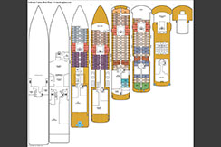
SEABOURN PURSUIT (IMO: 9862035) is a Passenger Ship sailing under the flag of BAHAMAS. Her carrying capacity is 23,000 Gross Tonnage. Her length overall (LOA) is 170 meters and her width is 24.02 meters.
-
Launched in July 2023, Seabourn Pursuit is the luxury cruise line’s second custom-built expedition ship, following in the footsteps of 2022’s Seabourn Venture. And Seabourn Pursuit is nearly identical to its sister ship: a 23,000-gross-ton, 264-passenger luxury vessel that features PC6 Polar Class standards, advanced technology and two submarines.
-
Other than the name, the differences between the two ships are very subtle and are restricted to the onboard décor. Where Seabourn Venture features more accents that allude to cold-weather destinations, Seabourn Pursuit looks to the Tropics for inspiration.
-
The choice of decorative details isn’t merely cosmetic: Seabourn Pursuit’s itineraries are built with an emphasis on longitudinal treks, meaning the ship spends more time on warm-weather destinations than Seabourn Venture, while still visiting polar regions yearly during the Arctic and Antarctic seasons.
-
Beyond its subtle nods to the flora and fauna of equatorial latitudes, Seabourn Pursuit displays the luxury touches that the cruise line is known for. The ship’s luxe resort style follows the blueprint conjured by renowned designer Adam D. Tihany – who also designed Seabourn Venture, Seabourn Encore and Seabourn Ovation. The posh design matches the product: with the exception of some special excursions -- including those that require the use of kayaks or the onboard submarines – Seabourn Pursuit is an all-inclusive cruise.
- Return to Table of Contents
|


My Videos of First Sea Day
My Images of First Sea Day
|
- - - - MY JAUNTS - - - -
-
XXX
-
XXX
-
XXX
-
XXX
-
XXX
- - - - INTERESTING BACKGROUND ON VALPARAISO - - - -
-
XXX
-
XXX
-
XXX
-
XXX
-
XXX
- Return to Table of Contents
|


My Images of Alejandro Selkirk Island
My Videos of Alejandro Selkirk Island
|
- - - - MY JAUNTS - - - -
-
XXX
-
XXX
-
XXX
-
XXX
-
XXX
- - - - INTERESTING BACKGROUND ON ALEJANDRO SELKIRK ISLAND - - - -
-
Alejandro Selkirk Island is the youngest and most remote island in the Juan Fernández Archipelago, formed as the summit of a submarine shield volcano roughly 1-2 million years ago during the Pleistocene epoch. It is also the tallest island in the archipelago - its highest peak, Cerro de Los Inocentes, rises to 1,268 m and occasionally sees snow in winter. Coastal cliffs on the eastern side reach up to 1,000 m, and the island covers roughly 49.5 km², measuring about 11 km north-south by 6 km east-west. (Sources: https://en.wikipedia.org/wiki/Alejandro_Selkirk_Island and https://en.wikipedia.org/wiki/Cerro_de_Los_Inocentes)
-
The island was originally named Isla Más Afuera ("Farther Out") but was renamed by the Chilean government in 1966 to honor Scottish castaway Alexander Selkirk, whose story partly inspired Daniel Defoe's 1719 novel Robinson Crusoe. Ironically, Selkirk was actually marooned on a different island in the same archipelago - now called Robinson Crusoe Island - located about 180 km away. The renaming is widely regarded as a deliberate move to capitalize on the literary association and boost tourism interest. (Source: https://en.wikipedia.org/wiki/Alejandro_Selkirk_Island)
-
The island is the only home of the Masafuera rayadito (Aphrastura masafuerae), a small endemic bird classified as Critically Endangered by the IUCN since 2005. As of a 2018 assessment, its population was estimated at just 50-250 mature individuals, down from roughly 500 counted in the 1980s. The bird lives in montane scrub and fern forest between about 800 and 1,300 m elevation, occasionally descending to 400 m in winter, favoring thick undergrowth near streams - habitat increasingly pressured by invasive plants and animals. (Sources: https://en.wikipedia.org/wiki/Masafuera_rayadito and https://birdsoftheworld.org/bow/species/masray1/cur/introduction)
-
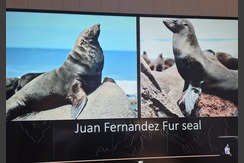
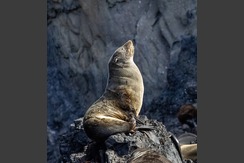
Juan Fernández fur seals, once hunted to near-extinction for their pelts, were thought virtually gone until a small surviving colony of about 200 animals was rediscovered near the archipelago in 1965. Protected since, the population has rebounded dramatically - archipelago-wide estimates now put numbers around 140,000 - making it one of the notable marine conservation recovery stories in the Southern Pacific. (Sources: https://en.wikipedia.org/wiki/Alejandro_Selkirk_Island and https://www.nationalgeographic.org/society/our-programs/pristine-seas/juan-fernandez-archipelago/)
-
In October 2017, Chile designated a 485,000 km² marine park around the Juan Fernández Archipelago, including the waters off Alejandro Selkirk - the largest marine protected area on the South American continent at the time. The island's only settlement, Rada La Colonia, is inhabited seasonally by lobster fishermen and their families for about eight months of the year, reflecting the local community's continued, now more sustainably managed, lobster fishing industry. (Sources: https://www.nationalgeographic.org/society/our-programs/pristine-seas/juan-fernandez-archipelago/ and https://www.islandconservation.org/welcome-to-alejandro-selkirk-island-chile/)
- Return to Table of Contents
|


My Images of Santa Clara Island, Chile
My Videos of Santa Clara Island, Chile
|
- - - - MY JAUNTS - - - -
-
XXX
-
XXX
-
XXX
-
XXX
-
XXX
- - - - INTERESTING BACKGROUND ON SANTA CLARA ISLAND - - - -
-
Santa Clara Island, the smallest of Chile's Juan Fernandez Islands, is geologically the oldest fragment of this volcanic archipelago: its lavas date to roughly 5.8 million years ago, older than neighboring Robinson Crusoe Island. Just 2.2 square kilometers in area and only about a kilometer long, the island is mostly flat and barren, rising to a modest 376 meters at Cerro Johow, its highest point. A reef fringes its southern shore. (Source: https://en.wikipedia.org/wiki/Santa_Clara_Island)
-
Santa Clara is one of only three places on Earth where the endangered pink-footed shearwater nests, alongside neighboring Robinson Crusoe Island and Mocha Island off mainland Chile. These seabirds fly from wintering grounds off Canada thousands of miles south each year to breed on the island's steep slopes. Because Santa Clara is uninhabited and protected within a national park, researchers have used it as a natural laboratory for two decades, tracking how shearwater colonies respond once predators were removed. (Source: https://www.oikonos.org/blog/santa-clara-island-in-the-juan-fernandez-archipelago-is-tiny-but-mighty)
-
For much of the twentieth century Santa Clara doubled as a working stockyard, with goats and sheep grazed there from the 1960s onward, while European rabbits, introduced in the 1930s as a food source, multiplied unchecked until their density reached roughly 65 animals per hectare by 1999, stripping the island's sparse vegetation. Chilean park authorities responded with intensive hunting and regulated poison baiting in 2002, and by 2003 Santa Clara was officially declared rabbit-free. (Source: https://earth.org/chilea-archipelago-rivaling-the-galapagos-fends-off-invasive-species/)
-
Within three years of the 2003 rabbit eradication on Santa Clara, breeding pairs of the endangered pink-footed shearwater rose by almost 40 percent. The recovery illustrates a broader pattern across the Juan Fernandez Archipelago, part of Chile's Valparaiso Region and protected since 1977 as a national park: once introduced grazing animals are removed, native seabirds and plants that evolved with no natural predators can rebound remarkably quickly. (Source: https://earth.org/chilea-archipelago-rivaling-the-galapagos-fends-off-invasive-species/ and https://en.wikipedia.org/wiki/Santa_Clara_Island)
-
Santa Clara lends its name to one of the world's rarest trees, the Santa Clara cabbage tree (Dendroseris pruinata), a daisy-family relative that has evolved a tree-like form found only here and on nearby Robinson Crusoe Island. Classified as critically endangered, it clings to steep, windswept cliffs, its succulent rosettes dying after producing one large feathery flower head, a life strategy known as monocarpy. Introduced grazing animals nearly wiped it out. (Source: https://www.rarepalmseeds.com/dendroseris-pruinata and https://chileanendemics.rbge.org.uk/taxa/dendroseris-pruinata-johow-skottsb)
- Return to Table of Contents
|


My Images of Almeria, Spain
My Videos of Almeria, Spain
|
- - - - MY JAUNTS - - - -
-
XXX
-
XXX
-
XXX
-
XXX
-
XXX
- - - - INTERESTING BACKGROUND ON VALPARAISO - - - -
-
XXX
-
XXX
-
XXX
-
XXX
-
XXX
- Return to Table of Contents
|


My Images of Cartagena, Spain
My Videos of Cartagena, Spain
|
- - - - MY JAUNTS - - - -
-
XXX
-
XXX
-
XXX
-
XXX
-
XXX
- - - - INTERESTING BACKGROUND ON VALPARAISO - - - -
-
XXX
-
XXX
-
XXX
-
XXX
-
XXX
- Return to Table of Contents
|


My Images of Palma de Mallorca, Spain
My Videos of Palma de Mallorca, Spain
|
- - - - MY JAUNTS - - - -
-
XXX
-
XXX
-
XXX
-
XXX
-
XXX
- - - - INTERESTING BACKGROUND ON VALPARAISO - - - -
-
XXX
-
XXX
-
XXX
-
XXX
-
XXX
- Return to Table of Contents
|


My Images of Malaga, Spain
My Videos of Malaga, Spain
|
- - - - MY JAUNTS - - - -
-
XXX
-
XXX
-
XXX
-
XXX
-
XXX
- - - - INTERESTING BACKGROUND ON VALPARAISO - - - -
-
XXX
-
XXX
-
XXX
-
XXX
-
XXX
- Return to Table of Contents
|


My Images of Palamós, Spain
My Videos of Palamós, Spain
|
- - - - MY JAUNTS - - - -
-
XXX
-
XXX
-
XXX
-
XXX
-
XXX
- - - - INTERESTING BACKGROUND ON EASTER ISLAND - - - -
-
Easter Island was first recorded by Europeans on Easter Sunday, April 5, 1722, when Dutch explorer Jacob Roggeveen sighted it and named it "Paasch-Eyland." Its Spanish name, Isla de Pascua, carries the same meaning. The now-common name "Rapa Nui" is actually a later Polynesian coinage, adopted after the devastating 1860s slave raids, meaning "Big Rapa" for its resemblance to the smaller island of Rapa in French Polynesia. (Source: https://en.wikipedia.org/wiki/Easter_Island and https://www.saexpeditions.com/blog/post/history-of-easter-island-whats-in-a-name)
-
Geologically, Easter Island is a small volcanic triangle formed by three extinct shield volcanoes, Terevaka, Poike, and Rano Kau, whose lava flows merged over roughly 750,000 years. The island covers just 163.6 square kilometers, making it one of the most isolated inhabited places on Earth: the nearest inhabited land, Pitcairn Island, lies about 2,075 kilometers away, while mainland Chile is 3,512 kilometers distant. (Source: https://en.wikipedia.org/wiki/Easter_Island)
-
Easter Island was one of the last places on Earth settled by humans, reached by Polynesian voyagers navigating open ocean in double-hulled canoes using stars, swells, and bird flight paths. Radiocarbon dating now places colonization at around 1200 CE, centuries later than earlier estimates. The settlers likely originated from the Mangareva or Gambier Islands region, arriving with the crops and animals needed to build a self-sufficient society an ocean away from any other land. (Source: https://news.mongabay.com/2006/03/easter-island-settled-around-1200-later-than-originally-believed/)
-
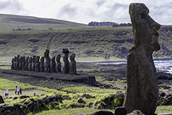
The Rapa Nui carved an estimated 887 monolithic statues, or moai, mostly between 1100 and 1680 CE, almost entirely from volcanic tuff at a single quarry. These were portraits of deified ancestors, called aringa ora, or "living faces," believed to channel mana, or spiritual power. Most were erected on rectangular stone platforms called ahu along the coastline, deliberately facing inward toward the villages they watched over rather than out to sea. (Source: https://en.wikipedia.org/wiki/Easter_Island and https://whc.unesco.org/en/list/715)
-
In 1995, UNESCO inscribed Rapa Nui National Park as a World Heritage Site, recognizing the island as a unique cultural phenomenon: a Polynesian society that, in complete isolation, developed a religious and social system expressed through monumental stone sculpture unmatched anywhere else in Polynesia. The designation places the moai, ceremonial platforms, petroglyphs, and quarry sites under formal international protection. (Source: https://whc.unesco.org/en/list/715)
- Return to Table of Contents
|


My Images of Sanary-sur-Mer, France
My Videos of Sanary-sur-Mer, France
|
- - - - MY JAUNTS - - - -
-
XXX
-
XXX
-
XXX
-
XXX
-
XXX
- - - - INTERESTING BACKGROUND ON EASTER ISLAND - - - -
-
The Rano Raraku quarry, an extinct volcanic crater on the island's southeastern side, was the birthplace of roughly 95 percent of all moai, carved directly from the crater's compressed volcanic ash using stone picks called toki. Close to 400 statues remain frozen mid-production there. The largest of all, nicknamed "El Gigante," lies unfinished on the quarry's slope at 21.6 meters tall and an estimated 270 tonnes. (Source: https://en.wikipedia.org/wiki/Rano_Raraku)
-
How the Rapa Nui moved multi-ton statues several kilometers from the quarry puzzled researchers for decades. A study by archaeologists Terry Hunt and Carl Lipo demonstrated that the statues' wide D-shaped bases and forward-leaning posture let teams "walk" them upright in a rocking, side-to-side motion using ropes. In tests, just 18 people walked a 4.35-ton replica 100 meters in about 40 minutes, supporting Rapa Nui oral tradition that the moai simply "walked" to their destinations. (Source: https://www.binghamton.edu/news/story/5830/easter-islands-statues-actually-walked-and-physics-backs-it-up)
-
Rapa Nui society's religious focus eventually shifted from moai worship to the tangata manu, or birdman, competition, centered on the clifftop ceremonial village of Orongo. Each year, chiefs sponsored young men who scaled sheer cliffs, swam through shark-infested water to the islet of Motu Nui, and raced to retrieve the season's first sooty tern egg. The winning sponsor became the sacred tangata manu, gaining ritual authority for a year. Documented into the 1860s, the tradition endures as a symbol of Rapa Nui identity. (Source: https://en.wikipedia.org/wiki/Tangata_manu)
-
For decades, the popular "ecocide" narrative held that islanders destroyed their own society by overharvesting palm forests, triggering a pre-European population collapse. Newer evidence complicates this: a 2024 ancient DNA analysis of pre-contact skeletons found no genetic signature of a population crash before Europeans arrived in 1722. Many researchers now argue the demographic catastrophe most associated with the island, a drop to roughly 111 people by 1877, was driven by 19th-century slave raids, disease, and colonial exploitation. (Source: https://www.nature.com/articles/s41586-024-07881-4 and https://www.scientificamerican.com/article/rethinking-easter-islands-historic-collapse/)
-
Chile formally annexed Easter Island on September 9, 1888, when naval captain Policarpo Toro secured an "Agreement of Wills" with Rapa Nui chief Atamu Tekena. For decades afterward, most of the island was leased to a foreign sheep-ranching operation that confined the Rapa Nui population to the village of Hanga Roa behind a fence until 1953. Islanders were not granted full Chilean citizenship until 1966. In 2007, a constitutional reform designated the island a "special territory" of Chile. (Source: https://en.wikipedia.org/wiki/Easter_Island)
- Return to Table of Contents
|


My Images of Monte Carlo, Monaco
My Videos of Monte Carlo, Monaco
|
- - - - MY JAUNTS - - - -
-
XXX
-
XXX
-
XXX
-
XXX
-
XXX
- - - - INTERESTING BACKGROUND ON VALPARAISO - - - -
-
XXX
-
XXX
-
XXX
-
XXX
-
XXX
- Return to Table of Contents
|


My Images of Cannes, France
My Videos of Cannes, France
|
- - - - MY JAUNTS - - - -
-
XXX
-
XXX
-
XXX
-
XXX
-
XXX
- - - - INTERESTING BACKGROUND ON VALPARAISO - - - -
-
XXX
-
XXX
-
XXX
-
XXX
-
XXX
- Return to Table of Contents
|


My Images of Portofino, Italy
My Videos of Portofino, Italy
|
- - - - MY JAUNTS - - - -
-
XXX
-
XXX
-
XXX
-
XXX
-
XXX
- - - - INTERESTING BACKGROUND ON DUCIE ISLAND - - - -
-
Ducie Island is a small, uninhabited coral atoll in the Pitcairn Islands group, covering about 3.9 square kilometers including its lagoon and made up of four low-lying islets - Acadia, Pandora, Edwards, and Westward - enclosing a shallow lagoon reaching roughly 15 meters deep. It is thought to have formed several million years ago through volcanic hotspot activity, leaving a classic ring-shaped reef structure with very little vegetation or soil, unusual even among remote Pacific atolls. (Source: https://en.wikipedia.org/wiki/Ducie_Island and https://tropicalislands.net/ducie-atoll/)
-
The atoll was first sighted by Portuguese navigator Pedro Fernandes de Queiros, sailing for Spain, on January 26, 1606, who named it Luna Puesta, "moon that has set." It was rediscovered on March 16, 1791 by Captain Edward Edwards of HMS Pandora while searching for the Bounty mutineers, who renamed it Ducie after Baron Ducie, an officer he had served under. Britain formally annexed the island on December 19, 1902, folding it into the Pitcairn Islands colony. (Source: https://en.wikipedia.org/wiki/Ducie_Island)
-
Despite its barren appearance, Ducie is a globally important seabird sanctuary, hosting more than 90 percent of the entire world population of Murphy's petrel along with around 3,000 pairs of Christmas shearwaters. In 1997 conservationists eradicated invasive Polynesian rats from the atoll, helping seabird populations recover. The surrounding lagoon and reef support roughly 138 fish species plus Galapagos and whitetip reef sharks, making the atoll a valuable, largely undisturbed marine ecosystem. (Source: https://en.wikipedia.org/wiki/Ducie_Island)
-
Ducie ranks among the most isolated atolls on Earth, lying about 540 kilometers east of Pitcairn Island, the nearest inhabited land, and roughly 355 kilometers west of uninhabited Henderson Island. With no airstrip, safe harbor, or permanent population, it receives only occasional visits, typically just one or two a year, from passing yachts, research expeditions, or cruise ships willing to make the long detour. (Source: https://en.wikipedia.org/wiki/Ducie_Island and https://tropicalislands.net/ducie-atoll/)
-
In a quirk of geography, Ducie's Pandora Islet is one of three land points that define Point Nemo, the oceanic pole of inaccessibility and the spot in the ocean farthest from any land. Pandora Islet, Motu Nui near Easter Island, and Maher Island off Antarctica each sit almost exactly 2,688 kilometers from that point, making tiny, uninhabited Ducie a reference marker for the most remote place in any ocean on the planet. (Source: https://en.wikipedia.org/wiki/Pole_of_inaccessibility)
- Return to Table of Contents
|


My Images of Portoferraio, Italy
My Videos of Portoferraio, Italy
|
- - - - MY JAUNTS - - - -
-
XXX
-
XXX
-
XXX
-
XXX
-
XXX
- - - - INTERESTING BACKGROUND ON PITCAIRN ISLAND - - - -
-
On 15 January 1790, nine mutineers from HMS Bounty, led by Fletcher Christian, landed on Pitcairn with eighteen Tahitians and an infant girl, choosing the island partly because an earlier surveyor had charted it about 330 kilometers out of true position, making it extraordinarily hard for the Royal Navy to find. On 23 January, Matthew Quintal burned the Bounty in the bay below, cutting off any retreat. By the time an American sealer happened upon it in 1808, only one mutineer, John Adams, was still alive. (Source: https://en.wikipedia.org/wiki/History_of_the_Pitcairn_Islands)
-
Pitcairn is one of the least populous jurisdictions on Earth: the CIA World Factbook put its 2025 estimate at just 50 residents, almost all clustered around the island's only settlement, Adamstown. Most islanders descend directly from the Bounty mutineers and the Tahitians who sailed with them, and the community speaks Pitkern, a creole blending eighteenth-century English with Tahitian. Nearly the entire population is nominally Seventh-day Adventist, a legacy of an 1887 mass conversion. (Source: https://en.wikipedia.org/wiki/Pitcairn_Islanders and https://theworldfactbook.org/country/pitcairn-islands.html)
-
Pitcairn Island itself is a small, rugged volcanic outcrop roughly 3.2 kilometers long and 1.6 kilometers wide, its steep cliffs rising to 346 meters. Unlike most South Pacific neighbors, it has no fringing coral reef, so all fishing is done offshore and the only access is a small pier at Bounty Bay, the same cove where the mutineers scuttled their ship in 1790. There is no airstrip; every visitor and supply shipment must be landed by small boat. (Source: https://en.wikipedia.org/wiki/Pitcairn_Island)
-
Pitcairn's governance dates to an 1838 constitution, when the settler community elected an annual magistrate chosen "by the free votes of every native born on the island, male or female" over eighteen - an extraordinarily early instance of women's suffrage, decades before it existed in Britain. Today Pitcairn is a British Overseas Territory run locally by an elected Island Council, while the non-resident Governor also serves as British High Commissioner to New Zealand. (Source: https://www.government.pn/history and https://en.wikipedia.org/wiki/Governor_of_Pitcairn)
-
One of Pitcairn's most surprising claims to fame is its honey. Roughly 170 years of isolation from continental beekeeping means the island's bee colonies have never encountered varroa mites or American foulbrood, making Pitcairn honey among the purest and rarest in the world. The Pitcairn Islands Producers Co-operative, founded in 1998, bottles it in tiny batches that reportedly sell out within days whenever a cruise ship calls, one of the few sources of outside income for the community. (Source: https://livebeekeeping.com/honey/pitcairn-island-honey/ and https://www.visitpitcairn.pn/the-pitkern-blog/pipco-launch)
- Return to Table of Contents
|


My Images of Civitavecchio, Italy
My Videos of Civitavecchio, Italy
|
- - - - MY JAUNTS - - - -
-
XXX
-
XXX
-
XXX
-
XXX
-
XXX
- - - - INTERESTING BACKGROUND ON VALPARAISO - - - -
-
XXX
-
XXX
-
XXX
-
XXX
-
XXX
- Return to Table of Contents
|


My Images of Sorento, Italy
My Videos of Sorento, Italy
|
- - - - MY JAUNTS - - - -
-
XXX
-
XXX
-
XXX
-
XXX
-
XXX
- - - - INTERESTING BACKGROUND ON VALPARAISO - - - -
-
XXX
-
XXX
-
XXX
-
XXX
-
XXX
- Return to Table of Contents
|


My Images of Giardini Naxos & Taormina, Italy
My Videos of Giardini Naxos & Taormina, Italy
|
- - - - MY JAUNTS - - - -
-
XXX
-
XXX
-
XXX
-
XXX
-
XXX
- - - - INTERESTING BACKGROUND ON FAKARAVA - - - -
-
Fakarava is the second-largest atoll in the Tuamotu Archipelago, a coral ring roughly 60 kilometers long and 21 kilometers wide enclosing a lagoon of about 1,121 square kilometers, the second-largest in French Polynesia. Like all atolls it is not a volcanic peak but a coral ring grown around a submerged volcanic seamount formed some 54 to 60 million years ago. Its two natural passes, Garuae in the north and Tumakohua in the south, are the only breaks where the ocean exchanges water with the lagoon. (Source: https://en.wikipedia.org/wiki/Fakarava)
-
Fakarava anchors a UNESCO Man and the Biosphere Reserve first designated in 1977, now spanning nearly 1.99 million hectares across seven Tuamotu atolls. The reserve pairs contrasting lagoon types for study, including Fakarava's wide-open system, fed by Garuae Pass (the widest pass in French Polynesia at roughly 1,600 meters across), alongside the sealed lagoons of Taiaro and Niau. The designation protects reef biodiversity while still permitting local pearl farming, fishing and copra production. (Source: https://www.unesco.org/en/mab/commune-de-fakarava)
-
Fakarava's Tumakohua, or South Pass, hosts one of the densest known aggregations of gray reef sharks on Earth, sometimes numbering several hundred in a single channel. Researchers called it an "extreme inverted trophic pyramid," an ecosystem with more predator biomass than the prey base could typically support. The explanation is a massive annual camouflage grouper spawning event each June around the full moon, when up to roughly 17,000 groupers crowd into the pass, drawing some 700 sharks to feast. (Source: https://www.nationalgeographic.com/magazine/article/shark-alley-breeding-grouper-french-polynesia-fakarava-atoll and https://pubmed.ncbi.nlm.nih.gov/27476598/)
-
Fakarava carries deep significance as the ancestral home of the Pomare dynasty, the royal line that later unified and ruled the Society Islands, including Tahiti. The atoll entered the written record in 1820, when Russian explorer Fabian Gottlieb von Bellingshausen charted it and, unaware it was inhabited, named it Wittgenstein Island. France absorbed the Tuamotus into its Pacific territories in the 19th century, after which Fakarava's economy turned to copra and mother-of-pearl harvesting. (Source: https://en.wikipedia.org/wiki/Fakarava)
-
A lesser-known detour on Fakarava is Tetamanu, the atoll's original capital before administration shifted north to Rotoava. Tetamanu still holds the first Catholic church built in the Tuamotu Archipelago from limestone, completed in 1874 using coral blocks cut from the reef, its interior decorated with a shell chandelier and a mother-of-pearl altar. Now nearly deserted, the old village and coral church remain standing beside the South Pass, a reminder that this celebrated shark-diving site was once the political and religious heart of the atoll. (Source: https://www.kupi.com/en-ae/explore/french-polynesia/fakarava/history and https://www.tahititourisme.com/cultural-heritage/tetamanu-ancient-village-and-church/)
- Return to Table of Contents
|

My Images of Day at Sea
My Videos of Day at Sea
|
- - - - MY JAUNTS - - - -
-
XXX
-
XXX
-
XXX
-
XXX
-
XXX
- - - - INTERESTING BACKGROUND - - - -
-
Tahanea is a vast, elongated coral atoll in the Tuamotu Archipelago, stretching roughly 48 kilometers in length with a lagoon spanning about 545 square kilometers. Its low-lying rim is broken into roughly 100 separate coral islets, or motu. Three navigable passes, Teavatapu, Motupuapua, and Otao, let ocean water flush in and out of the lagoon, driving the currents that feed its reef life. It lies about 12 to 15 kilometers east of Faaite Atoll. (Source: https://en.wikipedia.org/wiki/Tahanea and https://www.pacificpuddlejump.com/tahanea-a-deserted-paradise/)
-
Tahanea's passes and lagoon support a strikingly intact reef ecosystem, prized by sailors and researchers as a benchmark for an undisturbed Tuamotu atoll. Nutrient-rich currents draw large pelagic species alongside resident black-tip reef sharks, which cruise close to shore in the clear water. The lagoon's coral bommies shelter manta rays, moray eels, Napoleon wrasse, groupers, and butterflyfish, while the motu support kaveu, the large coconut crabs occasionally harvested for their prized meat. (Source: https://www.pacificpuddlejump.com/tahanea-a-deserted-paradise/ and https://www.jacarandajourney.com/89-tahanea)
-
Tahanea has no permanent inhabitants and was formally designated a nature reserve in 2001, traditionally overseen by the neighboring community of Faaite, which manages the atoll as an ancestral sanctuary rather than a settlement. In practice the protection is informal and lightly enforced, but it has still helped Tahanea remain one of the best-preserved atolls in the Tuamotus, its motu still forested with native vegetation. (Source: https://www.jacarandajourney.com/89-tahanea)
-
Europeans first recorded Tahanea in 1774, when Spanish navigator Domingo de Boenechea sighted it and named it San Julian. In 1820, Russian explorer Fabian Gottlieb von Bellingshausen charted the atoll again and named it Chichagov. Despite these European names, the atoll was never colonized or permanently settled, and it eventually reverted to its Polynesian name, administered today as part of the Anaa commune alongside Faaite and Motutunga. (Source: https://en.wikipedia.org/wiki/Tahanea)
-
In July 2011, conservationists carried out a rat eradication project on several of Tahanea's motu to protect the Tuamotu sandpiper, a small shorebird known locally as the titi, already wiped out across most of its range by introduced rats. Follow-up surveys confirmed the rats were gone and recorded territorial breeding pairs recolonizing the cleared islets, though a cyclone shortly afterward temporarily suppressed the bird's numbers. (Source: https://www.islandconservation.org/tahanea-atoll-motus-now-safe-for-the-titi/)
- Return to Table of Contents
|


My Images of Kotor, Montenegro
My Videos of Kotor, Montenegro
|
- - - - MY JAUNTS - - - -
-
XXX
-
XXX
-
XXX
-
XXX
-
XXX
- - - - INTERESTING BACKGROUND ON ANAA - - - -
-
Anaa is an elongated atoll in the eastern Tuamotu Archipelago, stretching roughly 28 to 30 kilometers long but only about 6 kilometers wide, enclosing a shallow lagoon just 5 to 6 meters deep. Unlike most Tuamotu atolls, Anaa has risen several meters above sea level, a result of the ocean floor flexing under the volcanic weight of Tahiti, a process geologists call lithospheric bulging, exposing fossilized coral cliffs and jagged limestone shoreline called feo. (Source: https://welcome-tahiti.com/en/anaa-the-realm-of-marvelous-treasures/)
-
Long before European contact, Anaa held outsized political power in the Tuamotus, functioning as the archipelago's de facto capital and home to the feared Parata warriors, who raided neighboring atolls for more than two centuries. Spanish navigator Pedro Fernandez de Quiros is credited with the first European sighting in 1606. James Cook passed by in 1769 and dubbed it Chain Island for its elongated shape, a name still found on some historical charts. (Source: https://en.wikipedia.org/wiki/Anaa and https://welcome-tahiti.com/en/anaa-the-realm-of-marvelous-treasures/)
-
Anaa's relatively rich soil, unusual for a Tuamotu atoll, helped it become one of the archipelago's most prosperous islands in the nineteenth century, thriving as a center of the mother-of-pearl shell and copra trade. Around 1850 its population peaked at roughly 2,000 people, a remarkable figure for a low coral island with limited fresh water. That prosperity faded as global demand shifted and younger residents left in growing numbers for Tahiti between the 1950s and 1960s. (Source: https://en.wikipedia.org/wiki/Anaa)
-
Anaa's low-lying position has made it repeatedly vulnerable to Pacific cyclones, with severe storms in 1878 and 1906 sending waves completely across the atoll. A hurricane in 1983 forced the main village to be rebuilt on higher, more sheltered ground, and the community subsequently built a dedicated cyclone refuge shelter sized to hold the entire island population during future storms. (Source: https://en.wikipedia.org/wiki/Anaa)
-
Beyond its single inhabited village of Tuuhora, Anaa contains three now-abandoned settlements - Putuahara, Otepipi, and Tematahoa - whose churches still stand and are periodically reopened for religious celebrations that draw former residents back. Local legend holds that Anaa's caves and brackish springs, carved into uplifted fossil coral, once served as gateways to the spirit world, connecting underground to every other island in the Tuamotu chain. (Source: https://welcome-tahiti.com/en/anaa-the-realm-of-marvelous-treasures/)
- Return to Table of Contents
|


My Images of Dubrovnik, Croatia
My Videos of Dubrovnik, Croatia
|
- - - - MY JAUNTS - - - -
-
XXX
-
XXX
-
XXX
-
XXX
-
XXX
- - - - INTERESTING BACKGROUND ON PAPEETE - - - -
-
Papeete's name derives from Tahitian words meaning "water from a basket," a name adopted during a royal naming taboo under King Pomare I. What began as a modest harbor settlement grew rapidly in the 1830s and 1840s into a favored port of call for whaling ships. France annexed Tahiti and its dependencies in 1880, after which Papeete became the seat of the colonial governor, formally achieving commune status in 1890. (Source: https://en.wikipedia.org/wiki/Papeete and https://www.britannica.com/place/Papeete)
-
Today Papeete remains the political and economic nerve center of French Polynesia, hosting the office of the President of French Polynesia alongside the residence of the French High Commissioner. Its harbor handles exports such as copra, vanilla, mother-of-pearl and coffee alongside heavy cruise ship and yacht traffic, while Faa'a International Airport links the islands to Los Angeles, Auckland, Tokyo and Paris, making the city the main gateway into a territory of roughly 118 islands. (Source: https://www.britannica.com/place/Papeete and https://www.going.com/guides/french-polynesia-the-pacific-ocean-country-of-118-islands)
-
As of the 2022 census, the commune of Papeete itself was home to just 26,654 residents, but the wider urban agglomeration held 124,724 people, a substantial share of French Polynesia's total population. About 72.5 percent of residents were born in French Polynesia, and the community includes a long-established Chinese population descended from 19th century laborers. French is spoken in 83.9 percent of households, while Tahitian remains the primary home language for 13.5 percent. (Source: https://en.wikipedia.org/wiki/Papeete)
-
Papeete hosts Heiva i Tahiti, widely considered the oldest festival in the Pacific, tracing its roots to Bastille Day celebrations first held in 1881. Traditional dance was largely absent from early events because missionary-influenced law had banned heiva performances since 1819; a 1956 revival restored 'ori Tahiti dance, and the festival took its current name in 1985. Every July the city's waterfront fills with weeks of competitive dance, drumming and choral singing. (Source: https://www.heiva.org/en/140-years-of-heiva-i-tahiti/)
-
On September 22, 1914, Papeete became an unlikely World War I battleground when German cruisers SMS Scharnhorst and SMS Gneisenau shelled the port while hunting for coal and Allied shipping. French defenders scuttled the gunboat Zelee and burned the coal stocks rather than let them fall into German hands, and two city blocks were destroyed. The raid exposed the German squadron's position, feeding into the chain of events leading to the naval battles of Coronel and the Falkland Islands weeks later. (Source: https://en.wikipedia.org/wiki/Bombardment_of_Papeete)
- Return to Table of Contents
|


My Images of Split, Croatia
My Videos of Split, Croatia
|
- - - - MY JAUNTS - - - -
-
XXX
-
XXX
-
XXX
-
XXX
-
XXX
- - - - INTERESTING BACKGROUND ON RAIATEA - - - -
-
Raiatea's Taputapuatea marae, a stone temple complex at Opoa, was inscribed as a UNESCO World Heritage Site in 2017 for its testimony to nearly a thousand years of Ma'ohi civilization. Its basalt-paved central courtyard measures roughly 44 by 60 meters and once served as the political, religious and funerary heart of eastern Polynesia. Built and expanded between the 14th and 18th centuries, the marae was damaged in intertribal warfare, abandoned after missionaries arrived, and archaeologically restored in 1994. (Source: https://whc.unesco.org/en/list/1529/ and https://en.wikipedia.org/wiki/Taputapuatea_marae)
-
Long before European contact, Raiatea was known to Polynesians as Havai'i, a sacred name echoed today in Hawaii and in Savai'i, Samoa's largest island. Positioned at the center of the Polynesian Triangle, Raiatea is widely regarded as the ancestral homeland from which voyaging canoes set out on the long migrations that settled Hawaii, Aotearoa, the Cook Islands and other archipelagos over roughly a thousand years. (Source: https://en.wikipedia.org/wiki/Ra%CA%BBi%C4%81tea and https://whc.unesco.org/en/list/1529/)
-
Raiatea is the second-largest of the Society Islands, covering about 175 square kilometers of rugged terrain crowned by the 1,017-meter Mount Tefatoaiti. Together with its smaller neighbor Tahaa, it sits inside a single shared barrier reef and lagoon, separated by a channel only about three kilometers wide. On Raiatea's east coast, the Faaroa River winds inland through a lush valley and is often cited as the only navigable river in French Polynesia. (Source: https://en.wikipedia.org/wiki/Ra%CA%BBi%C4%81tea)
-
The tiare apetahi, a fragrant white flower now critically endangered, grows wild nowhere on Earth except the volcanic plateaus of Mount Temehani on Raiatea, at elevations between roughly 550 and 800 meters. It figures prominently in local Polynesian mythology, and its wild population is threatened by over-collection and by rats introduced to the island. Visiting its native highland habitat is tightly managed, typically requiring a local guide. (Source: https://www.tahititourisme.com/natural-heritage/tiare-apetahi/ and https://en.wikipedia.org/wiki/Sclerotheca_raiateensis)
-
One startling chapter of Raiatea's natural history concerns its tree snails. The island once held roughly 34 partulid species, 33 found nowhere else on Earth. That fauna was almost wiped out after authorities introduced the carnivorous rosy wolfsnail in 1986 as biological control, a decision that instead devastated native snails across the Society Islands. In February 2006, researchers climbing Mount Tefatua discovered two surviving populations above 700 meters, including a species entirely new to science. (Source: https://www.cambridge.org/core/journals/oryx/article/not-completely-lost-two-partulid-tree-snail-species-persist-on-the-highest-peak-of-raiatea-french-polynesia/E9D05A1E3BC746ECC62C7F504181B75D)
- Return to Table of Contents
|


My Images of Rovinj, Croatia
My Videos of Rovinj, Croatia
|
- - - - MY JAUNTS - - - -
-
XXX
-
XXX
-
XXX
-
XXX
-
XXX
- - - - INTERESTING BACKGROUND ON XXX - - - -
-
XXX
-
XXX
-
XXX
-
XXX
-
XXX
- Return to Table of Contents
|
My Images of Malaga, Spain
My Videos of Malaga, Spain
|
- - - - MY JAUNTS - - - -
-
XXX
-
XXX
-
XXX
-
XXX
-
XXX
- - - - INTERESTING BACKGROUND ON AITUTAKI - - - -
-
Aitutaki is geologically classified as an "almost atoll," a rare intermediate stage between a fully volcanic high island and a true coral atoll: a subsiding volcanic remnant, its highest point Maunga Pu at about 123 meters, sits within a barrier reef enclosing a lagoon of roughly 50 to 74 square kilometers scattered with about 15 low coral motu. (Source: https://en.wikipedia.org/wiki/Aitutaki and https://www.britannica.com/place/Aitutaki-Atoll)
-
Polynesian voyagers are believed to have settled Aitutaki sometime between roughly AD 1225 and 1430. European contact came later: Captain James Cook sighted the island in 1777, and on 11 April 1789, Captain William Bligh and the crew of HMS Bounty called at Aitutaki just weeks before the famous mutiny, with Bligh introducing papaya, which later became a significant local export crop. (Source: https://en.wikipedia.org/wiki/Aitutaki and https://www.britannica.com/place/Aitutaki-Atoll)
-
During World War II, Allied forces built two airstrips on Aitutaki, completed in November 1942, at a cost the United States put at about 4.5 million dollars. The island became a link in the so-called "Milk Run," a Pacific air corridor connecting Hawaii to Australia; roughly 850 American servicemen were initially stationed there before the garrison shrank as the Japanese threat receded. The north-south strip, resealed in 2003, remains in use as Aitutaki's airport today. (Source: https://www.tracesofwar.com/sights/150444/Amuri-Field-Airstrip-Aitutaki.htm)
-
As of the 2021 census Aitutaki had about 1,782 residents, the second most populous island in the Cook Islands after Rarotonga, with its administrative center, Arutanga, home to the Cook Islands Christian Church, the country's oldest church, established after missionary John Williams arrived in 1821. Despite its small resident population, Aitutaki people maintain an unusually large diaspora, estimated at tens of thousands living mostly in New Zealand and Australia. (Source: https://en.wikipedia.org/wiki/Aitutaki)
-
In 1900 Aitutaki became the only island in the Cook Islands formally annexed by Britain rather than ceded by its chiefs, a distinct legal path into colonial status. Out in the lagoon, on the tiny motu of Tapuaetai, commonly called One Foot Island, a small kiosk operates as what is popularly billed as the world's smallest post office, where visitors can have their passports stamped with a unique island stamp. (Source: https://en.wikipedia.org/wiki/Aitutaki and https://cookislands.travel/islands/aitutaki)
- Return to Table of Contents
|
My Images of Malaga, Spain
My Videos of Malaga, Spain
|
- - - - MY JAUNTS - - - -
-
XXX
-
XXX
-
XXX
-
XXX
-
XXX
- - - - INTERESTING BACKGROUND ON XXX - - - -
-
XXX
-
XXX
-
XXX
-
XXX
-
XXX
- Return to Table of Contents
|
My Images of Malaga, Spain
My Videos of Malaga, Spain
|
- - - - MY JAUNTS - - - -
-
XXX
-
XXX
-
XXX
-
XXX
-
XXX
- - - - INTERESTING BACKGROUND ON XXX - - - -
-
XXX
-
XXX
-
XXX
-
XXX
-
XXX
- Return to Table of Contents
|
My Images of Malaga, Spain
My Videos of Malaga, Spain
|
- - - - MY JAUNTS - - - -
-
XXX
-
XXX
-
XXX
-
XXX
-
XXX
- - - - INTERESTING BACKGROUND - - - -
-
The International Date Line traces its origin to the International Meridian Conference held in Washington, D.C. in October 1884, where delegates from 25 nations agreed to adopt Greenwich, England as the world's prime meridian. The conference declined to mandate an actual date line, leaving that to custom; navigators and mapmakers subsequently settled on the meridian roughly opposite Greenwich, 180 degrees of longitude, as the practical place where the calendar date changes, since it runs mostly through open ocean. (Source: https://en.wikipedia.org/wiki/International_Date_Line and https://en.wikipedia.org/wiki/International_Meridian_Conference)
-
Rather than following the 180th meridian in a straight line, the Date Line zigzags sharply across the Pacific to keep entire nations and island groups on a single calendar date. It bends far east around Kiribati's Line Islands, swings west of Alaska's Aleutian Islands, and detours east of Russia's Chukchi Peninsula. These deviations exist because the line has no legal standing in international law; each government effectively chooses which side suits it best. (Source: https://en.wikipedia.org/wiki/International_Date_Line)
-
For a ship or airline passenger, crossing the Date Line has an immediate effect on the calendar. Traveling west means skipping a day entirely, so a cruise passenger might go to sleep Tuesday and wake up Thursday. Traveling east repeats a calendar day. On the open ocean, ships historically followed a separate nautical date line, formalized in 1917, running precisely along the 180th meridian rather than detouring around island nations. (Source: https://en.wikipedia.org/wiki/International_Date_Line)
-
Samoa has switched sides of the Date Line twice. In 1892, Samoan leaders moved to the eastern, American side to ease trade with California, timed so residents celebrated the Fourth of July twice that year. By 2011, Samoa's economy had reoriented toward Australia and New Zealand, so the government erased December 30, 2011, from the calendar entirely, jumping back across the line. Neighboring Tokelau made the identical move. (Source: https://www.smithsonianmag.com/smart-news/why-time-zones-make-work-worse-180961569/ and https://www.csmonitor.com/World/Global-News/2011/1229/Samoa-to-skip-Friday-lose-December-30th-2011-forever)
-
Until 1995, Kiribati was split by the date line itself, leaving its Gilbert Islands roughly a day behind its Phoenix and Line Islands. Kiribati's president solved this by redrawing the line to loop far around the entire country, pushing its easternmost territory, Kiritimati or Christmas Island, into its own time zone of UTC+14, the most advanced clock time on Earth, letting Kiribati become the first inhabited place to greet the new millennium on January 1, 2000. (Source: https://www.amusingplanet.com/2014/12/kiribati-true-land-of-rising-sun.html and https://en.wikipedia.org/wiki/International_Date_Line)
- Return to Table of Contents
|
My Images of Kotor, Montenegro
My Videos of Kotor, Montenegro
|
- - - - MY JAUNTS - - - -
-
XXX
-
XXX
-
XXX
-
XXX
-
XXX
- - - - INTERESTING BACKGROUND ON APIA - - - -
-
Apia began as a modest coastal settlement and grew through the nineteenth century as European traders, missionaries, and consuls established themselves around its natural harbor; Germany administered the territory as German Samoa from 1900 to 1914, after which New Zealand governed it until Samoa gained independence in 1962, with Apia formally confirmed as the nation's capital in 1959. (Source: https://en.wikipedia.org/wiki/Apia and https://en.wikipedia.org/wiki/German_Samoa)
-
Scottish novelist Robert Louis Stevenson, famed for Treasure Island and Kidnapped, spent the final four years of his life at Vailima, his estate above Apia, where Samoans affectionately called him "Tusitala," meaning "teller of tales." After his death on December 3, 1894, villagers carried his coffin up Mount Vaea and buried him at the summit, a climb still known locally as the Road of Loving Hearts. His old estate now houses the Robert Louis Stevenson Museum. (Source: https://en.wikipedia.org/wiki/Mount_Vaea)
-
Samoan society is organized around fa'a Samoa, "the Samoan way," a customary system built on the extended family, or 'aiga, each headed by an appointed chief known as a matai, who represents the family in village and district councils. Everyday conduct is governed by codes of respect, such as saying "tulou" when passing someone seated and observing the evening prayer curfew known as the sa. This system remains legally recognized and shapes daily life and land tenure. (Source: https://en.wikipedia.org/wiki/Fa%CA%BBa_S%C4%81moa)
-
Apia is the capital and largest urban center of Samoa, sitting on the central north coast of Upolu island, with the forested peak of Mount Vaea rising about 472 meters behind the harbor. The 2021 national census recorded a resident population of 35,974 in the Apia urban area, a compact city that concentrates most of the country's government offices, port facilities, and international connections. (Source: https://en.wikipedia.org/wiki/Apia)
-
Apia's harbor was the scene of one of the strangest disasters in naval history on March 15, 1889, when a violent cyclone caught thirteen American, German, and British warships anchored together amid a tense colonial standoff over Samoa. Commanders on both sides refused to be first to leave port for fear of losing face, and the storm wrecked most of the fleet, killing more than 200 sailors, while only the British cruiser HMS Calliope steamed clear and survived. (Source: https://en.wikipedia.org/wiki/1889_Apia_cyclone)
- Return to Table of Contents
|
My Images of Dubrovnik, Croatia
My Videos of Dubrovnik, Croatia
|
- - - - MY JAUNTS - - - -
-
XXX
-
XXX
-
XXX
-
XXX
-
XXX
- - - - INTERESTING BACKGROUND ON XXX - - - -
-
XXX
-
XXX
-
XXX
-
XXX
-
XXX
- Return to Table of Contents
|
My Images of Split, Croatia
My Videos of Split, Croatia
|
- - - - MY JAUNTS - - - -
-
XXX
-
XXX
-
XXX
-
XXX
-
XXX
- - - - INTERESTING BACKGROUND ON NEIAFU & NUKU ISLAND - - - -
-
Neiafu, the administrative capital of the Vava'u island group in Tonga, is built around Port of Refuge, a deep, protected natural harbor that has made the town one of the South Pacific's most popular yachting hubs. With around 3,845 residents at the 2021 census, it is Tonga's second-largest town. Germany operated a coaling station there under an 1876 treaty with Tonga, and Britain took over administration in 1900 after establishing a protectorate over the kingdom. (Source: https://en.wikipedia.org/wiki/Neiafu_(Vava%CA%BBu))
-
Nuku Island is a tiny, low-lying motu in the Vava'u group, fringed with white sand and coconut palms and small enough to walk around in minutes. Uninhabited and reachable only by boat, it sits close to the famous Swallows Cave and is a favorite stop on Vava'u day-tour itineraries, where visitors sunbathe, picnic, and snorkel in shallow, sandy waters where garden eels and reef fish are commonly spotted. (Source: https://www.tongatourism.travel/see-and-do/nuku-island)
-
Between roughly June and October each year, Vava'u becomes one of the very few places on Earth where people can legally swim alongside humpback whales, which migrate from Antarctic feeding grounds to breed and calve in Tonga's warm waters. Tonga declared its waters a whale sanctuary in 1978 and banned commercial whaling nationwide, helping the local humpback population recover from roughly 250 individuals to several thousand today. (Source: https://www.oceanicsociety.org/travel-ideas/swimming-with-whales-in-tonga-common-questions/ and https://en.wikipedia.org/wiki/Vava%CA%BBu)
-
Long before it became a yachting destination, Vava'u was charted by Spanish navigator Francisco Mourelle, who sailed into Neiafu's natural harbor in 1781 and gave it the enduring name Port of Refuge. The archipelago developed under Tongan chiefly rule and, from the 1820s to the 1880s, became a regular stop for Pacific whaling ships. Today Vava'u comprises one large island, 'Utu Vava'u, and roughly 40 smaller islands, including Nuku. (Source: https://en.wikipedia.org/wiki/Vava%CA%BBu)
-
Rising above Neiafu to about 131 meters, flat-topped Mount Talau is the most recognizable landmark in Vava'u, reachable by a short, steep trail rewarded with a 360-degree view. Geologists attribute its truncated summit to erosion, but Tongan legend tells that spirits from Samoa once tried to steal the mountain's peak and carry it away, leaving it flat behind them. The park is also a haven for native birds such as the Tongan whistler. (Source: https://en.wikipedia.org/wiki/Neiafu_(Vava%CA%BBu) and https://national-parks.org/tonga/mount-talau-national-park/)
- Return to Table of Contents
|
My Images of Rovinj, Croatia
My Videos of Rovinj, Croatia
|
- - - - MY JAUNTS - - - -
-
XXX
-
XXX
-
XXX
-
XXX
-
XXX
- - - - INTERESTING BACKGROUND ON VANUA BALAVU - - - -
-
Vanua Balavu, the third largest island in Fiji's Lau Group, is a striking hybrid of two geological histories: its southern half is volcanic, with fertile soil and hot springs, while its northern half is uplifted coral limestone sculpted by wind and tide into scalloped, mushroom-shaped islets. Encircling the island is a barrier reef roughly 130 kilometers long, enclosing a lagoon about 37 by 16 kilometers, though the island itself covers only about 53 square kilometers. (Source: https://en.wikipedia.org/wiki/Vanua_Balavu and https://www.fijimarinas.com/vanua-balavu-lau/)
-
On Vanua Balavu's northern coast lies the Bay of Islands, known locally as Qilaqila, a labyrinth of limestone islets rising from brilliant emerald and turquoise water. Within the bay, Ships Sound is guarded by limestone pinnacles, and the whole area is sheltered enough to serve as a recognized hurricane refuge for yachts. Local authorities established the Qilaqila Marine Reserve here, protecting one of Fiji's most photogenic and least developed anchorages. (Source: https://www.fijimarinas.com/vanua-balavu-lau/ and https://travelboatinglifestyle.com/fijis-bay-of-islands-worlds-best-anchorage/)
-
Vanua Balavu played a pivotal role in nineteenth century Fijian history as the power base of the Tongan chief Enele Ma'afu, who first arrived in 1847 and in 1850 was given the island by the paramount chief of Cakaudrove. Ma'afu settled at Lomaloma and used the island as headquarters while building the Tovata Confederacy, which by 1867 controlled much of northern and eastern Fiji. He died there on 6 February 1881. (Source: https://en.wikipedia.org/wiki/Enele_Ma%CA%BBafu and https://www.britannica.com/place/Vanua-Balavu)
-
Vanua Balavu is home to roughly 1,200 people spread across seventeen villages. About 400 residents of Tongan descent live in Sawana, a village adjoining Lomaloma settled by followers of chief Ma'afu; church services there are still conducted in both Tongan and Fijian. Sawana's Tongan community nominates a candidate for the paramount title of Tui Lau, a rare living link between Tongan and Fijian governance traditions. (Source: https://en.wikipedia.org/wiki/Sawana and https://www.fijimarinas.com/vanua-balavu-lau/)
-
A little-known custom on Vanua Balavu takes place in Mavana village, where each Christmas season residents gather at nearby Masomo Lake to hold a traditional fish-stunning ceremony. The island's deeper history is confirmed by archaeology: a 2000 excavation of Qaranilaca, a sea cave on Vanua Balavu's southeastern tip, uncovered evidence of continuous human occupation stretching back more than a thousand years. (Source: https://www.fijimarinas.com/vanua-balavu-lau/ and https://en.wikipedia.org/wiki/Vanua_Balavu)
- Return to Table of Contents
|
My Images of Malaga, Spain
My Videos of Malaga, Spain
|
- - - - MY JAUNTS - - - -
-
XXX
-
XXX
-
XXX
-
XXX
-
XXX
- - - - INTERESTING BACKGROUND - - - -
-
Yasawa Island, known in Fijian as Yasawa-i-Rara, is the northernmost island of the volcanic Yasawa chain and lends its name to the entire archipelago. The island covers roughly 32 square kilometers, stretches about 22 kilometers tip to tip while narrowing to less than a kilometer wide in places, and rises to a high point of 244 meters. Administratively it falls within Ba Province, far from the bustle of Viti Levu. (Source: https://en.wikipedia.org/wiki/Yasawa and https://en.wikipedia.org/wiki/Yasawa_Islands)
-
Near Yasawa Island's southern tip lies Sawa-i-lau, a limestone island riddled with caves partly flooded with clear turquoise seawater. Visitors swim through a narrow entrance into a main chamber whose domed ceiling soars about 15 meters overhead, lit by a natural skylight. Local legend holds that a giant hawk once seized a princess and hid her here, until a prince summoned winds to fly in and kill the bird, winds Fijians say still stir the cave today. (Source: https://en.wikipedia.org/wiki/Sawa%E2%80%91i%E2%80%91Lau_Caves and https://www.fiji.travel/places-to-go/yasawa-islands/locations/sawa-i-lau-the-heart-of-yasawa-islands)
-
Village life across the Yasawas still runs on customary Fijian protocol: a visitor calling on a settlement is expected to present a bundle of waka, or kava root, as sevusevu, formally asking the village chief permission to enter. Ceremonial kava drinking, communal meke dance performances, and pandanus-leaf weaving remain living practices passed down through generations, and many resorts arrange guided village visits so travelers can experience this etiquette respectfully. (Source: https://explorefijionline.com/5-things-you-didnt-know-about-the-yasawa-islands/ and https://www.fiji.travel/places-to-go/yasawa-islands/locations/ultimate-guide-to-the-yasawa-islands)
-
European awareness of the Yasawas dates to 1789, when Captain William Bligh sailed through the group after the mutiny on the Bounty. Land-based tourism stayed largely closed until 1987, when the traditional high chief lifted longstanding restrictions. International fame arrived regardless in 1980, when the film The Blue Lagoon was shot amid the archipelago's turquoise lagoons, helping spur the backpacker and resort tourism that defines the region today. (Source: https://www.britannica.com/place/Yasawa-Group and https://explorefijionline.com/5-things-you-didnt-know-about-the-yasawa-islands/)
-
Despite hosting dozens of resorts, the entire Yasawa Islands region has no roads connecting its settlements and relies almost entirely on boat transport; the main lifeline is the Yasawa Flyer catamaran, which departs Port Denarau near Nadi each morning and can take up to five hours to thread the length of the chain. The archipelago's only independent supermarket, restaurant, and ATM sit together at a resort in the group's northern reaches, a quirk that keeps the Yasawas feeling remote despite their popularity. (Source: https://www.fiji.travel/places-to-go/yasawa-islands/locations/ultimate-guide-to-the-yasawa-islands)
- Return to Table of Contents
|
My Images of Malaga, Spain
My Videos of Malaga, Spain
|
- - - - MY JAUNTS - - - -
-
XXX
-
XXX
-
XXX
-
XXX
-
XXX
- - - - INTERESTING BACKGROUND - - - -
-
Lautoka's modern origins trace to the sugar trade: the first recorded European sighting of the area was by Captain William Bligh on May 7, 1789, during his open-boat voyage after the mutiny on the Bounty, but the settlement only took shape after the Colonial Sugar Refining Company applied to build a wharf there in 1899. Lautoka was incorporated as a town in 1929 and formally proclaimed a city in 1977, later becoming the administrative capital of Fiji's Western Division in 2012. (Source: https://www.lautokacitycouncil.com.fj/history/ and https://en.wikipedia.org/wiki/Lautoka)
-
The industry that gave Lautoka its nickname, "Sugar City," was built around one of the largest sugar mills in the Southern Hemisphere, constructed between 1899 and 1903 with labor from indentured workers brought from India as well as recruits from the Solomon Islands. The mill remains a major employer today, with roughly 1,300 workers, and continues to anchor an economy that later diversified into timber milling, garment manufacturing, and fishing. (Source: https://fsc.com.fj/history/ and https://en.wikipedia.org/wiki/Lautoka)
-
As the main maritime gateway for western Viti Levu, the Port of Lautoka ranks as the second-largest port in Fiji after Suva, handling bulk exports of raw sugar and molasses alongside woodchips, petroleum, and gas shipments. It also serves as a regular port of call for international cruise ships, positioned near the edge of the Mamanuca and Yasawa reef systems that draw visitors onward into the islands. (Source: https://en.wikipedia.org/wiki/Lautoka and https://www.lautokacitycouncil.com.fj/history/)
-
Lautoka's population has grown dramatically alongside its sugar economy: from roughly 12,000 residents in the early 1970s to 71,573 at the 2017 census, spread across just 32 square kilometers of urban area. For much of the twentieth century the city was predominantly Indo-Fijian, descended from indentured laborers brought to work the cane fields, though in recent decades growth has increasingly been driven by indigenous Fijians relocating from rural areas. (Source: https://en.wikipedia.org/wiki/Lautoka)
-
"Lautoka" is said to mean "spear hit" or "hit to win" in Fijian, recalling a battle cry used by a victorious chief after killing a rival in a duel on the site. In a very different vein, the city is also the birthplace of Vijay Singh, the World Golf Hall of Fame member and three-time major champion, born in Lautoka before growing up in nearby Nadi. (Source: https://www.lautokacitycouncil.com.fj/history/ and https://en.wikipedia.org/wiki/Vijay_Singh)
- Return to Table of Contents
|
My Images of Malaga, Spain
My Videos of Malaga, Spain
|
- - - - MY JAUNTS - - - -
-
XXX
-
XXX
-
XXX
-
XXX
-
XXX
- - - - INTERESTING BACKGROUND - - - -
-
Nabukeru lies in Fiji's Yasawa Islands, a chain of roughly 20 volcanic islands that also contains the archipelago's largest landmass, Naviti Island, covering about 33 square kilometers and rising to 388 meters. The Yasawas stretch northeast for more than 80 kilometers through Fiji's Western Division, with mountainous terrain, dense tropical dry forest, mangroves, and coconut plantations, a rugged geography that has long kept island communities such as Nabukeru relatively isolated. (Source: https://en.wikipedia.org/wiki/Naviti and https://en.wikipedia.org/wiki/Yasawa_Islands)
-
In Nabukeru, a village on Yasawa Island, daily life still follows patterns generations old, with residents relying on fishing and subsistence farming. Visitors are expected to take part in a sevusevu, the formal Fijian welcome ceremony in which a bundle of waka, or kava root, is presented to the village chief as a gesture of respect before any exploration of the settlement or land is permitted. (Source: https://rosiefijicruises.com/nabukedru-yasawa-port/)
-
Nabukeru's main claim to fame among travelers is its proximity to the Sawa-i-Lau limestone caves, a network of collapsed volcanic caverns filled with turquoise pools that became internationally famous after appearing in the 1980 film Blue Lagoon. Reaching the inner chamber requires a short swim through a partly submerged passage into a naturally lit grotto. Cruise and yacht itineraries frequently pair a stop at Nabukeru with a guided caves excursion, snorkeling, and traditional dance performances. (Source: https://www.seabourn.com/en/us/cruise-destinations/australia-new-zealand-cruises/australia-new-zealand-ports/nabukeru-yasawa-island-fiji-ys1 and https://rosiefijicruises.com/nabukedru-yasawa-port/)
-
The Yasawa Islands, home to Nabukeru, were first sighted by Europeans in 1789 when Captain William Bligh sailed through in an open boat after the mutiny on HMS Bounty. For nearly two centuries the islands remained closed to land-based tourism, a restriction upheld into the 1980s at the wish of the paramount chief. Only after a policy reversal in 1987 did hotels and organized visits become possible, opening villages like Nabukeru to cruise and backpacker traffic. (Source: https://www.britannica.com/place/Yasawa-Group and https://rosiefijicruises.com/nabukedru-yasawa-port/)
-
Despite its idyllic image, Nabukeru sits on the front line of climate change in the Pacific, reporting worsening coastal inundation as tropical cyclones drive waves over the seawalls villagers built to hold back the ocean. Fiji has become a global reference point for climate adaptation policy, having already relocated several vulnerable coastal villages inland, and communities like Nabukeru illustrate how a single storm surge can threaten homes and freshwater supplies. (Source: https://www.seabourn.com/en/us/cruise-destinations/australia-new-zealand-cruises/australia-new-zealand-ports/nabukeru-yasawa-island-fiji-ys1)
- Return to Table of Contents
|
My Images of Malaga, Spain
My Videos of Malaga, Spain
|
- - - - MY JAUNTS - - - -
-
XXX
-
XXX
-
XXX
-
XXX
-
XXX
- - - - INTERESTING BACKGROUND - - - -
-
xxx
-
xxxx
-
xxxx
-
xxxx
-
xxxx
-
xxxx
-
xxxx
- Return to Table of Contents
|
My Images of Rovinj, Croatia
My Videos of Rovinj, Croatia
|
- - - - MY JAUNTS - - - -
-
XXX
-
XXX
-
XXX
-
XXX
-
XXX
- - - - INTERESTING BACKGROUND ON AMBRYM - - - -
-
Ambrym is home to twin active volcanoes, Marum and Benbow, rising within a roughly 12 kilometer wide caldera that formed during a catastrophic collapse about 1,900 years ago. For roughly three centuries the vents hosted rare, near-permanent lava lakes, glowing pools of molten rock whose thin crust constantly broke apart and reformed, making Ambrym one of only a handful of places on Earth with such persistent lava lakes, until a major fissure eruption in December 2018 caused them to drain. (Source: https://www.vmgd.gov.vu/geohazards/volcanoes/benbow-and-marum and https://science.nasa.gov/earth/earth-observatory/ambryms-lava-lakes-80014/)
-
On Ambrym, the Rom is a masked ceremonial dance performed only by men, part of a grade-taking system through which a man advances in social rank by purchasing the right to a mask design with pigs and money. Dancers wear a heavy cloak of dried banana leaves and a tall, painted conical mask kept hidden until the ceremony begins. At the close of the ceremony the mask is traditionally burned so no evil spirit lingers. (Source: https://www.heritage-expeditions.com/blog/vanuatu-culture-rom-dance/)
-
Vanuatu's tradition of sand drawing, practiced on Ambrym and other islands, is recognized by UNESCO as a masterpiece of intangible cultural heritage. A practitioner uses a single finger to trace one continuous, unbroken line across an imagined grid, producing a symmetrical geometric figure without lifting the hand. Individual drawings can encode myths, genealogies, and farming techniques, making them simultaneously art, mnemonic device, and message across roughly 80 distinct language groups. (Source: https://ich.unesco.org/en/RL/vanuatu-sand-drawings-00073)
-
Ambrym is Vanuatu's fifth largest island, a roughly triangular landmass of about 678 square kilometers built almost entirely from volcanic material, with a population of a little over 7,000 people concentrated in coastal villages rather than the blackened, ash-smothered interior. At the island's heart lies the 12-kilometer caldera where rainforest gives way abruptly to a barren volcanic desert surrounding Marum and Benbow. (Source: https://en.wikipedia.org/wiki/Ambrym)
-
In 2017 Google sent its Street View camera into the heart of Ambrym: explorers rappelled some 400 meters down the sheer wall of Marum crater to capture 360-degree panoramas beside an active lava lake roughly the size of two football fields, the first time Street View had ever documented the inside of an active volcano. A striking contrast to the island's older reputation, since Ambrym is also widely regarded as the "black magic" and sorcery capital of Vanuatu. (Source: https://blog.google/products/maps/journey-under-earths-surface-street-view/ and https://www.heritage-expeditions.com/blog/vanuatu-culture-rom-dance/)
- Return to Table of Contents
|
My Images of Malaga, Spain
My Videos of Malaga, Spain
|
- - - - MY JAUNTS - - - -
-
XXX
-
XXX
-
XXX
-
XXX
-
XXX
- - - - INTERESTING BACKGROUND - - - -
-
During World War II, Espiritu Santo became the site of Base Button, the largest United States military base in the South Pacific, sprawling across some 38 miles of the island around present-day Luganville. More than 500,000 American servicemen and women passed through by war's end, supported by four airfields, five hospitals, and a massive floating dry dock, making it a critical staging and repair hub for the Solomon Islands and New Guinea campaigns. (Source: https://en.wikipedia.org/wiki/Naval_Advance_Base_Espiritu_Santo and https://en.wikipedia.org/wiki/Luganville)
-
When the war ended, the United States offered to sell its surplus military hardware to the incoming colonial administrators at a discount, but the deal was refused in hopes of getting it for free. Rather than hand it over, American forces drove trucks, jeeps, bulldozers, tanks and supplies off a wharf into the sea. The resulting underwater junkyard, now known as Million Dollar Point, has become a popular and eerie snorkeling and diving site just outside Luganville. (Source: https://www.atlasobscura.com/places/million-dollar-point)
-
The SS President Coolidge, a converted luxury ocean liner serving as a troopship, struck two friendly mines while entering the harbor at Espiritu Santo on October 26, 1942. The captain deliberately grounded the sinking ship to allow more than 5,000 troops to escape, and only two men died. Since 1983 salvage has been banned, leaving the largely intact wreck one of the world's most famous accessible wreck dives. (Source: https://en.wikipedia.org/wiki/SS_President_Coolidge)
-
Luganville and Espiritu Santo hold a quiet literary claim to fame: novelist James Michener was stationed there during World War II, and from the island he could see the silhouette of neighboring Ambae rising hazily on the horizon. That distant island became his inspiration for the mystical Bali Ha'i in his 1947 story collection Tales of the South Pacific, later immortalized in Rodgers and Hammerstein's musical South Pacific. (Source: https://en.wikipedia.org/wiki/Bali_Ha%27i)
-
One of Luganville's oddest wartime relics is its unusually wide main thoroughfare, Boulevard Higinson, which locals say was built to that generous width because the American base commander insisted four tanks be able to drive abreast along it at once. The town's layout still bears other traces of its improvised military past, a reminder that Luganville essentially grew up around a hastily built wartime supply depot rather than a planned colonial town. (Source: https://en.wikipedia.org/wiki/Luganville)
- Return to Table of Contents
|
My Images of Malaga, Spain
My Videos of Malaga, Spain
|
- - - - MY JAUNTS - - - -
-
XXX
-
XXX
-
XXX
-
XXX
-
XXX
- - - - INTERESTING BACKGROUND - - - -
-
xxx
-
xxxx
-
xxxx
-
xxxx
-
xxxx
-
xxxx
-
xxxx
- Return to Table of Contents
|
My Images of Malaga, Spain
My Videos of Malaga, Spain
|
- - - - MY JAUNTS - - - -
-
XXX
-
XXX
-
XXX
-
XXX
-
XXX
- - - - INTERESTING BACKGROUND - - - -
-
xxx
-
xxxx
-
xxxx
-
xxxx
-
xxxx
-
xxxx
-
xxxx
- Return to Table of Contents
|
My Images of Malaga, Spain
My Videos of Malaga, Spain
|
- - - - MY JAUNTS - - - -
-
XXX
-
XXX
-
XXX
-
XXX
-
XXX
- - - - INTERESTING BACKGROUND ON XXX - - - -
-
XXX
-
XXX
-
XXX
-
XXX
-
XXX
- Return to Table of Contents
|
My Images of Rovinj, Croatia
My Videos of Rovinj, Croatia
|
- - - - MY JAUNTS - - - -
-
XXX
-
XXX
-
XXX
-
XXX
-
XXX
- - - - INTERESTING BACKGROUND ON ALOTAU - - - -
-
In late 1942, the beaches around what is now Alotau were the site of the Battle of Milne Bay, fought between Australian troops, supported by RAAF fighter squadrons, and an invading Japanese naval landing force. Fighting in relentless rain and jungle, roughly 9,000 Allied defenders repelled the Japanese assault, forcing a withdrawal. Historians regard it as the first outright defeat inflicted on Japanese land forces during WWII, preceding Guadalcanal and Kokoda. (Source: https://www.awm.gov.au/papua-campaign/milnebay and https://en.wikipedia.org/wiki/Alotau)
-
Alotau sits at the eastern tip of the Papuan Peninsula, hugging a sheltered harbor barely six meters above sea level. As capital of Milne Bay Province it functions as the region's main port and gateway, with a wharf built to receive cruise ships in the township and Gurney Airport about 12 kilometers away. The town receives over 3,100 millimeters of rain a year and stays consistently warm year-round. (Source: https://en.wikipedia.org/wiki/Alotau)
-
Milne Bay Province, of which Alotau is the capital, is overwhelmingly maritime: it covers about 14,345 square kilometers of land but nearly 253,000 square kilometers of sea, encompassing more than 600 islands, of which around 160 are inhabited. This has produced extraordinary linguistic diversity, with roughly 48 distinct languages spoken. Culturally the province is known as the Massim region, characterized by matrilineal descent and skilled woodcarving, particularly ornately carved canoe prows. (Source: https://en.wikipedia.org/wiki/Milne_Bay_Province)
-
Each year Alotau hosts the National Kenu and Kundu Festival, built around outrigger war canoes and the kundu, an hourglass-shaped hand drum. Canoes are ceremonially welcomed into Sanderson Bay, and the festival unfolds over roughly three days with canoe races, sing-sing groups dancing to kundu rhythms, craft and food markets, and weaving demonstrations, now one of the country's signature cultural events. (Source: https://www.nationalkenukundufestival.com/festival-program)
-
The waters around Milne Bay Province are the setting for the Kula ring, one of the most studied ceremonial exchange systems in the world, first documented by Bronislaw Malinowski in the 1910s and 1920s. Across roughly 18 island communities, participants paddle canoes long distances to trade red shell-disc necklaces, which travel clockwise, for white shell armbands, which travel counterclockwise. The valuables are never kept permanently; their purpose is to build lifelong trading partnerships and social prestige. (Source: https://en.wikipedia.org/wiki/Kula_ring)
- Return to Table of Contents
|
My Images of Malaga, Spain
My Videos of Malaga, Spain
|
- - - - MY JAUNTS - - - -
-
XXX
-
XXX
-
XXX
-
XXX
-
XXX
- - - - INTERESTING BACKGROUND - - - -
-
xxx
-
xxxx
-
xxxx
-
xxxx
-
xxxx
-
xxxx
-
xxxx
- Return to Table of Contents
|
My Images of Malaga, Spain
My Videos of Malaga, Spain
|
- - - - MY JAUNTS - - - -
-
XXX
-
XXX
-
XXX
-
XXX
-
XXX
- - - - INTERESTING BACKGROUND - - - -
-
xxx
-
xxxx
-
xxxx
-
xxxx
-
xxxx
-
xxxx
-
xxxx
- Return to Table of Contents
|
My Images of Malaga, Spain
My Videos of Malaga, Spain
|
- - - - MY JAUNTS - - - -
-
XXX
-
XXX
-
XXX
-
XXX
-
XXX
- - - - INTERESTING BACKGROUND ON XXX - - - -
-
XXX
-
XXX
-
XXX
-
XXX
-
XXX
- Return to Table of Contents
|
My Images of Malaga, Spain
My Videos of Malaga, Spain
|
- - - - MY JAUNTS - - - -
-
XXX
-
XXX
-
XXX
-
XXX
-
XXX
- - - - INTERESTING BACKGROUND ON AGATS - - - -
-
Agats, the capital of Asmat Regency in South Papua, Indonesia, is built almost entirely on stilts above a tidal swamp, where high tides can raise water levels by several meters. Because the ground is waterlogged mudflat, the town has no conventional roads or car traffic; residents move along raised wooden and concrete boardwalks. This has earned Agats the nickname "Kota Seribu Papan," meaning "Town of a Thousand Planks." (Source: https://en.wikipedia.org/wiki/Agats)
-
Agats sits at the heart of Asmat territory, home to the Asmat people, internationally renowned for elaborate wood carving centered on ancestor worship. Traditional carvers, called wow-ipits, produce towering bisj poles, carved from single mangrove trunks and reaching up to about 25 to 30 feet tall, stacked with human figures honoring the dead, historically tied to headhunting revenge rituals before that practice ended in the 1970s. (Source: https://en.wikipedia.org/wiki/Bisj_Pole)
-
Agats is home to the Asmat Museum of Culture and Progress, founded in 1969 by Catholic missionary Frank Trenkenschuh to preserve Asmat art and give local carvers an economic outlet. It officially opened in 1973 and today documents roughly 1,200 items, with more than 600 pieces on permanent display. The museum also organizes the annual Asmat Culture Festival, held since 1981, featuring woodcarving competitions and auctions. (Source: https://en.wikipedia.org/wiki/Asmat_Museum_of_Culture_and_Progress)
-
Agats is one of the most remote regional capitals in Indonesia, reachable only by air or boat since no roads connect it to the rest of Papua. It sits within a tropical rainforest climate zone with extremely heavy rainfall, averaging around 4,410 millimeters a year, conditions that reinforce the surrounding swamp terrain and make the elevated boardwalk town a practical adaptation to an otherwise nearly impassable landscape. (Source: https://en.wikipedia.org/wiki/Agats)
-
Despite being surrounded by water, Agats faces a persistent freshwater shortage because the nearby river is brackish and polluted by tidal saltwater intrusion, forcing residents to depend on collected rainwater and bottled water. Agats also holds a place in modern history as the last town from which Michael Rockefeller, son of future U.S. Vice President Nelson Rockefeller, departed in 1961 before he disappeared off the Southern Asmat coast and was presumed dead. (Source: https://en.wikipedia.org/wiki/Agats)
- Return to Table of Contents
|
My Images of Rovinj, Croatia
My Videos of Rovinj, Croatia
|
- - - - MY JAUNTS - - - -
-
XXX
-
XXX
-
XXX
-
XXX
-
XXX
- - - - INTERESTING BACKGROUND ON XXX - - - -
-
XXX
-
XXX
-
XXX
-
XXX
-
XXX
- Return to Table of Contents
|
My Images of Malaga, Spain
My Videos of Malaga, Spain
|
- - - - MY JAUNTS - - - -
-
XXX
-
XXX
-
XXX
-
XXX
-
XXX
- - - - INTERESTING BACKGROUND ON XXX - - - -
-
XXX
-
XXX
-
XXX
-
XXX
-
XXX
- Return to Table of Contents
|
My Images of Malaga, Spain
My Videos of Malaga, Spain
|
- - - - MY JAUNTS - - - -
-
XXX
-
XXX
-
XXX
-
XXX
-
XXX
- - - - INTERESTING BACKGROUND ON DARWIN - - - -
-
On 19 February 1942, Darwin suffered the largest single attack ever mounted by a foreign power on Australian soil, when 188 Japanese aircraft launched from four carriers struck the city and harbor in two raids, dropping 681 bombs - more than were dropped on Pearl Harbor ten weeks earlier - and sinking nine ships. Official estimates put the death toll near 250. Darwin endured nearly 100 further Japanese air raids before war's end, making it the most bombed place in Australian history. (Source: https://en.wikipedia.org/wiki/Bombing_of_Darwin)
-
Darwin has been rebuilt several times, most dramatically after Cyclone Tracy struck on Christmas Day 1974, flattening more than 70 percent of the city's buildings and leaving over 25,000 of its roughly 47,000 residents homeless; the storm killed 66 people. More than 35,000 residents were evacuated in the largest airlift in Australian history, and a dedicated Reconstruction Commission oversaw a five-year rebuild under strict new cyclone-resistant building codes. (Source: https://en.wikipedia.org/wiki/Cyclone_Tracy and https://en.wikipedia.org/wiki/Darwin,_Northern_Territory)
-
Darwin is the smallest, wettest and most tropical of Australia's capital cities, sitting just 12 degrees south of the equator with a monsoonal climate divided sharply into a hot, humid wet season from roughly November to April and a mild, dry season the rest of the year. Locals call the tense, humid weeks before the first rains break "the build-up." A single squall line in 2002 generated more than 5,000 cloud-to-ground lightning strikes within 60 kilometers of the city in a few hours. (Source: https://en.wikipedia.org/wiki/Darwin,_Northern_Territory)
-
Long before European settlement, the Darwin region was, and remains, the traditional country of the Larrakia people, who call themselves the "Saltwater People" for their ties to the coast and harbor. A smallpox epidemic in the mid-1800s devastated the population before colonial settlement began. In 1972, Larrakia elders petitioned Britain's Princess Margaret seeking recognition of their land rights, and after a 21-year legal battle, the Kenbi Land Claim was resolved in 2016, returning significant tracts of land to the Larrakia people. (Source: https://en.wikipedia.org/wiki/Larrakia_people)
-
Despite being an Australian capital, Darwin sits far closer to Southeast Asia than to most of its own country's major cities: it lies roughly 2,700 kilometers from Jakarta and only about 718 kilometers from Dili in Timor-Leste, compared with some 3,150 kilometers to Sydney. This geography has shaped Darwin's long-standing role as Australia's gateway to Asia, giving the city a distinctly multicultural population and cuisine drawing on Southeast Asian and Torres Strait Islander influences. (Source: https://www.geodatos.net/en/distances/from-darwin-to-jakarta and https://distancebetween2.com/darwin/sydney and https://distancebetween2.com/darwin/dili)
- Return to Table of Contents
|
My Images of Malaga, Spain
My Videos of Malaga, Spain
|
- - - - MY JAUNTS - - - -
-
XXX
-
XXX
-
XXX
-
XXX
-
XXX
- - - - INTERESTING BACKGROUND ON XXX - - - -
-
XXX
-
XXX
-
XXX
-
XXX
-
XXX
- Return to Table of Contents
|