|
My Adventures on a
Mediterranean Sailing Cruise
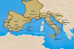
Portugal, Spain, France, Italy, Montenegro & Croatia
Augus, 2024
-
Below is a Table of Contents which links to each day's activity for easy access or, if you prefer, you can simply scroll down and read the adventures day by day.
The left hand column contains links to my images stored in my Adobe Portfolio and links to my hand-held camera videos stored in my YouTube channel.
- August 2, 3 - Lafayette, LA to Lisbon, Portugal
- August 4 - Lisbon, Portugal
- August 5 - Board Sailing Vessel Wind Surf
- August 6 - Day at Sea
- August 7 - Gibraltar
- August 8 - Cadiz, Spain
- August 9 - Málaga, Spain
- August 10 - Almeria, Granada, Spain
- August 11 - Cartagena, Spain
- August 12 - Palma de Mallorca, Spain
- August 13 - Barcelona, Spain
- August 14 - Palamós, Spain
- August 15 - Sanary Sur-Mer, France
- August 16 - Monte Carlo, Monaco
- August 17 - Cannes, France
- August 18 - Portofino, Italy
- August 19 - Portoferraio, Elba, Italy
- August 20 - Civitavecchia, Rome, Italy
- August 21 - Sorrento, Italy
- August 22 - Giardini Naxos, Taormina, Italy
- August 23 - Day at Sea
- August 24 - Kotor, Montenegro
- August 25 - Dubrovnik, Croatia
- August 26 - Split, Croatia
- August 27 - Rovinj, Croatia
- August 28 - Disembark in Venice, Italy
- August 29 - Venice, Italy
- August 30,31 - Returning Home
|
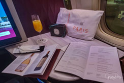
My Images En Route to med
|
-
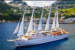
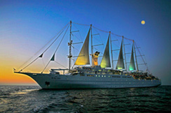
Friday, 8/2/24, I departed for Lisbon, Portugal to sail the Mediterranean for 24 days on Windstar's largest sailing ship, the 5-masted S/V Wind Surf.
-
Kali stayed at LVCC (Lafayette Veterinary Care Center) for 31 days boarding with four hours of play each day with her friends. Thankfully, the LVCC staff loves her and she loves the staff and the other dogs there as well.
-
I flew 1.5 hours to Atlata, GA on Delta Airlines with only a one hour layover.
Then I flew 3 hours to JFK airport, New York on Delta Airlines and had a two hour layover in their lounge.
Then I flew 7 hours to Lisbon, Portugal on Delta Airlines. I arrived at 8 a.m. on Satuday, 8/3/24. There is a six hour time zone difference between Louisiana and Portugal.
-
Return to Table of Contents
|
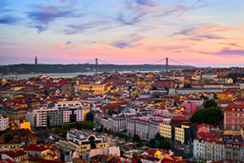
Video of Lisbon
My Images of Lisbon
|
- - - - MY JAUNTS - - - -
- Sunday, 8/4/24, Lisbon is the capital and largest city of Portugal, The city lies in the western portion of the Iberian Peninsula, on the northern shore of the River Tagus. The western portion of its metro area, the Portuguese Riviera, hosts the westernmost point of Continental Europe, culminating at Cabo da Roca.
- Lisbon is one of the oldest cities in the world and the second-oldest European capital city (after Athens), predating other modern European capitals by centuries. Settled by pre-Celtic tribes and later founded and civilized by the Phoenicians, Julius Caesar made it a municipium called Felicitas Julia, adding the term to the name Olissipo. After the fall of the Roman Empire, it was ruled by a series of Germanic tribes from the 5th century, most notably the Visigoths. Later it was captured by the Moors in the 8th century. In 1147 Afonso Henriques conquered the city and in 1255 it became Portugal's capital, replacing Coimbra.
- Return to Table of Contents
|
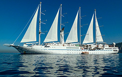
My Videos of Boarding
My Images of Boarding
|
- - - - MY JAUNTS - - - -
-
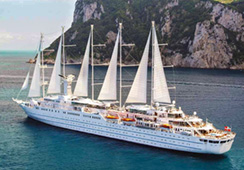
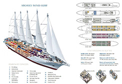
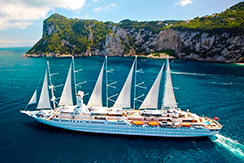
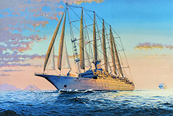
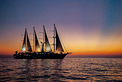
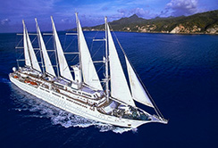
Monday, 8/5/24, we boarded Windstar's S/V Wind Surf, the largest sailing ship in the world.
- - - - INTERESTING BACKGROUND ON S/V WIND SURF - - - -
-
The standard staterooms measure 188 square feet and are fitted with many luxuries from queen sized beds with luxurious linens to bowls of fruit in your stateroom. Of course, the requisite TV is mounted on the wall. A fully equipped spa with massage services is available. Unlike other cruise ships, the bridge is always available.
-
CAPACITY: 342 Guests
-
STATEROOMS: 150 deluxe ocean view staterooms
-
DECKS: 6 decks
-
CREW: 210 international staff
- Return to Table of Contents
|
Videos of the Sea Day
My Images of the Sea Day
|
- - - - MY JAUNTS - - - -
-
Tuesday, 8/6/24, we spent day at sea cruising South down the coasts of Portugal and Spain in the Atlantic Ocean and then turning East bound through the Staits of Gibraltar and into the harbor at Gibraltar. Here are additional particulars for the S/V WindSurf:
- - - - INTERESTING BACKGROUND ON S/V WIND SURF - - - -
-
LENGTH: 535 feet (162 meters) at waterline; 617 feet (187meters) including bowsprit
-
DRAFT: 16.5 feet (5 meters)
-
BEAM: 66 feet (20 meters)
-
SAILS: 7 triangular, self-furling, computer-operated sails with 26,881 square feet (or 2,600 square meters) of Dacron surface area
-
MASTS: 5 at 221 feet (67.5 meters)
-
ENGINES: 4 diesel electric generating sets, 2 electrical propulsion motor
-
SPEED: 10 to 12 knots with engines only; up to 15 knots wind and engine assisted
-
TONNAGE: 14,745 gross registered tons (grt)
-
SHIP'S REGISTRY: Bahamas
- Return to Table of Contents
|
My Videos of Gibraltar
Images of Gibraltar
|
- - - - MY JAUNTS - - - -
-
Wednessday, 8/7/24, I visited Gibraltar.
- - - - INTERESTING BACKGROUND - - - -
-
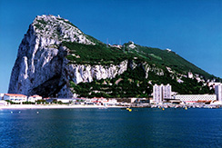
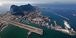
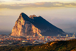
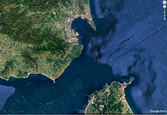
Gibraltar is a British Overseas Territory and city located at the southern tip of the Iberian Peninsula, on the Bay of Gibraltar, near the exit of the Mediterranean Sea into the Atlantic Ocean (Strait of Gibraltar). It has an area of 2.6 sq mi and is bordered to the north by Spain (Campo de Gibraltar). The landscape is dominated by the Rock of Gibraltar, at the foot of which is a densely populated town area, home to some 32,688 people, primarily Gibraltarians.
-
Gibraltar was founded as a permanent watchtower by the Almohads in 1160. It switched control between the Nasrids, Castilians and Marinids in the Late Middle Ages, acquiring larger strategic clout upon the destruction of nearby Algeciras circa 1375. It became again part of the Crown of Castile in 1462. In 1704, Anglo-Dutch forces captured Gibraltar from Spain during the War of the Spanish Succession, and it was ceded to Great Britain in perpetuity under the Treaty of Utrecht in 1713. It became an important base for the Royal Navy, particularly during the Napoleonic Wars and World War II, as it controlled the narrow entrance and exit to the Mediterranean Sea, the Strait of Gibraltar, with half the world's seaborne trade passing through it.
-
The sovereignty of Gibraltar is a point of contention in Anglo-Spanish relations, as Spain asserts a claim to the territory. Gibraltarians overwhelmingly rejected proposals for Spanish sovereignty in a 1967 referendum, and for shared sovereignty in a 2002 referendum. Nevertheless, Gibraltar maintains close economic and cultural links with Spain, with many Gibraltarians speaking Spanish as well as a local dialect known as Llanito.
-
Gibraltar's economy rests on financial services, e-gaming, tourism and the port. With one of the world's lowest unemployment rates, the largest part of the labour force are resident in Spain or non-Gibraltarians, especially in the private sector. Since Brexit, Gibraltar is not a member of the European Union but negotiations are under way to have it participate in the Schengen Agreement to facilitate border movements between Gibraltar and Spain.
- Return to Table of Contents
|
My Images of Cadiz, Spain
My Videos of Cadiz, Spain
|
- - - - MY JAUNTS - - - -
-
Friday, 8/8/24, I visited Cádiz.
- - - - INTERESTING BACKGROUND - - - -
-
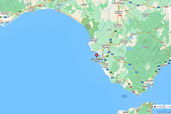
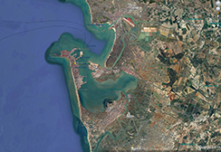
Cadiz is a city in Spain and the capital of the Province of Cádiz, in the autonomous community of Andalusia. It is located in the southwest of the Iberian Peninsula off the Atlantic Ocean separated from neighboring San Fernando by a narrow isthmus.
-
Cádiz, one of the oldest continuously inhabited cities in Western Europe, was founded by the Phoenicians as a trading post. In the 18th century, the Port in the Bay of Cádiz consolidated as the main harbour of mainland Spain, enjoying the virtual monopoly of trade with the Americas until 1778. It is also the site of the University of Cádiz.
-
Situated on a narrow slice of land surrounded by the sea‚ Cádiz is, in most respects, a typically Andalusian city with well-preserved historical landmarks. The older part of Cádiz, within the remnants of the city walls, is commonly referred to as the Old Town, and represents a large area of the total size of the city. It is characterized by the antiquity of its various quarters (barrios), among them El Pópulo, La Viña, and Santa María, which present a marked contrast to the newer areas of town. While the Old City's street plan consists of narrow winding alleys connecting large plazas, newer areas of Cádiz typically have wide avenues and more modern buildings. In addition, the city is dotted with numerous parks where exotic plants flourish, including giant trees supposedly brought to the Iberian Peninsula from the New World.
-
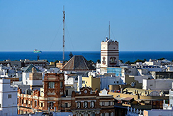
Tavira Tower
In the 18th century, Cádiz had more than 160 towers from which local merchants could look out to sea to watch for arriving merchant ships from the New World. These towers often formed part of the merchants' houses, but this particular tower was located on a high point in the city, 45 meters above sea level, and was chosen by the Navy as their official lookout in 1787 (after eliminating several other locations previously). The Torre Tavira, was named for its original watchman, Don Antonio Tavira, a lieutenant in the Spanish Navy. Today it is the tallest of the towers which still dot the Cádiz skyline. Since 1994 there is a camera obscura, a room that uses the principle of the pinhole camera and a specially prepared convex lens to project panoramic views of the Old City onto a concave disc. There are also two exhibition rooms and a rooftop terrace.
-
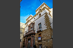
Admiral's House
The Casa del Almirante is a palatial house, adjacent to the Plaza San Martín in the Barrio del Pópulo, which was constructed in 1690 with the proceeds of the lucrative trade with the Americas. It was built by the family of the admiral of the Spanish treasure fleet, the so-called Fleet of the Indies, Don Diego de Barrios. The exterior is sheathed in exquisite red and white Genoan marble, prepared in the workshops of Andreoli, and mounted by the master, García Narváez. The colonnaded portico, the grand staircase under the cupola, and the hall on the main floor are architectural features of great nobility and beauty. The shield of the Barrios family appears on the second-floor balcony.
-
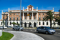
Old Customs House
Situated within the confines of the walls which protect the flank of the port of Cádiz are three identical adjacent buildings: the Customs House, the House of Hiring and the consulate. Of the three, the former had been erected first, built in a sober neo-classical style and of ample and balanced proportions. The works began in 1765 under the direction of Juan Caballero at a cost of 7,717,200 reales.
-
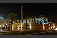
Palacio de Congresos
Cádiz's refurbished tobacco factory offers international conference and trade-show facilities. Home to the third annual MAST Conference and trade-show.
-
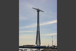
Pylons of Cádiz
The Pylons of Cádiz are electricity pylons of unusual design, one on either side of the Bay of Cádiz, used to support huge electric-power cables. The pylons are 158 meters (518 ft) high and designed for two circuits. The very unconventional construction consists of a narrow frustum steel framework with one crossbar at the top of each one for the insulators.
-
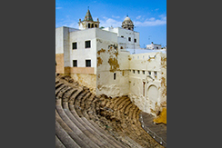
Roman Theatre
The Roman theatre was discovered in 1980, in the El Pópulo district, after a fire had destroyed some old warehouses, revealing a layer of construction that was judged to be the foundations of some medieval buildings; the foundations of these buildings had been built, in turn, upon much more ancient stones, hand-hewn limestone of a Roman character. Systematic excavations have revealed a largely intact Roman theatre. The theatre, constructed by order of Lucius Cornelius Balbus (minor) during the 1st century BC, is the second-largest Roman theatre in the world, surpassed only by the theatre of Pompeii, south of Rome. Cicero, in his Epistulae ad Familiares ('Letters to his friends'), wrote of its use by Balbus for personal propaganda.
- Return to Table of Contents
|
My Images of Málaga, Spain
My Videos of Málaga, Spain
|
- - - - MY JAUNTS - - - -
-
Saturday, 8/9/24, I visited Málaga, Spain.
- - - - INTERESTING BACKGROUND - - - -
-
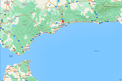
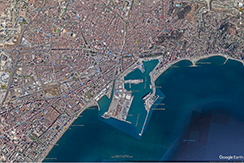
Málaga is a municipality of Spain, capital of the Province of Málaga, in the autonomous community of Andalusia. With a population of 578,460 in 2020, it is the second-most populous city in Andalusia and the sixth most populous in the country. It lies in Southern Iberia on the Costa del Sol ("Coast of the Sun") of the Mediterranean, primarily in the left bank of the Guadalhorce. The urban core originally developed in the space between the Gibralfaro Hill and the Guadalmedina.
-
Málaga's history spans about 2,800 years, making it one of the oldest continuously inhabited cities in Western Europe. According to most scholars, it was founded about 770 BC by the Phoenicians from Tyre as Malaka. From the 6th century BC the city was under the hegemony of Ancient Carthage, and from 218 BC, it was under Roman rule, economically prospering owing to garum production. In the 8th century, after a period of Visigothic and Byzantine rule, it was placed under Islamic rule. In 1487, the Crown of Castile gained control in the midst of the Granada War. In the 19th century, the city underwent a period of industrialisation followed by a decay in all socioeconomic parametres in the last third of the century.
-
The most important business sectors in Málaga are tourism, construction and technology services, but other sectors such as transportation and logistics are beginning to expand. Málaga has consolidated as a tech hub, with companies mainly concentrated in the Málaga TechPark (Technology Park of Andalusia). It hosts the headquarters of the region's largest bank, Unicaja, and it is the fourth-ranking city in Spain in terms of economic activity. Málaga is served by the Málaga–Costa del Sol Airport and the Port of Málaga. The city is connected to the high-speed railway network since 2007.
-
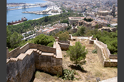
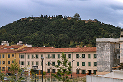
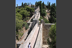
The Castle of Gibralfaro has been the site of fortifications since the Phoenician foundation of Málaga city, circa 770 BC. The location was fortified by Caliph Abd-al-Rahman III in 929 CE. At the beginning of the 14th century, Yusuf I of the Kingdom of Granada expanded the fortifications within the Phoenician lighthouse enclosure and erected a double wall to the Alcazaba. The castle is famous for its three-month siege in 1487 by the Catholic monarchs, King Ferdinand and Queen Isabella, which ended when hunger forced the Arabs to surrender.
-
The most visible remains of the Castle today are the solid ramparts rising above the pines. In the Gibralfaro Interpretation Center in the former gunpowder arsenal of the Castle is a little museum that shows the castle’s history over the centuries since the Reconquest. The castle was used as a military base until 1925.
- Return to Table of Contents
|
My Images of Almeria, Spain
My Videos of Almeria, Spain
|
- - - - MY JAUNTS - - - -
-
Saturday, 8/10/24, I visited Almeria.
- - - - INTERESTING BACKGROUND - - - -
-
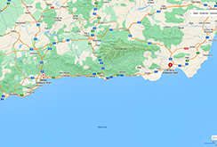
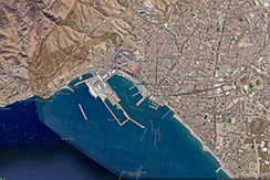
Almería is the capital of the province of the same name. It lies in southeastern Iberia on the Mediterranean Sea. Caliph Abd al-Rahman III founded the city in 955. The city grew wealthy during the Islamic era, becoming a world city throughout the 11th and 12th centuries. It enjoyed an active port that traded silk, oil, and raisins. Being adjacent to a small desert, Almería has an exceptionally dry climate by European standards.
-
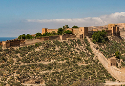
The Alcazaba, a medieval fortress that was begun in the 10th century but destroyed by an earthquake in 1522. It includes a triple line of walls, a majestic keep and large gardens. It commands a city quarter with buildings dressed in pastel colors, of Muslim-age aspect. It is the second largest among the Muslim fortresses of Andalusia, after the Alhambra.
-
Almería air raid shelters, underground galleries for civilian protection during the Spanish Civil War, currently the longest in Europe open for tourists.
-
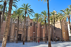
The Cathedral has a fortress-like appearance due to its towers, merlons and protected paths, created to defend it from Mediterranean pirates. Originally designated as a mosque, it was later converted into a Christian church, before being destroyed in the 1522 earthquake. In the 16th century it was rebuilt in the Renaissance style, whilst keeping some of its defensive features.
-
Renaissance church of Santiago, built in 1533, with tower and portal decorated with reliefs.
-
Chanca, a group of houses carved into rocks.
-
Castle of San Cristobal, now in ruins. It is connected to the Alcazaba by a line of walls.
-
Museum of Almería. Includes findings from Prehistoric, Iberic, Roman, Greek ages and Muslim objects, mostly from the Alcazaba.
-
Paseo de Coches, a modern seaside promenade with gardens and palms.
-
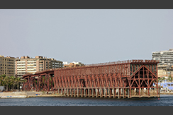
Cable Inglés (English Pier), 1904 iron railway pier built to transfer iron ore, copper, and silver produced by British- and French-run mines in Granada from trains to waiting cargo ships.
- Return to Table of Contents
|
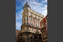
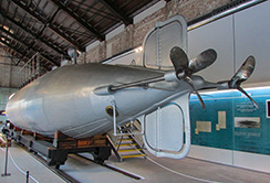
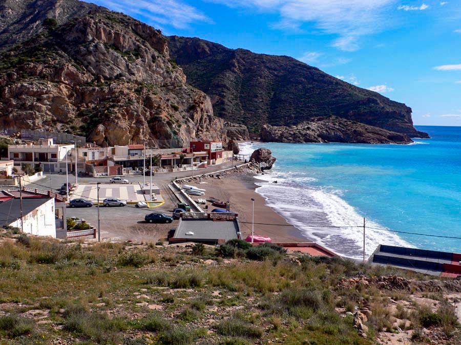
My Images of Cartagena, Spain
My Videos of Cartagena, Spain
|
- - - - MY JAUNTS - - - -
-
Sunday, 8/11/24, I visited Cartagena, Spain.
- - - - INTERESTING BACKGROUND - - - -
-
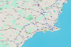
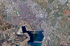
Cartagena a major naval station on the Mediterranean coast, south-eastern Iberia. Cartagena is Murcia's second-largest municipality and Spain's sixth-largest city. The wider urban or metropolitan area of Cartagena, known as Campo de Cartagena, has a population of 409,586 inhabitants.
-
Cartagena has been inhabited for over two millennia, being founded around 227 BC by the Carthaginian military leader Hasdrubal the Fair as Qart Hadasht, the same name as the original city of Carthage. The city had its heyday during the Roman Empire, when it was known as Carthago Nova (the New Carthage) and Carthago Spartaria, capital of the province of Carthaginensis.
-
Much of the historical significance of Cartagena stemmed from its coveted defensive port, one of the most important in the western Mediterranean. Cartagena has been the capital of the Spanish Navy's Maritime Department of the Mediterranean since the arrival of the Spanish Bourbons in the 18th century. As far back as the 16th century it was one of the most important naval ports in Spain, together with Ferrol in the North. It is the main military haven of Spain, and is home to a large naval shipyard.
-
The "Cartagena, Port of Cultures" initiative was created to allow visitors to enjoy a wide range of activities and visits, discovering the cultural wealth and rich history of the city. It is one of several projects to energize the tourist possibilities of this potential major cultural destination, frequently neglected by the mass-tourism, due to the proximity of several holiday resorts, and the refinery and other industrial development, which gave a bad reputation to the city because of pollution; these last have now fortunately been eradicated.
-
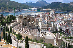
The Roman Theatre of Carthago Nova and Cathedral ruins of Cartagena - Although there are some ruins from the Carthaginian period, like the remains of the Punic rampart (built in 227 BC with the foundation of the city), most of its oldest monuments date from the time of the Roman Empire when Cartagena flourished. Among its numerous Roman remains, the recently restored Roman theatre of Carthago Nova is prominent and is one of the city's landmarks.
-
Other Roman remains can be found in several buildings and interpretative centres, including the Roman Colonnade, the House of Fortune, the decumanus/cardo and the Augusteum. The Torre Ciega was built by the Romans for burials; it formed part of the Necropolis.
-
The Roman Amphitheatre (1st century AD) was sited where the now-abandoned Bullring was built, but only some of the surrounding walls and part of the rooms under the stands are still visible. Recent work is revealing more evidence.
-
Besides the Roman heritage, archaeological sights include the remains of the Santa María la Vieja Cathedral, which was irreversibly destroyed during the Spanish Civil War. It dates from the end of the 13th century. The decorated floor of a Roman house of the 1st century BC can be found in the crypt. A Byzantine rampart can be found, close to the Roman Theatre and the Cathedral.
-
The Concepción Castle (now Centre for the Interpretation of the History of Cartagena) was reconstructed in the 13th century using large structures from the Amphitheatre. Apart from the Roman Theatre Museum, there are also two important archaeological museums: the Municipal Archaeological Museum and the recently opened Arqua (National Museum of Maritime Archaeology).
-
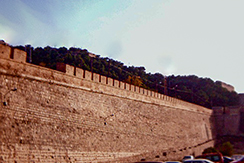
Original Charles III rampart - The Campus Muralla del Mar, an old military hospital, was one of the first works carried out after the transformation of the city into the main Spanish naval base in the Mediterranean, and is now the seat of the Polytechnic University. In the vicinity, there is the Autopsy Theatre, which is where anatomy classes used to be given. Rehabilitation for tourism provides for the interpretation of the nearby buildings at the time of their construction.
-
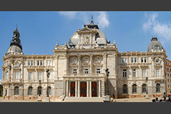
These buildings and several other baroque or neo-classical buildings demonstrate the military importance of Cartagena. These include the Charles III Rampart, the Castillo de San Julián, the Arsenal, the Midshipmen's Barracks (academy and naval barracks), the Naval Headquarter Palace (built in 1740 and subsequently rebuilt) and the Artillery Headquarters, which also houses the Military Museum. Among the Baroque or Neo-classical Churches in Cartagena are El Carmen, Santo Domingo and Santa Maria de Gracia.
-
The austere facade of the Molina House hides the Centre of Arts and Craft.
- Return to Table of Contents
|
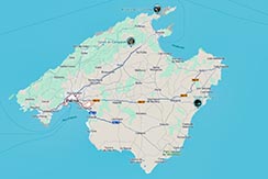
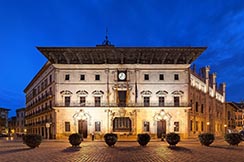
My Images of Palma de Mallorca, Spain
My Videos of Palma de Mallorca, Spain
|
- - - - MY JAUNTS - - - -
-
Monday, 8/12/24 I visited Palma de Mallorca, Spain.
- - - - INTERESTING BACKGROUND - - - -
-
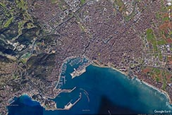
Palma is the capital and largest city of the autonomous community of the Balearic Islands in Spain. It is situated on the south coast of Mallorca on the Bay of Palma. The Cabrera Archipelago, though widely separated from Palma proper, is administratively considered part of the municipality.
-
Palma was founded as a Roman camp upon the remains of a Talaiotic settlement. The city was subjected to several Vandal raids during the fall of the Western Roman Empire, then reconquered by the Byzantine Empire, then colonized by the Moors (who called it Medina Mayurqa) and, in the 13th century, by James I of Aragon.
-
Between 902 and 1229, the city was under Islamic control. It remained the capital of the island and it was known as Medina Mayurqa, which in Arabic means "City of Majorca".
-
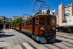
The Plaça d'Espanya is the transport hub of Palma. The Estació Intermodal caters to buses and trains (the latter controlled by TIB). The two old buildings are home to the tourist information centre and several cafés sit on either side of the two large escalators which lead into the Estació, which sits underneath a large and popular park. On the lawns are several glass boxes, which let in light and ventilation to the station below ground. There are also train-themed playing structures, each one shaped like a train carriage and named after towns along the line of the Ferrocarril de Sóller, a railway dating back to 1911 which has its Palma Station right next to the park.
-
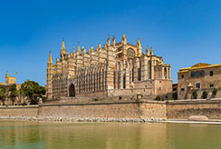
Palma is famous for La Seu, its vast cathedral built on a previous mosque which was built atop an original Christian church. Although construction of the present Cathedral began in 1229, it did not finish until 1601. Catalan architect Antoni Gaudí was drafted to restore the building in 1901. The Parc de la Mar (Park of the Sea) lies just south, overlooked by the great building which sits above it on the city's stone foundations. Between the two are the town walls.
-
The Old City (in the southeast area of Palma behind the cathedral) is a maze of streets clearly hinting at an Arab past. Except for a few streets and squares which allow traffic and are populated with tourists most of the time, the walkways of this city quarter are fairly narrow, quiet streets, surrounded by a diverse range of interesting buildings, the architecture of which is comparable to cities such as Florence. The majority are private houses, some of which are open to the public as discreet museums or galleries. The Old City is also home to the Ajuntament (or Town Hall), the Convent of the cathedral, and the Banys Àrabs.
-
The Banys Àrabs, or Arab Baths, one of the few remnants of Palma's Moorish past, are accessed via the quiet Ca'n Serra street near the Convent of the cathedral, and include the lush gardens of Ca'n Fontirroig, home to Sardinian warblers, house sparrows, cacti, palm trees and a wide range of flowers and ferns. The small two-roomed brick building that once housed the baths is of Byzantine origin, dating back to the 11th century and possibly once part of the home of a Muslim nobleman. The bathroom has a cupola with five oculi which let in dazzling light. The twelve columns holding up the small room were pillaged from an earlier Roman construction. The floor over the hypocaust has been worn away by people standing in the centre, mainly to photograph the entrance and the garden beyond it. The whole room is in a rather dilapidated condition. The other room is a brick cube with a small model of the baths as they once were in the corner.
- Return to Table of Contents
|
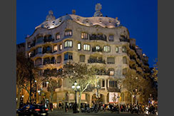
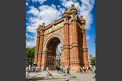
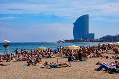
My Images of Malaga, Spain
My Videos of Malaga, Spain
|
- - - - MY JAUNTS - - - -
-
Tuesday, 8/13/24, xxxx
- - - - INTERESTING BACKGROUND - - - -
-
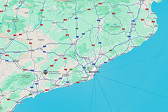
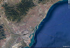
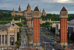
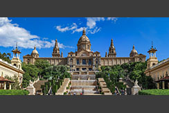
Barcelona is the capital and largest city of the autonomous community of Catalonia, as well as the second-most populous municipality of Spain. With a population of 1.6 million within city limits, its urban area extends to numerous neighboring municipalities within the province of Barcelona and is home to around 4.8 million people, making it the fifth most populous urban area in the European Union after Paris, the Ruhr area, Madrid and Milan. It is one of the largest metropolises on the Mediterranean Sea, located on the coast between the mouths of the rivers Llobregat and Besòs, bounded to the west by the Serra de Collserola mountain range.
-
Founded as a Roman city, in the Middle Ages Barcelona became the capital of the County of Barcelona. After joining with the Kingdom of Aragon to form the confederation of the Crown of Aragon, Barcelona became the most important economic and administrative centre of the Crown, only to be overtaken by Valencia. Barcelona became the centre of Catalan separatism, briefly becoming part of France during the 17th century Reapers' War and again in 1812 until 1814 under Napoleon. It was the capital of Revolutionary Catalonia during the Spanish Revolution of 1936, and the seat of government of the Second Spanish Republic later in the Spanish Civil War, until its capture by the fascists in 1939. After the Spanish transition to democracy in the 1970s, Barcelona once again became the capital of an autonomous Catalonia.
-
Barcelona has a rich cultural heritage and is today an important cultural centre and a major tourist destination. Particularly renowned are the architectural works of Antoni Gaudí and Lluís Domènech i Montaner, which have been designated UNESCO World Heritage Sites. The city is home to two of the most prestigious universities in Spain: the University of Barcelona and Pompeu Fabra University.
-
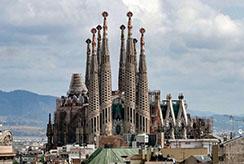
The Barri Gòtic (Catalan for "Gothic Quarter") is the centre of the old city of Barcelona. Many of the buildings date from medieval times, some from as far back as the Roman settlement of Barcelona. Catalan modernista architecture (related to the movement known as Art Nouveau in the rest of Europe) developed between 1885 and 1950 and left an important legacy in Barcelona. Several of these buildings are World Heritage Sites. Especially remarkable is the work of architect Antoni Gaudí, which can be seen throughout the city. His best-known work is the immense but still unfinished church of the Sagrada Família, which has been under construction since 1882 and is still financed by private donations.
-
Barcelona was also home to Mies van der Rohe's Barcelona Pavilion. Designed in 1929 for the International Exposition for Germany, it was an iconic building that came to symbolize modern architecture as the embodiment of van der Rohe's aphorisms "less is more" and "God is in the details". The Barcelona pavilion was intended as a temporary structure and was torn down in 1930 less than a year after it was constructed. A modern re-creation by Spanish architects now stands in Barcelona, however, constructed in 1986.
-
The Basílica i Temple Expiatori de la Sagrada Família, otherwise known as Sagrada Família, is a church under construction in the Eixample district of Barcelona, Catalonia, Spain. It is the largest unfinished Catholic church in the world. Designed by Catalan architect Antoni Gaudí (1852–1926), in 2005 his work on Sagrada Família was added to an existing (1984) UNESCO World Heritage Site, "Works of Antoni Gaudí". On 7 November 2010, Pope Benedict XVI consecrated the church and proclaimed it a minor basilica.
-
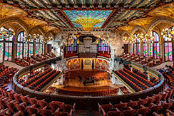
Palau de la Música Catalana is a concert hall in Barcelona, Designed in the Catalan modernista style by the architect Lluís Domènech i Montaner, it was built between 1905 and 1908 for Orfeó Català, a choral society founded in 1891 that was a leading force in the Catalan cultural movement that came to be known as the Renaixença (Catalan Rebirth). It was inaugurated on 9 February 1908. In 1997, the palace de la Música Catalana was declared a UNESCO World Heritage Site along with Hospital de Sant Pau.
v
-
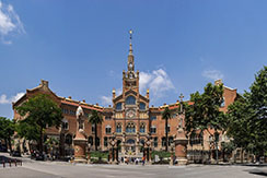
The former Hospital de la Santa Creu i Sant Pau, (English: Hospital of the Holy Cross and Saint Paul) in the neighborhood of El Guinardó, Barcelona, is a complex built between 1901 and 1930. It is one of the most prominent works of the Catalan modernisme architect Lluís Domènech i Montaner. The complex was listed as a Conjunto Histórico in 1978. Together with Palau de la Música Catalana, it was declared a UNESCO World Heritage Site in 1997. Composed of 12 pavilions connected through long underground galleries within its large green space, Sant Pau is the largest complex built in Art Nouveau style. It was a fully functioning hospital until June 2009, when the new hospital opened next to it. It underwent restoration for use as a museum and cultural center, and re-opened in 2014.
- Return to Table of Contents
|
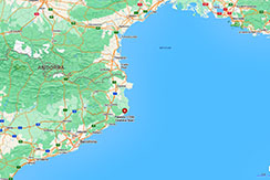
My Images of Palamós, Spain
My Videos of Palamós, Spain
|
- - - - MY JAUNTS - - - -
-
Wednessday, 8/14/24, I visited Palamós, Spain.
- - - - INTERESTING BACKGROUND - - - -
-
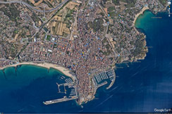
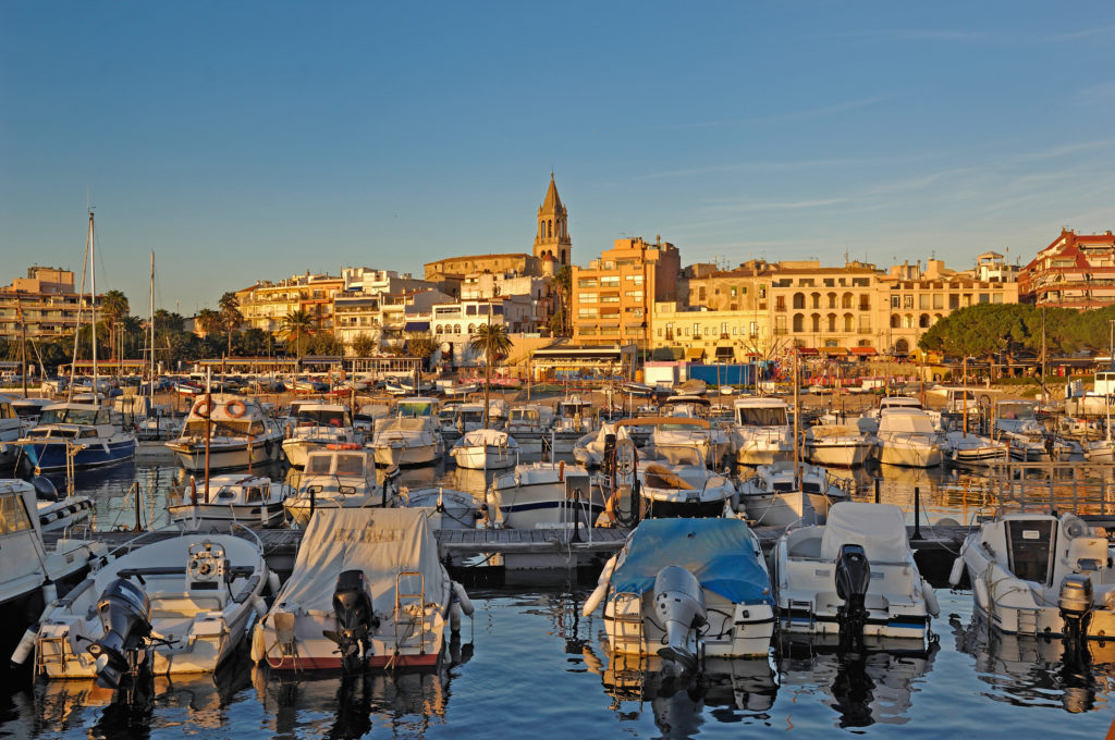
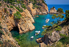
Palamós is a town in the Mediterranean Costa Brava, located in the comarca of Baix Empordà, in the province of Girona, Catalonia, Spain. Palamós is located at the northern end of a large bay.
-
The first evidence of human settlement in the Palamós area is the Dolmen de Montagut, on the top of Montagut hill between Palamós and Vall-llobrega. Dating from the 3rd or 2nd millennium BC, this has 3 slabs in their original state and the remains of a tomb that these once covered.
-
Evidence exists of an early settlement lies around 1.1 mi north-east of the town, on a rocky promontory at the north end of Platja de Castell beach. The Castell de la Fosca is a stone settlement of the Iberian Indigetes people which seems to have been inhabited from the 6th century BC to the 1st century AD.
-
Further south than the Castell de la Fosca, but still north of the current town and port, is the Castell de Sant Esteve de Mar. Archaeological evidence suggests that this site was occupied from the Roman period, and that the site was fortified in the twelfth century AD. By the thirteenth century, Peter II of Barcelona (also known as Peter III of Aragon) was looking to found a new port on the coast as the previous royal port in the region at Torroella de Montgrí on the River Ter had silted up. In 1277, he bought the castle and its estate, which included the site of the current port, with that in mind. As a consequence of the purchase, Palamos was founded and recognised as a village on 3 December 1279.
-
The site of the current port was used during the Roman period and before, but it was then disused until it was rebuilt after Peter's purchase of 1277. In 1285, the Battle of Les Formigues was fought near the Formigues Islands, just offshore from Palamós, resulting in a victory for the Catalan fleet over the French.
-
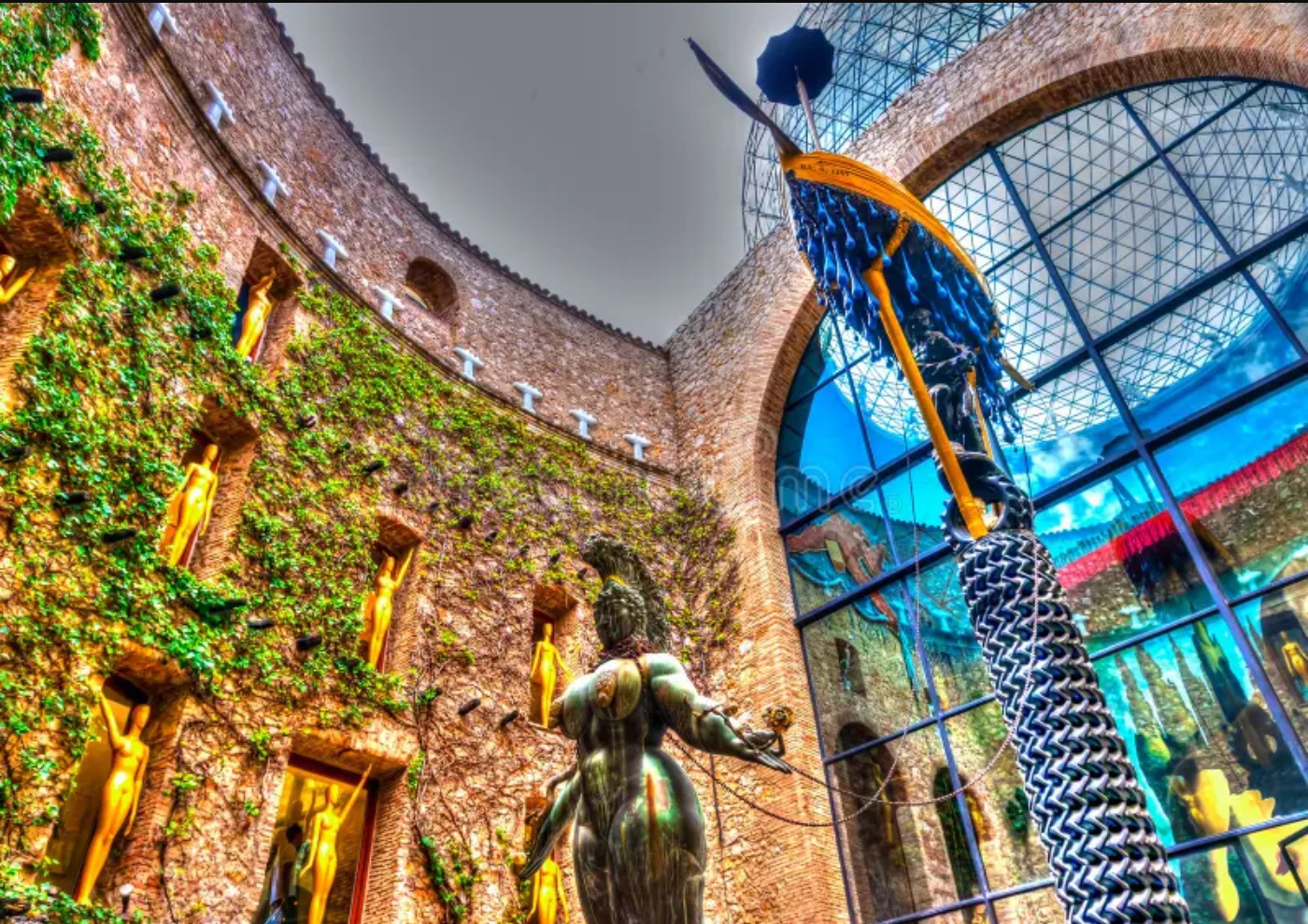
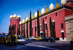
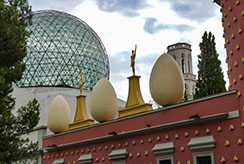
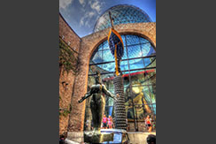
The Dalí Theatre and Museum is a museum dedicated to the artist Salvador Dalí in his home town of Figueres, in Catalonia, Spain. Salvador Dalí lived there from 1984 to 1989, and is buried in a crypt below the stage.
-
The heart of the museum is the town's theatre that Dalí knew as a child. It was where one of the first public exhibitions of young Dalí's art was shown. The old theatre was burned during the Spanish Civil War and remained in a state of ruin. In 1960, Dalí and the mayor of Figueres decided to rebuild it as a museum dedicated to the town's most famous son. The museum now includes buildings and courtyards adjacent to the old theatre.
- Return to Table of Contents
|
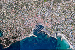
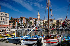
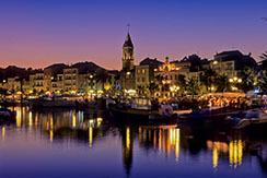
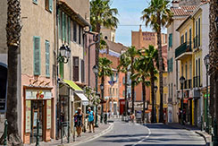
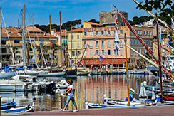
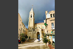
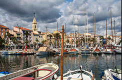
My Images of Sanary-sur-Mer, France
My Videos of Sanary-sur-Mer, France
|
- - - - MY JAUNTS - - - -
-
Thursday, 8/15/24, I visited Sanary-sur-Mer, France.
- - - - INTERESTING BACKGROUND - - - -
-
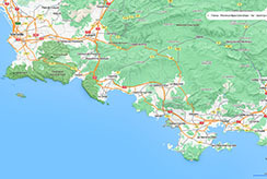
Sanary-sur-Mer, popularly known as Sanary, is a commune in the Var department in the Provence-Alpes-Côte d'Azur region, Southeastern France. Sanary-sur-Mer is located in coastal Provence on the Mediterranean Sea, 8 mi west of Toulon and 30 mi southeast of Marseille. It can be reached from Paris by TGV Bullet Train in less than four hours.
-
The seafront location was part of the commune of Ollioules. In the 16th century the seigneur established a fishing village here, clustered around the medieval watchtower, under the protection of "Sanct Nazari" of Lérins Abbey. The port was constructed and the harbour deepened in the mid-16th century. The little fishing port known in the Provençal dialect of Occitan as Sant Nazari, later Sant Nàri, contracted later on as Sanàri, was finally granted its independence from Ollioules by Louis XIV of France on 10 July 1688. On 12 November 1890 it officially received its Francised name, Sanary, which was formalised and distinguished as "sur-Mer" ("on Sea") on 27 July 1923.
-
As a tourist rendezvous, the village underwent a strong decade of growth in the 1980s. Sanary-sur-Mer's coastline has a number of small beaches; it is an active village all year round, unlike most small towns on the Mediterranean coast. Sanary-sur-Mer is one of the sunniest places in France, with an average of only 61 days of rain, mostly in winter, as well as major solar radiation, comparable to Sicily. It is regularly swept by the Mistral, a strong wind coming from the Rhône Valley, which brings low humidity around 20%, gusts up to 81 mph, cool temperatures, sun and deep blue skies. Wind is near gale force or higher on average 115 days per year (storm force eight days per year), making Sanary a favourite destination for windsurfers.
-
Chapelle Notre-Dame-de-Pitié: From this chapel built in 1560 on a headland west of the town, one sees a broad view over the bay of Sanary. It has a large number of ex-voto votive offerings.
-
Église Saint Nazaire: A Gothic Revival church of the late 19th century, Michel Pacha, architect.
-
Port: Sanary has a large collection of traditional wooden fishing boats, mainly the local "pointus". It also has a small fleet of artisan fishermen, who sell their catch every morning.
-
Portissol: The nicest beach in Sanary.
-
Market: Every morning there is a Provençal market under the plane trees, with much fresh produce.
-
Museum (Musée Frédéric-Dumas) is in a 13th-century Romanesque tower made available by the municipality; it bills itself as an historical city of diving. Frédéric Dumas was a co-inventor with Cousteau of the aqua-lung.
-
Sanary hosts every year during the month of May the prestigious international photography festival PHOTOMED, now also held in parallel in Beirut.
- Return to Table of Contents
|
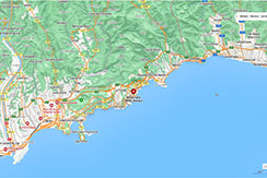
My Images of Monte Carlo, Monaco
My Videos of Monte Carlo, Monaco
|
- - - - MY JAUNTS - - - -
-
Friday, 8/16/24, I visited Monte Carlo, Monaco
- - - - INTERESTING BACKGROUND - - - -
-
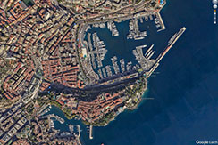
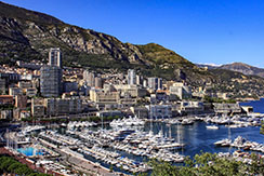
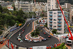
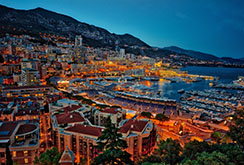
Monte Carlo is an official administrative area of Monaco, specifically the ward of Monte Carlo/Spélugues, where the Monte Carlo Casino is located. Informally, the name also refers to a larger district, the Monte Carlo Quarter which besides Monte Carlo/Spélugues also includes the wards of La Rousse/Saint Roman, Larvotto/Bas Moulins and Saint Michel. The permanent population of the ward of Monte Carlo is about 3,500, while that of the quarter is about 15,000. Monaco has four traditional quarters. From west to east they are: Fontvieille (the newest), Monaco-Ville (the oldest), La Condamine, and Monte Carlo.
-
Monte Carlo is situated on a prominent escarpment at the base of the Maritime Alps along the French Riviera. Near the quarter's western end is the "world-famous Place du Casino, the gambling center ... that has made Monte Carlo an international byword for the extravagant display and reckless dispersal of wealth". It is also the location of the Hôtel de Paris, Café de Paris and Salle Garnier (the casino theatre which is the home of the Opéra de Monte-Carlo). The quarter's eastern part includes the community of Larvotto with Monaco's only public beach, as well as its new convention center (the Grimaldi Forum), and the Monte-Carlo Bay Hotel and Resort. At the quarter's eastern border, one crosses into the French town of Beausoleil, and 5 miles to its east is the western border of Italy.
-
Charles III of Monaco was responsible for turning the Monte Carlo district and Monaco into a thriving town. In 1856, Charles III of Monaco granted a concession to Napoleon Langlois and Albert Aubert, to establish a sea-bathing facility for the treatment of various diseases, and to build a German-style casino.
-
The initial casino opened in La Condamine in 1862, but was unsuccessful. It relocated several times, before reaching its present location in the "Les Spélugues" (The Caves) area of Monte Carlo. Success came slowly, largely because Monaco was inaccessible from much of Europe. The railway, installed in 1868, brought with it an influx of people, and Monte Carlo grew in wealth.
-
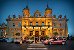
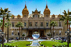
The Monte Carlo Casino, officially named Casino de Monte-Carlo, is a gambling and entertainment complex located in Monaco. It includes a casino, the Opéra de Monte-Carlo, and the office of Les Ballets de Monte-Carlo. The Casino de Monte-Carlo is owned and operated by the Société des Bains de Mer (SBM), a public company in which the government of Monaco and the ruling princely family have a majority interest. The company also owns the principal hotels, sports clubs, foodservice establishments, and nightclubs throughout the Principality.
-
The citizens of Monaco are forbidden to enter the gaming rooms of the casino. The rule banning all Monegasques from gambling or working at the casino was an initiative of Princess Caroline, the de facto regent of Monaco, who amended the rules on moral grounds. The idea that the casino was intended only for foreigners was even emphasized in the name of the company that was formed to operate the gambling business, the Société des Bains de Mer et du Cercle des Etrangers (English: Company of Sea Baths and of the Circle of Foreigners).
-
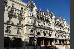
The Hôtel de Paris, established in 1864 by Charles III of Monaco, is located on the west side of the Place du Casino in the heart of Monte Carlo. It belongs to the Société des bains de mer de Monaco (SBM), and is part of the elite Palace Grand Hotels in Monaco with the Hotel Hermitage, the Monte-Carlo Beach Hotel, Monte-Carlo Bay Hotel and Resort, the Hotel Metropole and Fairmont hotel. The hotel has 106 rooms divided into four groups based on type of view, decoration and luxury. The Exclusive City View offers 20 rooms, the Superior Courtyard has 29 large rooms, the Exclusive Sea View 59 and the Exclusive Casino has six. Additionally, there are 74 suites and junior suites which are grouped similarly, offering more luxury than the rooms. There are single and double suites as well as courtyard junior suites and Sea/Casino Junior suites. There is also one Presidential suite.
-
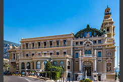
The Opéra de Monte-Carlo or Salle Garnier was built to designs of the architect Charles Garnier, who also designed the Paris opera house now known as the Palais Garnier. Although much smaller, the Salle Garnier is very similar in style with decorations in red and gold, and frescoes and sculptures all around the auditorium. It was inaugurated on 25 January 1879 with a performance by Sarah Bernhardt dressed as a nymph. The first opera performed there was Robert Planquette's Le Chevalier Gaston on 8 February 1879, and that was followed by three more in the first season.
- Return to Table of Contents
|
My Images of Cannes, France
My Videos of Cannes, France
|
- - - - MY JAUNTS - - - -
-
Saturday, 8/17/24, I visited Cannes, France.
- - - - INTERESTING BACKGROUND - - - -
-
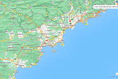
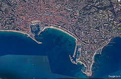
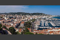
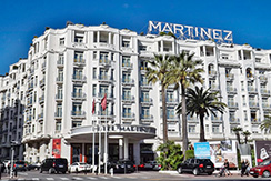
Cannes is a city located on the French Riviera. It is a commune located in the Alpes-Maritimes department, and host city of the annual Cannes Film Festival, Midem, and Cannes Lions International Festival of Creativity. The city is known for its association with the rich and famous, its luxury hotels and restaurants, and for several conferences.
-
By the 2nd century BC, the Ligurian Oxybii established a settlement here known as Aegitna. Historians are unsure what the name means, but the connection to Greek seems evident. The second element could be compared to the Cretan and Thessalian towns of Itanos and Iton. The area was a fishing village used as a port of call between the Lérins Islands.
-
An attack by the Saracens in 891, who remained until the end of the 10th century, devastated the country around Canua. The insecurity of the Lérins islands forced the monks to settle on the mainland, at the Suquet. Construction of a castle in 1035 fortified the city then known as Cannes, and at the end of the 11th century construction was started on two towers on the Lérins islands. One took a century to build. Around 1530, Cannes detached from the monks who had controlled the city for hundreds of years and became independent.
-
During the 18th century, both the Spanish and British tried to gain control of the Lérins Islands but were chased away by the French. The islands were later controlled by many, such as Jean-Honoré Alziary and the Bishop of Fréjus. They had many different purposes: in the middle of the 19th century, one served as a hospital for soldiers wounded in the Crimean War.
-
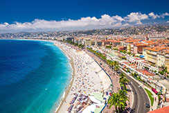
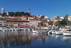
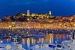
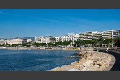
The Promenade de la Croisette is the waterfront avenue with palm trees. La Croisette is known for picturesque beaches, restaurants, cafés, boutiques, and luxury hotels. Le Suquet, the old town, provides a good view of La Croisette. The fortified tower and the Chapelle Sainte-Anne house the Musée des Explorations du monde. A distinctive building in Cannes is the Russian Orthodox church.
-
Cannes of the 19th century can still be seen in its grand villas, built to reflect the wealth and standing of their owners and inspired by anything from medieval castles to Roman villas. They are not open to the public. Lord Brougham's Italianate Villa Eléonore Louise (one of the first in Cannes) was built between 1835 and 1839. Also known as the Quartier des Anglais, this is the oldest residential area in Cannes. Another landmark is the Villa Fiésole (known today as the Villa Domergue) designed by Jean-Gabriel Domergue in the style of Fiesole, near Florence, which may be visited on appointment.
-
It took the Man in the Iron Mask 11 years to leave the tiny, forested St Marguerite Island. The mysterious individual was believed to be of noble blood, but his identity has never been proven. His cell can be visited in the Fort of St Marguerite, now renamed the Musée de la Mer (Museum of the Sea). This museum also houses discoveries from shipwrecks off the island, including Roman (1st century BC) and Saracen (10th century AD) ceramics.
-
The Cannes Film Festival founded in 1946 is held annually, usually in May, at the Palais des Festivals et des Congrès. The Cannes Lions International Festival of Creativity is a global event and awards show for those working in advertising and related fields, held annually in June. The Festival d'art pyrotechnique de Cannes is an annual fireworks competition held in the summer at the Bay of Cannes. Midem, the foremost trade show for the music industry. MIPIM, the world's largest property-related trade show. Carnival on the Riviera is an annual parade through the streets to mark the 21 days before Shrove Tuesday. The International Festival of Games is a festival of bridge, belote, backgammon, chess, draughts, tarot, and more (February). Cannes Yachting Festival is an event for boating enthusiasts in the Vieux Port (September).
- Return to Table of Contents
|
My Images of Portofino, Italy
My Videos of Portofino, Italy
|
- - - - MY JAUNTS - - - -
-
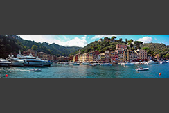
Sunday, 8/18/24, I visited Portofino, Italy.
- - - - INTERESTING BACKGROUND - - - -
-
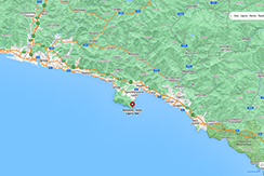
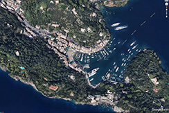
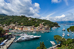
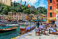
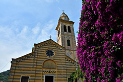
Portofino is a commune located in the Metropolitan City of Genoa on the Italian Riviera. The town is clustered around its small harbour, and is known for the colourfully painted buildings that line the shore. Since the late 19th century, Portofino has attracted tourism of the European aristocracy and it is now a resort for the world's jet set.
-
Pliny the Elder (AD 23 – AD 79) referred to Portus Delphini (Port of the Dolphin) as on the Ligurian coast between Genoa and the Gulf of Tigullio.
-
The village is mentioned in a diploma from 986 by Adelaide of Italy, which assigned it to the nearby Abbey of San Fruttuoso di Capodimonte. In 1171, together with the neighbouring Santa Margherita Ligure, it was included in Rapallo's commune jurisdiction. After 1229 it was part of the Republic of Genoa. The town's natural harbour supported a fleet of fishing boats, but was somewhat too cramped to provide more than a temporary safe haven for the growing merchant marine of the Republic of Genoa.
-
In 1409, when Charles VI of France was Doge of Genoa, he sold Portofino to the Republic of Florence. When Charles was ousted from Genoa, the Florentines gave it back. In the 15th century it was a fief of families such as the Fieschi, Spinola, Adorno, and Doria. In 1815, it became part of the Kingdom of Sardinia and, from 1861, of the unified Kingdom of Italy.
-
In the late 19th century, first British, then other Northern European aristocratic tourists began to visit Portofino, which they reached by horse and cart from Santa Margherita Ligure. Aubrey Herbert and Elizabeth von Arnim were among the more famous English people to make the area fashionable. Eventually, more expatriates built expensive holiday houses, and by 1950, tourism had replaced fishing as the town's chief industry, and the waterfront was a continuous ring of restaurants and cafés.
-
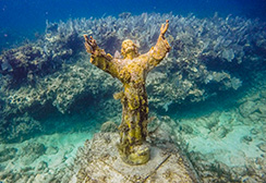
Statue of Christ of the Abyss, placed underwater on 29 August 1954 in the inlet at a depth of 56 ft. This statue was placed to protect fishermen and scuba divers and in memory of Dario Gonzatti, the first Italian to use SCUBA gear, who died in 1947. Sculpted by Guido Galletti, it represents Christ in the act of blessing while looking towards the sky with open arms in a sign of peace.
-
Restriction on photography - In 2023, the municipality introduced zones where tourists are forbidden to linger to take photographs, which was causing congestion. Fines of up to €275 could be imposed on those infringing the regulations.
- Return to Table of Contents
|
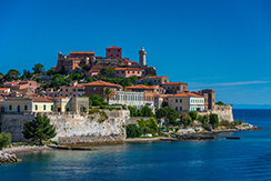
My Images of Portoferraio, Italy
My Videos of Portoferraio, Italy
|
- - - - MY JAUNTS - - - -
-
Monday, 8/19/24, xxxx
- - - - INTERESTING BACKGROUND - - - -
-
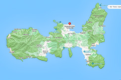
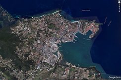
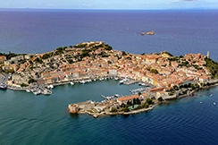
Portoferraio is a town and commune in the province of Livorno, on the edge of the eponymous harbour of the island of Elba. It is the island's largest city. Because of its terrain, many of its buildings are situated on the slopes of a tiny hill bordered on three sides by the sea.
-
It was founded by Cosimo I de' Medici, Grand Duke of Tuscany, in 1548, with the name of Cosmopoli, to balance the presence of the Spanish citadel in Porto Azzurro. It had three forts (Forte Stella, Forte Falcone, and Forte Inglese) and a massive line of walls, all still visible today. The name evolved from Ferraia with etruscan, Fabricia with Romans and Ferraio with Grand Duchy of Tuscany.
-
The city remained attached to the Grand Duchy of Tuscany until the late 18th century, when, due to its strategic position, it came into contention with France, Great Britain, and Austria. A British garrison withstood the Siege of Porto Ferrajo in 1801, but the 1802 Treaty of Amiens transferred the town to France. In 1814 it was handed over to Napoleon Bonaparte, as the seat of his first exile. In the 19th century, the city grew quickly, due to the construction of infrastructures and the exploitation of new iron mills in Rio Marina. Portoferraio then became the main shipping port of the ore to the mainland, whence the current name, meaning "Iron Port" in Italian. After the end of the Napoleonic Era, Portoferraio returned to Tuscany and became part of the Kingdom of Italy in 1860. Here brigand Carmine Crocco was imprisoned until his death for his revolution against the reign of Victor Emmanuel II and the anarchist Giovanni Passannante who attempted to kill King Umberto I.
-
During World War II, Portoferraio became the scene of battle when Elba was occupied by German forces. In late June 1944, an Allied force composed mainly of Free French troops liberated the island in a fight that lasted two days. Portoferraio was taken by French troops on 18 June but was damaged by the fighting and the bombing raids which preceded the invasion. Portoferraio's economy suffered from the end of mining activities starting from the 1970s, but in the following decades, it gained status as an internationally renowned seaside destination.
-
The Jewish community - The first Jews arrived in Portoferraio at the beginning of the 17th century following the publication of the edict of 1556 in which Cosimo I de' Medici granted special privileges to all those who settled in Cosmopoli. In 1593, Ferdinando I de' Medici issued letters patent, called La Livornina, by which more privileges were granted to foreign merchants, Jews in particular, who were willing to settle in the new free ports on Elba and in Leghorn. The first synagogue was built in 1631–1632 when there were barely over ten Jewish families living on the island. At the beginning of the 18th century the Jewish community numbered more than 50 people.
-
In 1826, the Governor, at the request of the heads of 10 Jewish families, drew up a set of rules for the Jewish community. The rules were approved by the Grand Duke, Leopold II who nominated two massari ("bailiffs") to represent the community. In the second half of the 18th century, the Jewish community declined in number due to the worsening of economic conditions on the island. Peace had been signed with the Ottoman Empire resulting in a reduction of military garrisons and the suppression of the “compagnia urbana” made up of 180 men. At the beginning of the 20th century, the construction of a steel mill attracted new Jewish families to the island. However, due to the anti-Jewish laws and persecutions, these families left the island. Alfonso Preziosi, in his book, cited above, wrote “generally, the Jews found the island of Elba to be an oasis of peace thanks to the privileges granted by the Medici and the Lorraine which allowed them to develop their trade with Eastern ports.”
-
Portoferraio lighthouse - The lighthouse stands on the northern rampart of Forte Stella built in 1548 by Cosimo I de' Medici. It was built by Leopold II Grand Duke of Tuscany in 1788; the stone tower is 25 metres high and has a double balcony and lantern. The lighthouse is fully automated, operated by Marina Militare and identified by the code number 2072 E.F.; the lantern is 63 metres above sea level and emits a group of three white lightning strikes in a 14-second period visible up to 16 nautical miles. On the same tower is an additional light identified by the number 2072.2.E.F. that emits a red fixed light at 60 metres above sea level.
- Return to Table of Contents
|
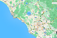
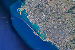
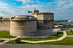
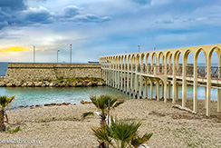
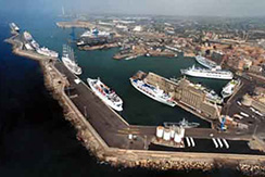
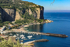
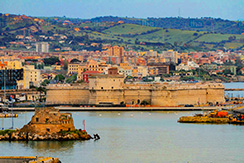
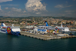
My Images of Civitavecchio, Italy
My Videos of Civitavecchio, Italy
|
- - - - MY JAUNTS - - - -
-
Tuesday, 8/20/24, I visited Civitavecchio, Italy.
- - - - INTERESTING BACKGROUND - - - -
-
Civitavecchia is a commune in the Metropolitan City of Rome Capital, in the Italian region of Lazio. A sea port on the Tyrrhenian Sea, it is located 37 miles west-north-west of Rome. The harbour is formed by two piers and a breakwater, on which stands a lighthouse.
-
The whole territory of Civitavecchia is dotted with the remains of Etruscan tombs and it is likely that in the centre of the current city a small Etruscan settlement thrived. The Etruscan necropolis of Mattonara, not far from the Molinari factory, is almost certainly from the 7th - 6th century BC and was most likely connected with the nearby necropolis of Scaglia. An ancient port formed by small parallel basins capable of accommodating single vessels was still visible at the end of the 19th century near Fort Michelangelo.An Etruscan settlement on the hill of Ficoncella can still be seen where the first baths were built before 70 BC, known by the Romans as Aquae Tauri.
-
The nearby monumental baths at Terme Taurine were built originally in the Roman Republican era, possibly by Titus Statilius Taurus, prefect of Rome. The harbour was greatly enlarged by the Emperor Trajan at the beginning of the 2nd century and known as Centum Cellae thereafter probably due to the many vaulted "cells" forming the harbour wall some of which can still be seen. The first occurrence of the name Centum Cellae is from a letter by Pliny the Younger in AD 107. It has been suggested that the name could instead refer to the centum ("hundred") halls of the extensive villa of Trajan which was nearby. The harbour was probably built by Trajan's favourite architect, Apollodorus of Damascus. The town was also known as Centum Cellae and was developed from the same time. Trajan's sumptuous villa pulcherrima must have been built at the same time but traces have yet to be found, although the Terme Taurine baths and the large cistern nearby are likely to have been included. Pliny was summoned by Trajan to his villa there for an exceptional meeting there of the consilium principis (advisory council) which normally took place in Rome, and which indicates the status of the villa as an imperial residence.
-
It became part of the Papal States in 728 and Pope Gregory III refortified Centumcellae. As the port was raided by the Saracens in 813–814, 828, 846 and finally in 876, a new settlement in a more secure place was therefore built by order of Pope Leo VII as soon as 854. In the meantime, however, the inhabitants returned to the old town by the shore in 889 and rebuilt it, giving it the name Civitas Vetus. The Popes gave the settlement as a fief to several local lords, including the Count Ranieri of Civitacastellana and the Abbey of Farfa, and the Di Vico, who held Centumcellae in 1431. In that year, pope Eugene IV sent an army under cardinal Giovanni Vitelleschi and several condottieri to recapture the place, which, after the payment of 4,000 florins, became thenceforth a full Papal possession, led by a vicar and a treasurer. The place became a free port under Pope Innocent XII in 1696 and by the modern era was the main port of Rome. The French Empire occupied it in 1806.
-
During World War II, the Allies launched several bombing raids against Civitavecchia, which damaged the city and inflicted several civilian casualties. On June 27, 1944, two American soldiers from the 379th Port Battalion, Fred A. McMurray and Louis Till, allegedly raped two Italian women in Civitavecchia and murdered a third. McMurray and Till were subsequently both executed by the United States Army by hanging five months later.
-
Civitavecchia is today a major cruise and ferry port, the main starting point for sea connection from central Italy to Sardinia, Sicily, Tunis and Barcelona. Fishing has a secondary importance. The city is also the seat of two thermal power stations. The conversion of one of them to coal has raised the population's protests, as it is feared it could create heavy pollution.
-
The modern inner harbour (darsena) rests on the ancient foundations many of which can be seen and whose shape is still very much the same as it was in Trajan's time. It had a curved breakwater on the southern side and a straight one to the north with arches to reduce the waves which still exist. The Torre di Lazzaretto is on the end of the north mole and the only one remaining of four large Roman round towers around the ancient harbour that served as beacons. Remains of warehouses can be seen between the large basin and the inner harbour (darsena), still used during the middle ages.
-
A section of the Via Aurelia running along the harbour, 6 m wide and at a depth of 3 m, was excavated. Some of the Roman city wall is visible in the basement of the Fraternity of the Banner in the Piazza Leandra. Remains of an aqueduct and a large cistern, possibly part of Trajan's villa, are preserved.
-
The massive Forte Michelangelo was first commissioned from Donato Bramante by Pope Julius II, to defend the port of Rome. The upper part of the "maschio" tower, however, was designed by Michelangelo, whose name is generally applied to the fortress. Pius IV added a convict prison, and the arsenal, designed by Bernini, was built by Alexander VII.
-
The Port of Civitavecchia, also known as "Port of Rome", is an important hub for the maritime transport in Italy, for goods and passengers. Part of the "Motorways of the Sea", it is linked to several Mediterranean ports and represents one of the main links between Italian mainland to Sardinia.
- Return to Table of Contents
|
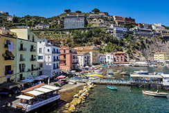
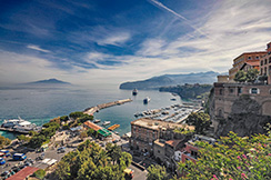
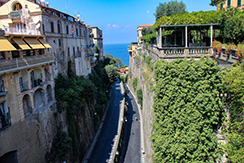
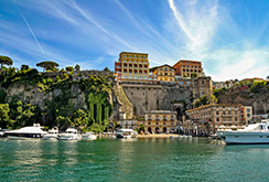
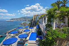
My Images of Sorento, Italy
My Videos of Sorento, Italy
|
- - - - MY JAUNTS - - - -
-
Wednessday, 8/21/24, I visited Sorento, Italy.
- - - - INTERESTING BACKGROUND - - - -
-
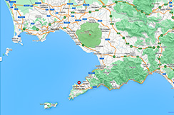
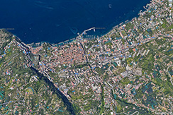
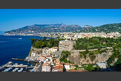
Sorrento is a town overlooking the Bay of Naples in Southern Italy. A popular tourist destination, Sorrento is located on the Sorrentine Peninsula at the south-eastern terminus of the Circumvesuviana rail line, within easy access from Naples and Pompei. The town is widely known for its small ceramics, lacework and marquetry (woodwork) shops. The Sorrentine Peninsula has views of Naples, Vesuvius and the Isle of Capri. The Amalfi Drive, connecting Sorrento and Amalfi, is a narrow road along the high cliffs above the Tyrrhenian Sea.
-
Limoncello, a digestif made from lemon rinds, alcohol, water and sugar, is produced in Sorrento along with citrus fruit, wine, nuts and olives.
-
The Roman name for Sorrento was Surrentum. From the 8th century BC the area had the presence of a community of indigenous villages, which was a crossing point for Etruscan traffic. Subsequently, the area fell into the hands of the Osci, who exercised an important influence there, in fact the oldest ruins of Surrentum are Oscan, dating from about 600 BC. Before its control by the Roman Republic, Surrentum was one of the towns subject to Nuceria, and shared its fortunes up to the Social War; it seems to have joined in the revolt of 90 BC like Stabiae; and was reduced to obedience in the following year, when it seems to have received a colony.
-
The most important temples of Surrentum were those of Athena and of the Sirens (the latter the only one in the Greek world in historic times); the former gave its name to the promontory. In antiquity, Surrentum was famous for its wine (oranges and lemons which are now widely cultivated there were not yet introduced in Italy in antiquity), its fish, and its red Campanian vases; the discovery of coins of Massilia, Gaul, and the Balearic Islands here indicates the extensive trade which it carried on.
-
The myth of the Sirens has been loosely associated with Sorrento since antiquity. Three mermaids settled near Punta Campanella enchanting the seafarers sailing through those waters.
-
Having been a city victim of numerous attacks by pirates for its riches, Sorrento boasted in the past numerous castles and fortifications, especially on the strip of land that runs along the sea.
-
Main sights to See:
- Marina Grande, Sorrento
- Marina Piccola, Sorrento
- Amalfi Coast
- Marina Grande, port of Sorrento
- Marina Piccola, small port of Sorrento
- Park of Villa communale with a view of the Gulf of Naples with the volcano Vesuvius
- Piazza Tasso, central place in Sorrento
- Sorrento funicular (1883-1886), remnants of the defunct inclined railway descending from Hotel Vittoria
- Museo della tarsia lignea (intarsia)
- Museum Correale (Museo Correale di Terranova), museum with small archeologic department
- Via San Cesareo, Sorrento's main shopping street
- Cathedral of Sorrento (Santi Filippo e Giacomo Cathedral), from the 14th century with façade reconstructed in 1924. It was built over time in different styles, with doors of the 11th century from Constantinople
Church of Santi Felice e Baccolo
- Monastery of St Francesco, 14th century
- Roman ruins at the Punta del Capo
- Vallone dei Mulini (Valley of the Mills)
- Return to Table of Contents
|
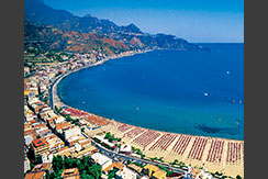
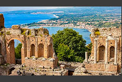
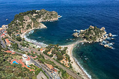
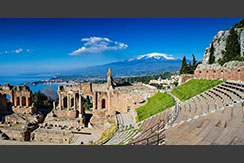
My Images of Giardini Naxos & Taormina, Italy
My Videos of Giardini Naxos & Taormina, Italy
|
- - - - MY JAUNTS - - - -
-
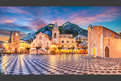
Thursday, 8/22/24, I visited Giardini Naxos & Taormini, Italy.
- - - - INTERESTING BACKGROUND - - - -
-
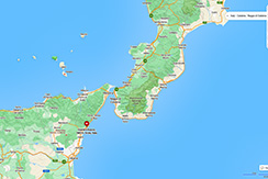
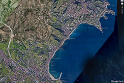
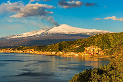
Giardini Naxos is a commune in the Metropolitan City of Messina on the island of Sicily in southern Italy. It is situated on the coast of the Ionian Sea on a bay which lies between Cape Taormina and Cape Schisò. Since the 1970s it has become a seaside-resort, a popular tourist destination and cruise ship stop.
-
Founded by Thucles the Chalcidian in 734 BC in Magna Graecia, Naxos was never a powerful city, but its temple of Apollo Archegetes, protecting deity of all the Greek colonies, gave it prominence in religious affairs. Leontini and Catania were both colonized from here. Hippocrates, tyrant of Gela, captured it in 494 BC. Its opposition to Syracuse ultimately led to its capture and destruction in 403 BC at the hands of Dionysius the tyrant, after it had supported Athens during that city's disastrous Sicilian Expedition. Though the site continued to be inhabited, most activity shifted to neighbouring Tauromenium.
-
In 1544, following the raids by corsair, Kheir-ed-Din, several military buildings were constructed to protect Cape Schisò from the Barbary pirates who continued to attack and plunder the coastal villages. These were Schisò Castle, which was rebuilt from an earlier 13th-century castle, Schisò fort, and Vignazza Tower. The latter is a quadrangular watchtower which served to patrol the coast south of Port Schisò; if any pirate boats were sighted, the observers inside the tower could alert the villagers and neighbouring watchtowers by sending out smoke signals. Vignazza Tower is located in the Recanati area of Giardini Naxos. Vignazza Tower, a watchtower built in 1544 to patrol the coast against raids by Barbary pirates.
-
Prior to the early 1970s, Giardini Naxos was a quiet fishing village. Now it is a tourist destination, its attractions including beaches, the panoramic view of the bay and surrounding hills, and its small fishing port. A larger port services the cruise ships which arrive regularly. It attracts foreign visitors and Italians alike, many of whom own summer residences in the comune. The seafront is lined with hotels, smaller pensions, pubs, lidos, restaurants and discos.
-
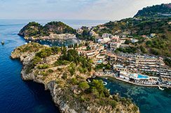
Taormina is a commune in the Metropolitan City of Messina, on the east coast of the island of Sicily, Italy. Taormina has been a tourist destination since the 19th century. Its beaches on the Ionian sea, including that of Isola Bella, are accessible via an aerial tramway built in 1992, and via highways from Messina in the north and Catania in the south. On 26–27 May 2017 Taormina hosted the 43rd G7 summit.
-
The history of Taormina dates back to before Ancient Greece established its first colony on Sicily in 734 BCE in Magna Graecia. After the fall of the Western Roman Empire, Taormina continued to rank as one of the more important towns of the island. Taormina followed the history of Sicily in being ruled by successive foreign monarchs. After the Italian unification, Taormina began to attract well-off tourists from northern Europe, and it became known as a welcoming haven for gay men and artists.
-
The present town of Taormina occupies the ancient site, on a hill that forms the last projecting point of the mountain ridge that extends along the coast from Cape Pelorus to this point. The site of the old town is about 820 ft above the sea, while a very steep and almost isolated rock, crowned by a Norman castle, rises about 490 ft higher. This is the likely site of the ancient Arx or citadel, an inaccessible position mentioned by ancient writers. Portions of the ancient walls may be traced at intervals all round the brow of the hill, the whole of the summit of which was occupied by the ancient city. Numerous fragments of ancient buildings are scattered over its whole surface, including extensive reservoirs of water, sepulchres, tessellated pavements, etc., and the remains of a spacious edifice, commonly called a Naumachia, but the real purpose of which it is difficult to determine.
-
Saracen Castle: Built by the Arabs about 400 meters high on the rock of Monte Tauro, the Castello Saraceno allowed to dominate on Taormina and its beautiful bay, and control the valley of the river Alcantara.
-
Arab Necropolis: The necropolis was probably built between the ninth and eleventh century with symmetrical cells positioned one on the other. Located outside the city walls that defended the town of Taormina, the necropolis extended toward northeast, between the existing ruins and the Church of St. Pietro.
-
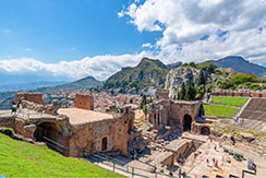
The ancient theatre of Taormina is built for the most part of brick, and is therefore probably of Roman date, though the plan and arrangement are in accordance with those of Greek, rather than Roman, theatres; whence it is supposed that the present structure was rebuilt upon the foundations of an older theatre of the Greek period. With a diameter of 358 ft, this theatre is the second largest of its kind in Sicily; it is frequently used for operatic and theatrical performances and for concerts. The greater part of the original seats have disappeared, but the wall which surrounded the whole cavea is preserved, and the proscenium with the back wall of the scena and its appendages, of which only traces remain in most ancient theatres, are here preserved in an uncommon state of integrity. From the fragments of architectural decorations still extant it has been determined that these were of the Corinthian order, and richly ornamented. Some portions of a temple are also visible, converted into the church of San Pancrazio, but the edifice is of small size.
-
Other sights include the 12th-14th century Palazzo Corvaja, the cathedral (Duomo di Taormina) dating from the thirteenth century, a 1635 Baroque fountain, the Palazzo Duchi di Santo Stefano in Gothic style of the fourteenth century, the Church of San Domenico, the Anglican Church of Saint George, and the municipal gardens (Giardini della Villa Comunale).
- Return to Table of Contents
|

My Images of Day at Sea
My Videos of Day at Sea
|
- - - - MY JAUNTS - - - -
-
Friday, 8/23/24, we voyaged from Siciliy to Kotor, Montenegro.
- - - - INTERESTING BACKGROUND - - - -
-
xxx
-
xxxx
-
xxxx
-
xxxx
-
xxxx
-
xxxx
-
xxxx
- Return to Table of Contents
|
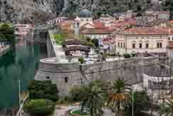
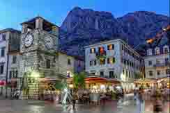
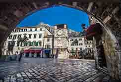
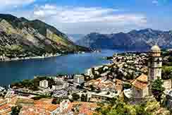
My Images of Kotor, Montenegro
My Videos of Kotor, Montenegro
|
- - - - MY JAUNTS - - - -
-
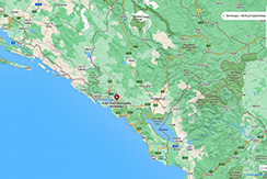
Saturday, 8/24/24, I visited Kotor, Montenegro
- - - - INTERESTING BACKGROUND - - - -
-
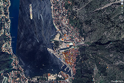
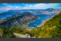
Kotor is a town in the Coastal region of Montenegro. It is located in a secluded part of the Bay of Kotor. The city has a population of 13,347 and is the administrative center of Kotor Municipality. The old Mediterranean port of Kotor is surrounded by fortifications built during the Venetian period. It is located on the Bay of Kotor, one of the most indented parts of the Adriatic Sea. Some have called it the southernmost fjord in Europe, but it is a ria, a submerged river canyon. Together with the nearly overhanging limestone cliffs of Orjen and Lovćen, Kotor and its surrounding area form an impressive landscape.
-
Since the early 2000's Kotor has seen an increase in tourists, many of them coming by cruise ship. Visitors are attracted to the natural environment of the Bay of Kotor and the old town of Kotor. Kotor is part of the UNESCO World Heritage Site dubbed the Natural and Culturo-Historical Region of Kotor. The fortified city of Kotor was also included in UNESCO's World Heritage Site list as part of Venetian Works of Defence between 16th and 17th centuries: Stato da Terra – western Stato da Mar in 2017.
-
The entrance of old city Kotor has a post-World War II sign "What belongs to others we don't want, ours we don't give." Once populated by the Illyrians, the exact time of foundation of the first settlement is not known. According to some sources, the oldest settled area dates two millennia back. The city, first mentioned in 168 BC, was settled during ancient Roman times, when it was known as Acruvium, Ascrivium, or Ascruvium and was part of the Roman province of Dalmatia.
-
The city has been fortified since the early Middle Ages, when Emperor Justinian built a fortress above Ascrivium in 535, after expelling the Ostrogoths. Ascrivium was plundered by the Saracens in 840. It was further fortified towards the peak of Saint Ivan by Constantine VII Porphyrogennetos in the 10th century. It was one of the more influential Dalmatian city-states, initially with a Romance-speaking population, as throughout the early Middle Ages, and until the 11th century the Dalmatian language was still spoken in Kotor. The city was part of Byzantine Dalmatia in that period, and the modern name of Kotor probably originated in the Byzantine name for the city: Dekatera or Dekaderon.
-
Four centuries of Venetian domination have given the city the typical Venetian architecture, that contributes to make Kotor a UNESCO world heritage site. In the 14th and 15th centuries, there was an influx of settlers from the oblasts of Trebinje (the region around forts Klobuk Ledenica and Rudina) and the Hum lands to Kotor. The Italian name of the city is Cattaro. Under Venetian rule, Kotor was besieged by the Ottoman Empire in 1538 and 1657, endured the plague in 1572, and was nearly destroyed by earthquakes in 1563 and 1667.
-
After the Treaty of Campo Formio in 1797, it passed to the Habsburg monarchy. However, in 1805, it was assigned to the French Empire's client state, the Napoleonic Kingdom of Italy, by the Treaty of Pressburg, although in fact held by a Russian squadron under Dmitry Senyavin. After the Russians retreated, Kotor was united in 1806 with this Kingdom of Italy and then in 1810 with the French Empire's Illyrian Provinces. Kotor was captured by the British in an attack on the Bay led by Commodore John Harper in the brig sloop HMS Saracen (18 guns). To seal off Kotor, residents along the shore literally pulled the ship in windless conditions with ropes. Saracen's crew later hauled naval 18-pounder guns above Fort St. John, the fortress near Kotor, and were reinforced by Captain William Hoste with his ship HMS Bacchante (38 guns). The French garrison had no alternative but to surrender, which it did on 5 January 1814.
-
During World War I, Cattaro was one of three main bases of the Austro-Hungarian Navy, the home port of the Austrian Fifth Fleet, consisting of pre-dreadnought battleships and light cruisers, and a base for Austrian and German submarines. The area was the site of some of the fiercest battles between local Montenegrins and Austria-Hungary. After 1918, the city became a part of Yugoslavia and officially became known as Kotor.
-
Between 1941 and 1943 the Kingdom of Italy annexed the area of Kotor which became one of three provinces of the Italian Governorate of Dalmatia – the Province of Cattaro had an area (subdivided in 15 "Comuni") of 547 km2 and a population of 39,800 inhabitants. Most of the city's inhabitants were Orthodox (with some Roman Catholics). After the war the remaining Dalmatian Italians of Kotor (300 inhabitants) left Yugoslavia towards Italy (Istrian-Dalmatian exodus).
-
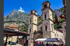
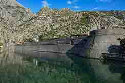
Kotor has one of the best preserved medieval old towns in the Adriatic and is a double UNESCO World Heritage Site: it is part of Natural and Culturo-Historical Region of Kotor and Venetian Works of Defence between the 16th and 17th centuries: Stato da Terra – western Stato da Mar. It is home to numerous sights, such as the Cathedral of Saint Tryphon in the old town (built in 1166), and the ancient walls which stretch for3 mi directly above the city. Sveti Đorđe and Gospa od Škrpijela islets off the coast of Perast are also among the tourism destinations in the vicinity of Kotor.
- Return to Table of Contents
|
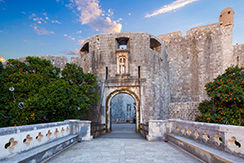
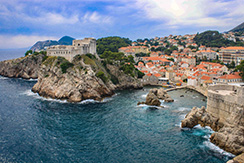
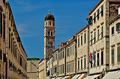
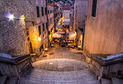
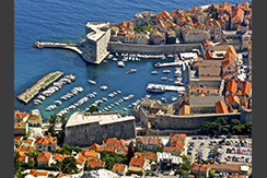
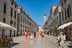
My Images of Dubrovnik, Croatia
My Videos of Dubrovnik, Croatia
|
- - - - MY JAUNTS - - - -
-
Sunday, 8/25/24, I visited Dubrovnik, Croatia
- - - - INTERESTING BACKGROUND - - - -
-
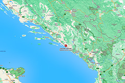
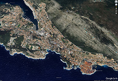
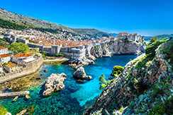
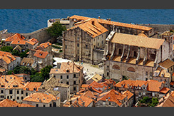
Dubrovnik is a city in southern Dalmatia, Croatia, by the Adriatic Sea. It is one of the most prominent tourist destinations in the Mediterranean, a seaport and the centre of the Dubrovnik-Neretva County. Its total population is 41,562 (2021 census). In 1979, the city of Dubrovnik was added to the UNESCO list of World Heritage Sites in recognition of its outstanding medieval architecture and fortified old town.
-
The history of the city probably dates back to the 7th century, when the town known as Ragusa was founded by refugees from Epidaurum (Ragusa Vecchia). It was under the protection of the Byzantine Empire and later under the sovereignty of the Republic of Venice. Between the 14th and 19th centuries, Dubrovnik ruled itself as a free state. The prosperity of the city was historically based on maritime trade; as the capital of the maritime Republic of Ragusa, it achieved a high level of development, particularly during the 15th and 16th centuries, as it became notable for its wealth and skilled diplomacy. At the same time, Dubrovnik became a cradle of Croatian literature. In his letter to Nikola Nalješković (1564), poet Ivan Vidalić named it "crown of Croatian cities".
-
The entire city was almost destroyed in a devastating earthquake in 1667. During the Napoleonic Wars, Dubrovnik was occupied by the French Empire forces, and then the Republic of Ragusa was abolished and incorporated into the Napoleonic Kingdom of Italy and later into the Illyrian Provinces. In the early 19th to early 20th century, Dubrovnik was part of the Kingdom of Dalmatia within the Austrian Empire. Dubrovnik became part of the Kingdom of Yugoslavia immediately upon its creation, and it was incorporated into its Zeta Banovina in 1929, before becoming part of the Banovina of Croatia upon its creation in 1939. During World War II, it was part of the Axis puppet state Independent State of Croatia, before being reincorporated into SR Croatia in SFR Yugoslavia.
-
In 1991, during the Croatian War of Independence, Dubrovnik was besieged by the Yugoslav People's Army for seven months and suffered significant damage from shelling. After undergoing repair and restoration works in the 1990s and early 2000s, it re-emerged as one of the Mediterranean's top tourist destinations, as well as a popular filming location. According to Statista, Dubrovnik is the most 'over-touristed' destination in Europe, with 36 tourists for each resident.
-
Few of Dubrovnik's Renaissance buildings survived the earthquake of 1667 but enough remained to give an idea of the city's architectural heritage. The finest Renaissance highlight is the Sponza Palace which dates from the 16th century and is currently used to house the National Archives. The Rector's Palace is a Gothic-Renaissance structure that displays finely carved capitals and an ornate staircase. It now houses a museum. Its façade is depicted on the reverse of the Croatian 50 kuna banknote, issued in 1993 and 2002. The St. Saviour Church is another remnant of the Renaissance period, next to the much-visited Franciscan Church and Monastery. The Franciscan monastery's library possesses 30,000 volumes, 216 incunabula, and 1,500 valuable handwritten documents. Exhibits include a 15th-century silver-gilt cross and silver thurible, an 18th-century crucifix from Jerusalem, a martyrology (1541) by Bemardin Gucetic and illuminated psalters.
-
Dubrovnik's most beloved church is St Blaise's church, built in the 18th century in honour of Dubrovnik's patron saint. Dubrovnik's Baroque Cathedral was built in the 18th century and houses an impressive Treasury with relics of Saint Blaise. The city's Dominican Monastery resembles a fortress on the outside but the interior contains an art museum and a Gothic-Romanesque church. A special treasure of the Dominican monastery is its library with 216 incunabula, numerous illustrated manuscripts, a rich archive with precious manuscripts and documents and an extensive art collection.
-
The Neapolitan architect and engineer Onofrio della Cava completed the aqueduct with two public fountains, both built in 1438. Close to the Pile Gate stands the Big Onofrio's Fountain in the middle of a small square. It may have been inspired by the former Romanesque baptistry of the former cathedral in Bunić Square. The sculptural elements were lost in the earthquake of 1667. Water jets gush out of the mouth of the sixteen mascarons. The Little Onofrio's Fountain stands at the eastern side of the Placa, supplying water to the market place in the Luža Square. The sculptures were made by the Milanese artist Pietro di Martino (who also sculpted the ornaments in the Rector's Palace and made a statue – now lost – for the Franciscan church).
-
The 102 ft Dubrovnik Bell Tower, built in 1444, is one of the symbols of the free city state of Ragusa. It was built by the local architects Grubačević, Utišenović and Radončić. It was rebuilt in 1929 as it had lost its stability through an earthquake and was in danger of falling. The brass face of the clock shows the phases of the moon. Two human figures strike the bell every hour. The tower stands next to the House of the Main Guard, also built in Gothic style. It was the residence of the admiral, commander-in-chief of the army. The Baroque portal was built between 1706 and 1708 by the Venetian architect Marino Gropelli (who also built St Blaise's church).
-
In 1418, the Republic of Ragusa, as Dubrovnik was then named, erected a statue of Roland as a symbol of loyalty to Sigismund of Luxembourg (1368–1437), King of Hungary and Croatia (as of 1387), Prince-Elector of Brandenburg (between 1378 and 1388 and again between 1411 and 1415), German King (as of 1411), King of Bohemia (as of 1419) and Emperor of the Holy Roman Empire (as of 1433), who helped by a successful war alliance against Venice to retain Ragusa's independence. It stands in the middle of Luža Square. Roland statues were typical symbols of city autonomy or independence, often erected under Sigismund in his Electorate of Brandenburg. In 1419 the sculptor Bonino of Milano, with the help of local craftsmen, replaced the first Roland with the present Gothic statue. Its forearm was for a long time the unit of measure in Dubrovnik: one ell of Dubrovnik is equal to 20.2 in.
-
A feature of Dubrovnik is its walls (1.3 million visitors in 2018), which run almost 1.2 miles around the city. The walls are 13–20 feet thick on the landward side but are much thinner on the seaward side. The system of turrets and towers was intended to protect the vulnerable city. The walls of Dubrovnik have also been a popular filming location for the fictional city of King's Landing in the HBO television series, Game of Thrones.
- Return to Table of Contents
|
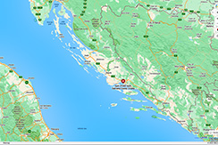
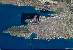
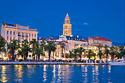
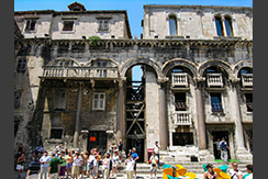
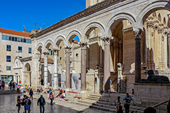
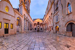
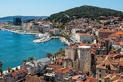
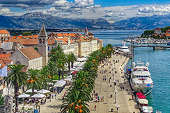
My Images of Split, Croatia
My Videos of Split, Croatia
|
- - - - MY JAUNTS - - - -
-
Monday, 8/26/24, I visited Split, Croatia.
- - - - INTERESTING BACKGROUND - - - -
-
Split is the second-largest city of Croatia after the capital Zagreb, the largest city in Dalmatia and the largest city on the Croatian coast. It lies on the eastern shore of the Adriatic Sea and is spread over a central peninsula and its surroundings. An intraregional transport hub and popular tourist destination, the city is linked to the Adriatic islands and the Apennine Peninsula. More than 900,000 tourists visit Split each year.
-
The city was founded as the Greek colony of Aspálathos in the 3rd or 2nd century BCE on the coast of the Illyrian Dalmatae, and in 305 CE, it became the site of the Palace of the Roman emperor Diocletian. It became a prominent settlement around 650 when it succeeded the ancient capital of the Roman province of Dalmatia, Salona. After the sack of Salona by the Avars and Slavs, the fortified Palace of Diocletian was settled by Roman refugees. Split became a Byzantine city. Later it drifted into the sphere of the Republic of Venice and the Kingdom of Croatia, with the Byzantines retaining nominal suzerainty. For much of the High and Late Middle Ages, Split enjoyed autonomy as a free city of the Dalmatian city-states, caught in the middle of a struggle between Venice and Croatia for control over the Dalmatian cities.
-
Venice eventually prevailed and during the early modern period Split remained a Venetian city, a heavily fortified outpost surrounded by Ottoman territory. Its hinterland was won from the Ottomans in the Morean War of 1699, and in 1797, as Venice fell to Napoleon, the Treaty of Campo Formio rendered the city to the Habsburg monarchy. In 1805, the Peace of Pressburg added it to the Napoleonic Kingdom of Italy and in 1806 it was included in the French Empire, becoming part of the Illyrian Provinces in 1809. After being occupied in 1813, it was eventually granted to the Austrian Empire following the Congress of Vienna, where the city remained a part of the Austrian Kingdom of Dalmatia until the fall of Austria-Hungary in 1918 and the formation of Yugoslavia. In World War II, the city was annexed by Italy, then liberated by the Partisans after the Italian capitulation in 1943. It was then re-occupied by Germany, which granted it to its puppet Independent State of Croatia. The city was liberated again by the Partisans in 1944, and was included in the post-war Socialist Yugoslavia, as part of its republic of Croatia. In 1991, Croatia seceded from Yugoslavia amid the Croatian War of Independence.
-
In 1100, the bell tower which became the main symbol of the city was constructed and dedicated to Saint Domnius, by then regarded as the patron saint of the city.
-
In the years following 2000, Split finally gained momentum and started to develop again, with a focus on tourism. From being just a transport centre, Split is now a major Croatian tourist destination. Many new hotels are being built, as well as new apartment and office buildings. Many large development projects are being revived, and new infrastructure is being built. An example of one of the latest large city projects is the Spaladium Arena, built in 2009.
-
View of Diocletian's Palace - In 1979, the historic center of Split was included into the UNESCO list of World Heritage Sites. Split is said to be one of the centres of Croatian culture. Its literary tradition can be traced to medieval times, and includes names like Marko Marulić, while in more modern times Split excelled by authors famous for their sense of humor. Among them the most notable is Miljenko Smoje, famous for his TV series Malo misto and Velo misto, with the latter dealing with the development of Split into a modern city.
-
The Croatian Maritime Museum has a collection of marine equipment and supplies, weapons and navigation equipment, medals, ship models, uniforms and equipment, and related artwork. A permanent exhibition is planned to complete the presentation of military maritime and naval history, with a presentation that covers the period from the arrival of the Slavs to the present day.
- Return to Table of Contents
|
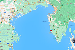
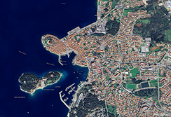
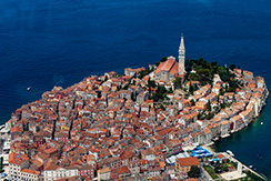
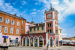
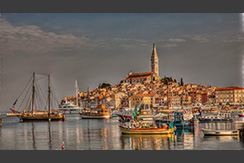
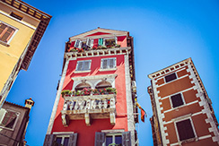
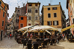
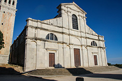
My Images of Rovinj, Croatia
My Videos of Rovinj, Croatia
|
- - - - MY JAUNTS - - - -
-
Tuesday, 8/27/24, I visited Rovinj, Croatia.
- - - - INTERESTING BACKGROUND - - - -
-
Rovinj is a city in Croatia situated on the north Adriatic Sea with a population of 14,294 (2011). Located on the western coast of the Istrian peninsula, it is a popular tourist resort and beach destination, in addition to being an active fishing port. Istriot, a Romance language once widely spoken in this part of Istria, is still spoken by some of the residents. The town is officially bilingual, Croatian and Italian, hence both town names are official and equal.
-
Rovinj was already a settlement of Venetian or Illyrian tribes before being captured by the Romans, who called it Arupinium or Mons Rubineus, and later Ruginium and Ruvinium. Built on an island close to the coast, it became connected to the mainland much later, in 1763, by filling in the channel.
-
Rovinj was eventually incorporated into the Byzantine Empire, later becoming part of the Exarchate of Ravenna in the 6th century, before being taken over by the Frankish Empire in 788. For the following several centuries it was ruled by a succession of feudal lords, and in 1209 it was acquired by the Patriarchate of Aquileia under Wolfger von Erla.
-
From 1283 to 1797, Rovinj was one of the most important towns in Istria governed by the Republic of Venice. During this period, three town gates were constructed and Rovinj was fortified by two rows of defensive walls, remains of which can still be seen today. The Rovinj pier is home to one of the old town gates, Balbi's Arch, dating from 1680, and a late-Renaissance clock tower. The first city statute was proclaimed in 1531.
-
Following the fall of Venice in 1797 and the ensuing Napoleonic interlude, Rovinj became part of the Austrian Empire, which lasted until World War I. According to the last Austrian census in 1911, 97.8% of the population was Italian-speaking. Rovinj then belonged to Kingdom of Italy from 1918 to 1947, when it was ceded to SFR Yugoslavia, as part of SR Croatia. The original town name "Rovigno" was then changed to "Rovinj." During the post-war period, many Italian inhabitants left Rovinj, leading to significant changes in the city's demographic structure
-
Following Croatia's independence in 1991, Rovinj became one of the most important centers of Istria County, an administrative unit encompassing most of Istria. Rovinj is today the third most populous town in the county, behind Pula and Poreč.
-
Sights and landmarks
The Rovinj islands and mainland - These natural sights have been described as "outstanding scenic wonders," because of the pristine beauty of the indented coastline and its forests, consisting of holm oak and Alpine pine trees. This area "of outstanding natural beauty" extends from St. Ivan promontory to Barbariga, including all the Rovinj islands and the mainland 500 metres from the shore line. The Rovinj archipelago consists of 19 islands.
Limska Draga - The Palud marsh and the Due Sorelle Islands – The Due Sorelle (Two Sisters) islands are a nesting site for seagulls. Because of its thick holm oak forest, the Gustinja promontory is regarded as "a forest vegetation reserve."
Rovinj Town Museum
- Return to Table of Contents
|
My Images of Malaga, Spain
My Videos of Malaga, Spain
|
- - - - MY JAUNTS - - - -
-
Thursday, 8/28/24, xxxx
- - - - INTERESTING BACKGROUND - - - -
-
xxx
-
xxxx
-
xxxx
-
xxxx
-
xxxx
-
xxxx
-
xxxx
- Return to Table of Contents
|
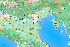
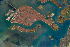
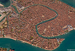
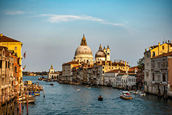
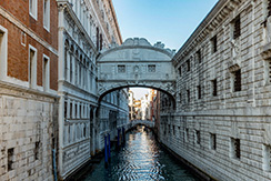
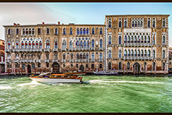
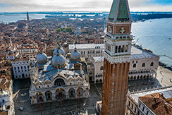
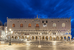

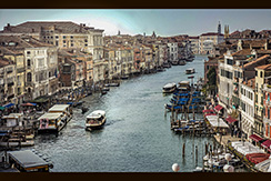
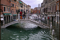
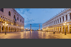
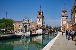
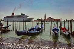
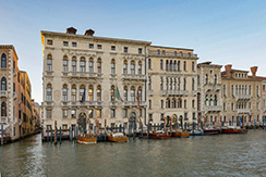
My Images of Venice, Italy
My Videos of Venice, Italy
|
- - - - MY JAUNTS - - - -
-
Friday, 8/29/24, I toured Venice, Italy
- - - - INTERESTING BACKGROUND - - - -
-
Venice is a city in northeastern Italy and the capital of the Veneto region. It is built on a group of 126 islands that are separated by expanses of open water and by canals; portions of the city are linked by 472 bridges. The islands are in the shallow Venetian Lagoon, an enclosed bay lying between the mouths of the Po and the Piave rivers (more exactly between the Brenta and the Sile). In 2020, around 258,685 people resided in greater Venice or the Comune di Venezia, of whom around 51,000 live in the historical island city of Venice (centro storico) and the rest on the mainland (terraferma). Together with the cities of Padua and Treviso, Venice is included in the Padua-Treviso-Venice Metropolitan Area (PATREVE), which is considered a statistical metropolitan area, with a total population of 2.6 million.
-
The name is derived from the ancient Veneti people who inhabited the region by the 10th century BC. The city was historically the capital of the Republic of Venice for almost a millennium, from 810 to 1797. It was a major financial and maritime power during the Middle Ages and Renaissance, and a staging area for the Crusades and the Battle of Lepanto, as well as an important centre of commerce — especially silk, grain, and spice, and of art from the 13th century to the end of the 17th. The city-state of Venice is considered to have been the first real international financial centre, emerging in the 9th century and reaching its greatest prominence in the 14th century. This made Venice a wealthy city throughout most of its history. For centuries Venice possessed numerous territories along the Adriatic Sea and within the Italian peninsula, leaving a significant impact on the architecture and culture that can still be seen today. The Venetian Arsenal is considered by several historians to be the first factory in history, and was the base of Venice's naval power. The sovereignty of Venice came to an end in 1797, at the hands of Napoleon. Subsequently, in 1866, the city became part of the Kingdom of Italy.
-
Venice has been known as "La Dominante", "La Serenissima", "Queen of the Adriatic", "City of Water", "City of Masks", "City of Bridges", "The Floating City", and "City of Canals". The lagoon and the historic parts of the city within the lagoon were inscribed as a UNESCO World Heritage Site in 1987, covering an area of 173,410 acres. In view of the fact that Venice and its lagoon are under constant threat in terms of their ecology and the safeguarding of the cultural heritage, Venice's UNESCO listing has been under constant examination by UNESCO. Parts of Venice are renowned for the beauty of their settings, their architecture, and artwork. Venice is known for several important artistic movements – especially during the Renaissance period – and has played an important role in the history of instrumental and operatic music; it is the birthplace of Baroque composers Tomaso Albinoni and Antonio Vivaldi.
-
In the 21st century, Venice remains a very popular tourist destination, a major cultural centre, and has been ranked many times the most beautiful city in the world. It has been described by The Times as one of Europe's most romantic cities and by The New York Times as "undoubtedly the most beautiful city built by man". However, the city faces challenges including an excessive number of tourists, pollution, tide peaks and cruise ships sailing too close to buildings.
-
During World War II, the historic city was largely free from attack, the only aggressive effort of note being Operation Bowler, a successful Royal Air Force precision strike on the German naval operations in the city in March 1945. The targets were destroyed with virtually no architectural damage inflicted on the city itself. However, the industrial areas in Mestre and Marghera and the railway lines to Padua, Trieste, and Trento were repeatedly bombed. On 29 April 1945, a force of British and New Zealand troops of the British Eighth Army, under Lieutenant General Freyberg, liberated Venice, which had been a hotbed of anti-Mussolini Italian partisan activity.
-
Subsidence - The gradual lowering of the surface of Venice, has contributed – along with other factors – to the seasonal Acqua alta ("high water") when the city's lowest lying surfaces may be covered at high tide.
Building foundations - Those fleeing barbarian invasions who found refuge on the sandy islands of Torcello, Iesolo, and Malamocco, in this coastal lagoon, learned to build by driving closely spaced piles consisting of the trunks of alder trees, a wood noted for its water resistance, into the mud and sand,[53][54] until they reached a much harder layer of compressed clay. Building foundations rested on plates of Istrian limestone placed on top of the piles.
-
Venice is predominantly Roman Catholic (85.0% of the resident population in the area of the Patriarchate of Venice in 2022), but because of the long-standing relationship with Constantinople, there is also a noticeable Orthodox presence; and as a result of immigration, there is now a large Muslim community (about 25,000 or 9.5% of city population in 2018) and some Hindu, and Buddhist inhabitants.
-
Today, there are numerous attractions in Venice, such as St Mark's Basilica, the Doge's Palace, the Grand Canal, and the Piazza San Marco. The Lido di Venezia is also a popular international luxury destination, attracting thousands of actors, critics, celebrities, and others in the cinematic industry. The city also relies heavily on the cruise business. The Cruise Venice Committee has estimated that cruise ship passengers spend more than US$193 million annually in the city, according to a 2015 report. Other reports, however, point out that such day-trippers spend relatively little in the few hours of their visits to the city.
-
The need to protect the city's historic environment and fragile canals, in the face of a possible loss of jobs produced by cruise tourism, has seen the Italian Transport Ministry attempt to introduce a ban on large cruise ships visiting the city. A 2013 ban would have allowed only cruise ships smaller than 40,000-gross tons to enter the Giudecca Canal and St Mark's basin. In January 2015, a regional court scrapped the ban, but some global cruise lines indicated that they would continue to respect it until a long-term solution for the protection of Venice is found. In 2014, the United Nations warned the city that it may be placed on UNESCO's List of World Heritage in Danger sites unless cruise ships are banned from the canals near the historic centre.
-
On 2 June 2019, the cruise ship MSC Opera rammed a tourist riverboat, the River Countess, which was docked on the Giudecca Canal, injuring five people, in addition to causing property damage. The incident immediately led to renewed demands to ban large cruise ships from the Giudecca Canal, including a Twitter message to that effect posted by the environment minister. The city's mayor urged authorities to accelerate the steps required for cruise ships to begin using the alternate Vittorio Emanuele canal. Italy's transport minister spoke of a "solution to protect both the lagoon and tourism ... after many years of inertia" but specifics were not reported. As of June 2019, the 2017 plan to establish an alternative route for large ships, preventing them from coming near the historic area of the city, has not yet been approved.
-
There are approximately 400 licensed gondoliers in Venice, in their distinctive livery, and a similar number of boats, down from 10,000 two centuries ago. Many gondolas are lushly appointed with crushed velvet seats and Persian rugs. At the front of each gondola that works in the city, there is a large piece of metal called the fèro (iron). Its shape has evolved through the centuries, as documented in many well-known paintings. Its form, topped by a likeness of the Doge's hat, became gradually standardized, and was then fixed by local law. It consists of six bars pointing forward representing the sestieri of the city, and one that points backwards representing the Giudecca. A lesser-known boat is the smaller, simpler, but similar, sandolo.
- Return to Table of Contents
|
My Images of Malaga, Spain
My Videos of Malaga, Spain
|
- - - - MY JAUNTS - - - -
-
Saturday, 8/30/24, xxxx
- - - - INTERESTING BACKGROUND - - - -
-
xxx
-
xxxx
-
xxxx
-
xxxx
-
xxxx
-
xxxx
-
xxxx
- Return to Table of Contents
|